

Friday 18 March – The night walk in
We had a stunning Southern Crossing adventure, enjoying one of the classic Tararua tramps! On the Friday, seven of us met up at the Wellington Railway station at 3pm, ready for an early departure to Otaki Forks. Arriving at the “new” Otaki Forks carpark at 4.30pm, we started off and headed up the emergency detour route, which added an extra hour or so, and 200 meters of climbing, to our route.
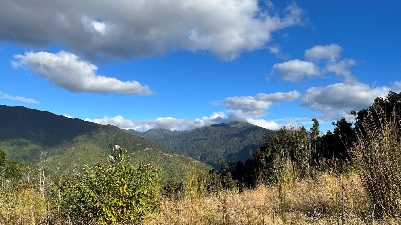
The track up and then back down again to the road was quite scrambly and slippery in places – it was manageable but could be tricky in the dark or rain. After about 90 minutes we got back to the main road and had some dinner past the Otaki Forks bridge at the turnoff to Parawai Lodge. We’d all pre-packed something to make this quick and easy. From here we began our ascent up to Field Hut. We walked the final hour with head torches being serenaded by moreporks and frogs. We got to Field Hut around 9.30pm and I was quite grateful that there were a few people awake, so we didn’t disturb anyone while we found our spots. We were surprised to find only 5 other people there, given the excellent weather forecast.
Saturday 19 March – Stunning tops
The next morning, we left around 8am to begin our trek along the tops. We knew Alpha Hut would be very full and wanted to maximize our chances of securing a bunk. It looked like it was going to be a stunning day with barely a cloud in the sky.
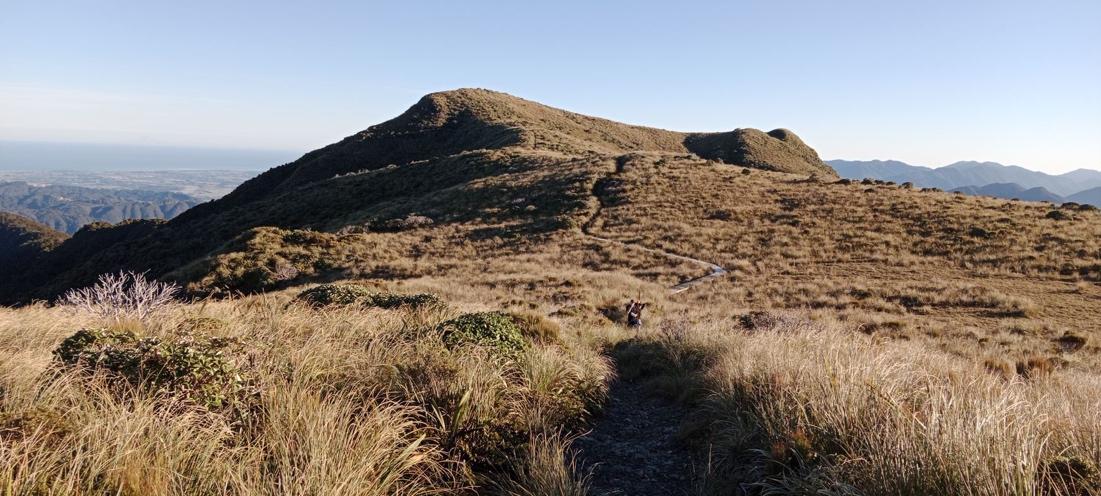
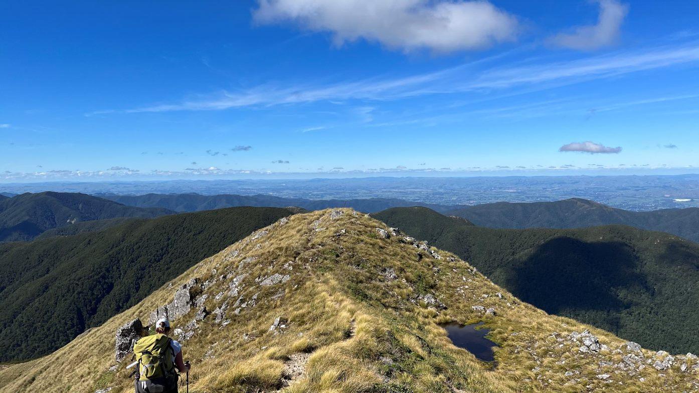
Climbing up and past Bridge Peak at this height, we could also make out Mt Taranaki and Mt Ruapehu in the far distance. At Kime Hut, we had a quick 15-minute stop for morning tea, before climbing up the last two hills to Mt Hector (there is a slight dip right before Hector – we commented that a flying fox would be handy).
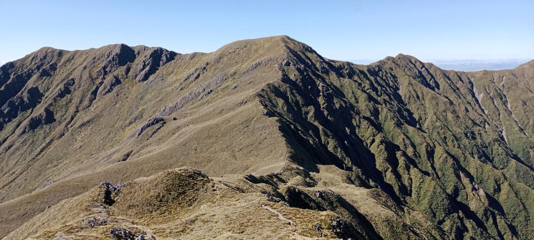
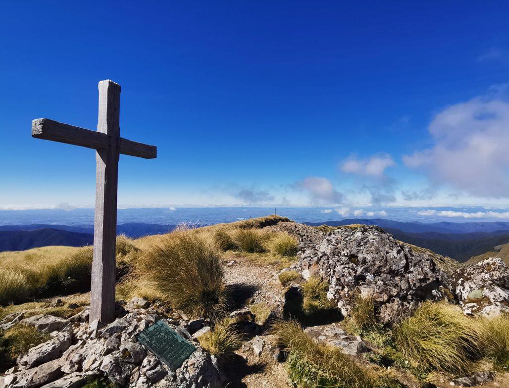
At Mt Hector, we had a lunch stop enjoying the epic views. This was my first 1500m peak and I am now keen to start climbing more of them!
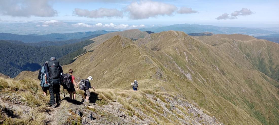
We wound our way along the tops, spreading out as we all found our own pace, and then rejoining when we came to the Elder – Alpha junction. From here we continued on until we got to the Alpha Hut at 3.30pm.
Arriving at the hut we bagged a mattress and then relaxed while others slowly started to full up the hut. The hut was quite packed, but we all managed to find space, a few of our group also passed over unused air mattresses for those that didn’t have them and were on the floor. We had a yummy meal of tofu laksa which I would recommend – most of us went back for seconds or thirds. We also met up with the two other WTMC groups, one was doing the crossing in reverse (we swapped keys) and a medium fit duo were heading to Eastern Hutt hut. It was great having such a mixed group in the hut!
Sunday 20 March – Plod through the bush
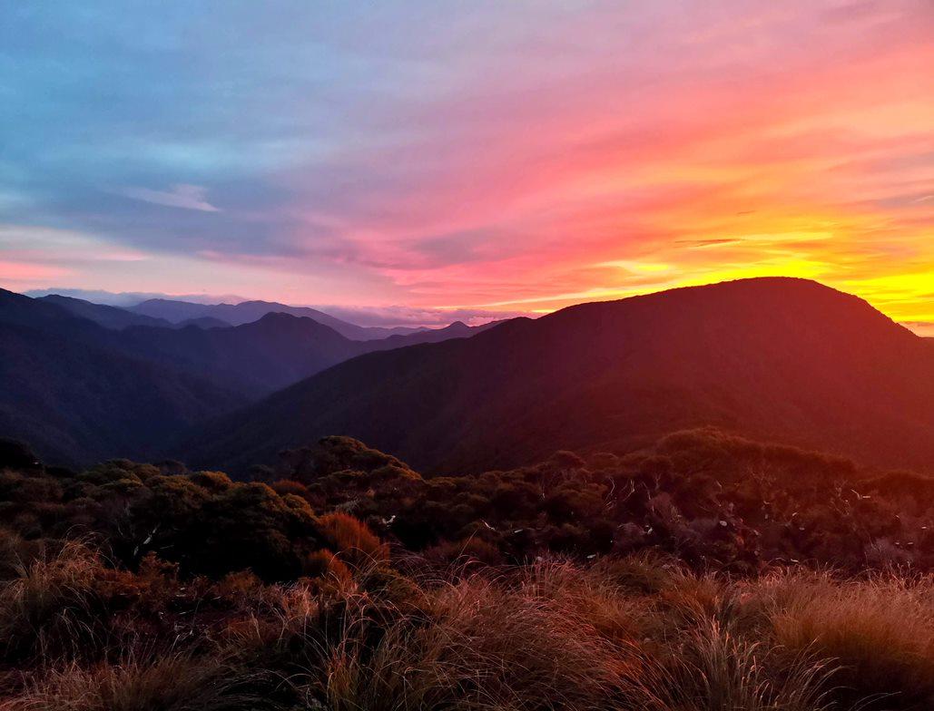
The next morning, we woke up early and headed up to a little clearing a few minutes from the hut to watch the glorious sunrise.
The other WTMC group heading out and over the tops to Otaki Forks looked like they would have awesome weather for the tops. Around 8am, we left the hut and said goodbye to the last of the trampers still there. After a few undulations and a short climb up and out of Hells Gate we were onto Marchant Ridge proper. If you are prepared for Marchant to be long, which I was, then I actually found it to be quite pleasant. I was also glad we were heading downhill, even though the first half is quite undulating. Once you get to Marchant Peak, where we had our lunch stop in the clearing, it starts heading more steeply downhill. Just after Marchant Peak, there are some large, exposed sections where you get some great views of the valley and Mt Alpha behind you in the distance.
Then the track starts dropping into the forest and before you know it, you’re onto the Dobson Loop and only have about an hour to go from there! After arriving triumphantly at the carpark around 3.30pm, we then proceeded to drive around to the main campground to pick up Aimee and Tereza who had walked to Eastern Hutt Hut. After picking them up, we had a short drive back into town.
Thanks to Dan for organizing the trip and picking up all the food and the gear from the club, this was much appreciated! Thanks to everyone for an awesome trip – the company and the walk was amazing! Thank you also to Anne, the Chief Guide, for magically scheduling the trip in a perfect weather window!
Walking times
Otaki Forks Carpark to Field Hut via emergency detour route: elapsed time 4 hours 45 minutes, walking time 3 hours 40 minutes, ~12.5km in total, ~1,030m ascent. Note: could have probably saved 1.5 hours by just walking along the slipped section and have heard it is quite passable – would not really want to take the emergency route in the dark. [This will change with time and weather; check DOC’s website and follow their guidance – Ed.]
Field Hut to Alpha Hut: elapsed time 7 hours 15 minutes, walking time 5 hours 10 minutes, ~13.5km, ~1,120m ascent, ~950m descent.
Alpha Hut to Kaitoke Carpark: elapsed time 7 hours 15 minutes, walking time 5 hours 45 minutes, ~17.5km, ~620m ascent, ~1,500m descent.