U Pass Fiordland National Park
A 2 day hiking loop trip through the unusually shaped U Pass between Mistake Creek and Hut Creek in Fordland.
While licking ice creams at the Manupouri Café after our successful ascent of Mount Titiroa, Pete suggested we make the most of the next two day weather window by going over U Pass. I had never heard of U Pass but I certainly did not want to miss out on another adventure!
Although some web reports claim you can do the U Pass trip in a day, we thought this was a bit optimistic. We were starting to feel the colder, shorter days of an approaching winter and Angie’s report on the WTMC website confirmed that it was easy to chew through time on this route. Plus our goal was to spend more time in the hills, not less! Therefore we decided to do it as an overnight trip and organised ourselves to be on the track by 7.45am.
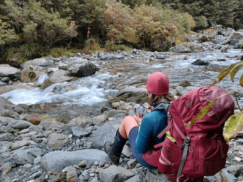
The morning was grey and moody. After carefully negotiating the walkwire, we took a right-hand turn at the first junction to get onto the Mistake Creek Track. Emily set the pace and we reached the river crossing at 9am.
I had a turn at the front next. About 10am we emerged from forest into what I would call “short bush” – short trees and lots of head high fern and flax. Being a damp morning, we were soon completely soaked by pushing through the ferns. The track was less obvious here and I think it might be easy to come acropper if you don’t have an Emily keeping an eye on where you are going!
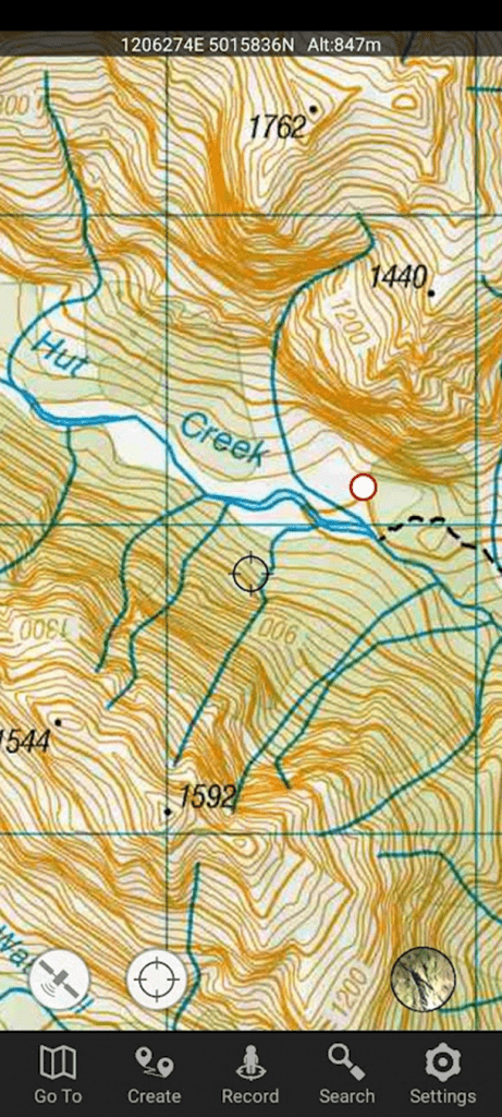
At about 10.45am we emerged from the “short bush” into open tussock. This is where the bushline ends on the map. The tussock was a wee bit holy, and there was a swampy tarn to negotiate, but we wiggled our way to the branch of mistake creek leading up to U Pass. Just inside the bush on the true right of the river we found a secret campsite, complete with kettle!
After about 5 minutes in the creek bed itself, Emily led us out onto the true right of the river where, following the faintest of footpads which often disappeared, she led us very comfortably up a climb of about 100m. You need to get out of the river early on as there is a small waterfall to negotiate.
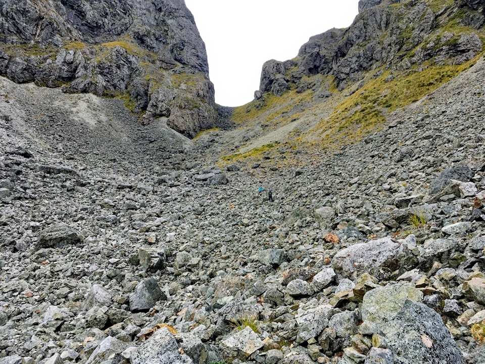
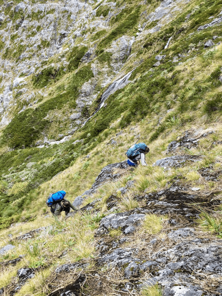
The next 100m of ascent was gained by walking in the creek bed itself, or on the fringes. This brought us to the “big waterfall” by 12.30pm. We stopped and had lunch at this point so we could stare at the waterfall and contemplate our options. An OUTC report suggested the true right was passable, but most reports seemed to opt for the true left, either up the “Impossible Staircase” (as in Angie’s report) or via a long sidle (Southern Alps photography). We choose something similar to the long sidle. We climbed up to the lowest big black rock and from there discovered an excellent little footpad that continued almost all of the way up to the top of the waterfall. Although I was nervous about the steep drop-off to the left, there was plenty of scrub to hang on to. With about 60m of ascent to go, we found a flat spot with some conveniently placed rocks for a rest. After this, the trail got a bit confused. We opted to sidle across a rocky ditch, rather than continuing to angle up. Continuing across-ways rather than up-ways we came onto another river of rocks, which led us straight up to the top of the waterfall.
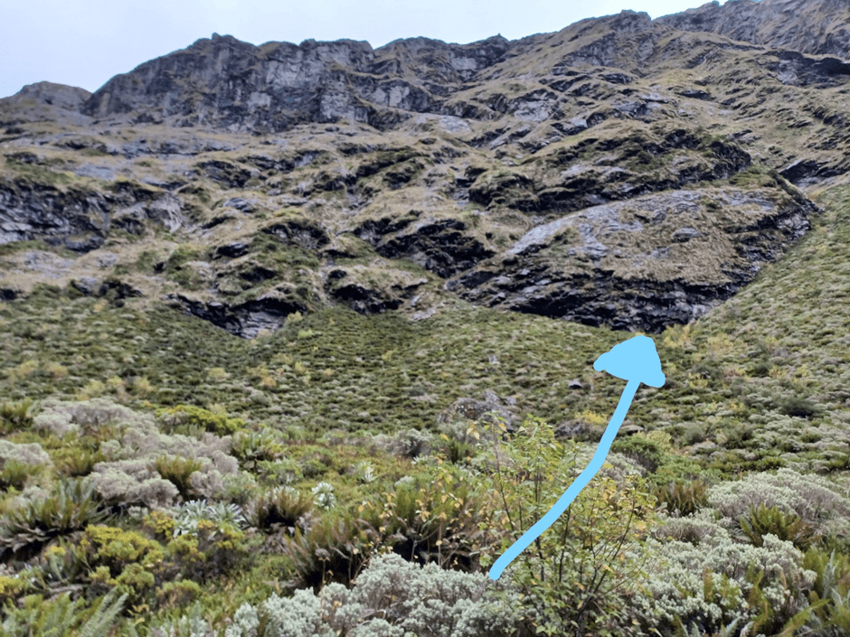
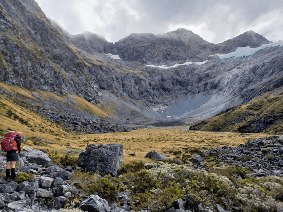
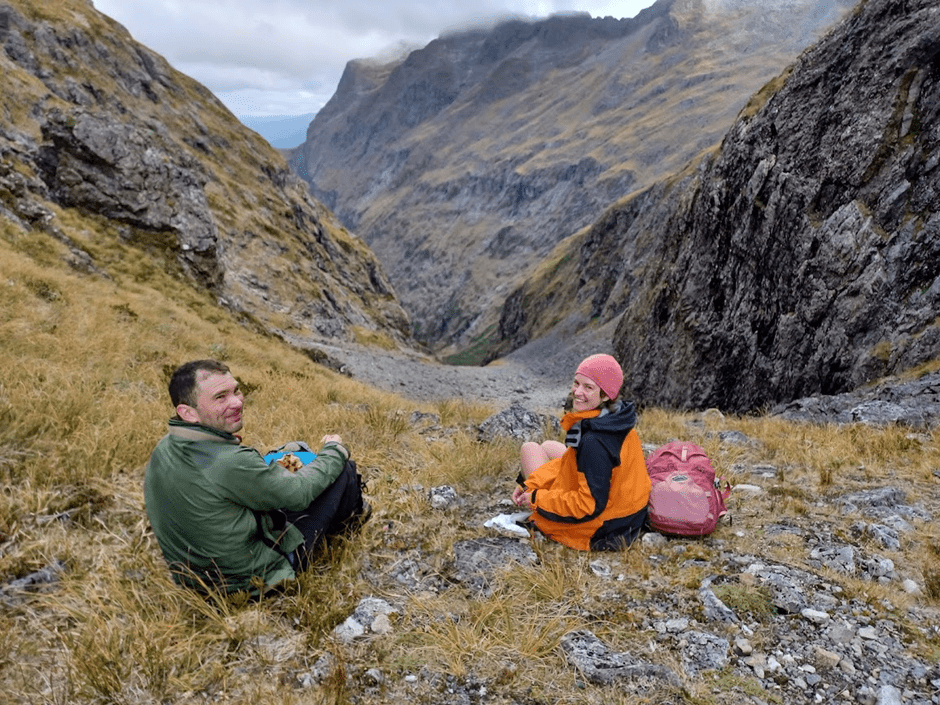
We then got to enjoy the views of the big circular basin just below U-Pass. At this point, Pete sensibly suggested we consider our progress and options. As it was 2pm, we decided we still had enough daylight and energy to get over the pass and down to a suitable campsite. We duly filled all our containers with water and began sidling up through the tussock toward the pass.
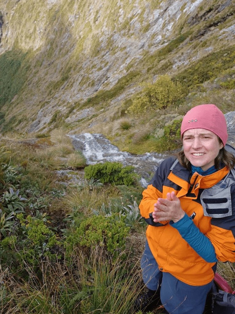
We arrived on the pass at about 3pm, took some photos and ate lots of lollies. The first section down from the pass was gravel and had a nice wee track along it. However, once the gradient steepened, we were funnelled into the rocky river bed. It was a bit of a grind for me getting down, but it was pleasantly broken up by the spotting of at least three rock wren. I also noted that the river came above ground for a section up here, so contrary to some trip reports we had read, there was an opportunity to get water on this side of the pass (but this may not always be so).
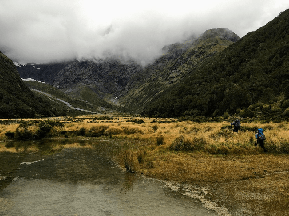
Once down in the valley we began looking for a campsite. Emily had astutely noted that the riverbed would not have water in it until there was another drop in height, which would require quite a bit more walking, so we choose a flat, less tussocky spot near the first alternative water source we could find – a waterfall coming off the cliffs on the true left of the valley. By this point the sandflies had descended, so we all hastily got our tents up and got changed into “sandfly proof” attire. The sandflies got into bed when it got dark, so we could comfortably sit outside and admire the stars. I was quite tired – this had felt like a reasonable day’s tramping.
The next day we essentially followed the creek bed until the start of the marked track. Shortly after our campsite, the creek bed began descending, and as Emily had predicted, water appeared in it. Getting down this section took about 40 minutes, with lots of wiggling and bum-sliding around big rocks required. When we got out onto flat terrain again we noted a big orange triangle on the true right of the creek bed, and we speculated there might have been an easier way through the bush. However we did not go and investigate to confirm whether a track actually existed behind the orange triangle.
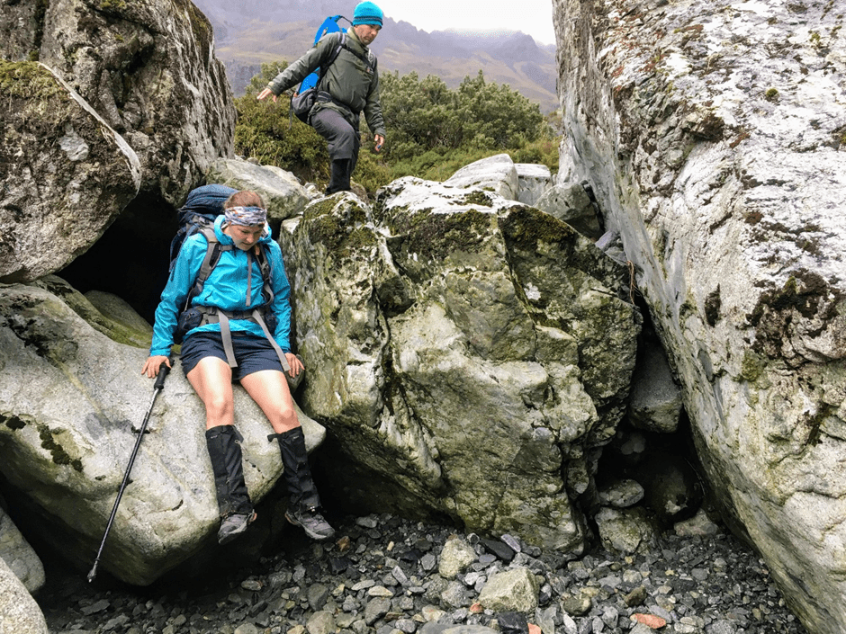
A little further down we noted another big orange triangle on the true right but did not go and investigate. Instead we stayed in the creek bed, which was good travel. As we approached the bushline where the marked track started on the map, eagle-eyed Emily spotted two big orange triangles on the true left of the creek bed. This is where the official DOC track started. It was a cruisy walk down from here. The two crossings of Mistake Creek before the junction did not cause us any trouble, and the Eglinton River was low enough for us to walk across the river rather than taking the walk wire. We were out by 12pm, in time to get a coffee/hot drink from the “Coffee Cat” cart at Mirror Lakes. What a way to finish!