
The Dobson Loop Track is located in one of the most southern points of Tararua Forest Park. The great thing about this walk is you get a good day out walking in what feels like a remote and very scenic back country area yet it’s only a 30 minute drive from downtown Petone – so you still have time to get other things done on your weekend too! Alternatively, you can continue on for a multi-day adventure – all the way to Holdsworth Lodge near Masterton or to Otaki Forks (the Southern Crossing walk).
The three of us met at Petone Railway Station at 9am on Sunday morning and then drove Tony’s car to the start of the track – which is at the end of Kiwi Ranch Rd in Kaitoke (a suburb of Upper Hutt). The carpark is right beside the YMCA Kaitoke Outdoor Education Centre.
We were lucky to have a really lovely sunny day.
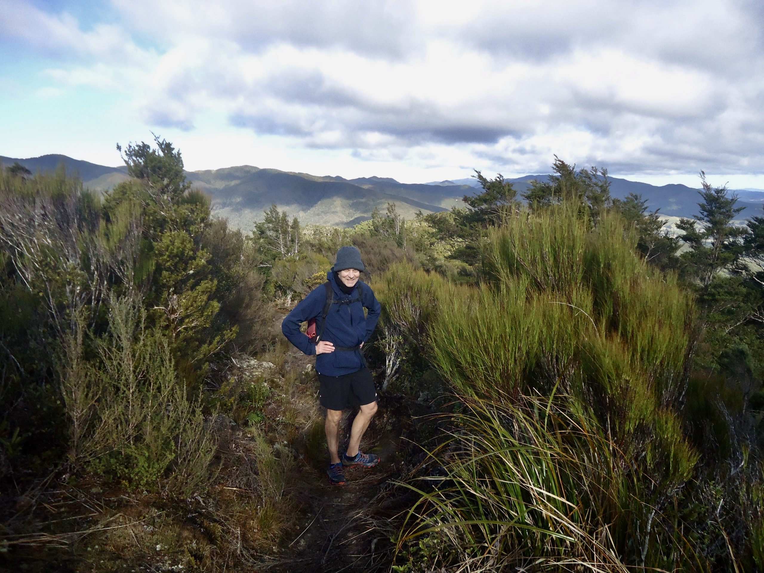
We started on our way – initially travelling through bush as we headed uphill. There are two routes to Smith Creek Shelter (go over Puffer Saddle and then along Smith Creek OR walk uphill to the old Dobson Hut and then downhill to the Shelter). We decided to take the latter route (harder part first) while we still had lots of energy and to get the hard bit out of the way. This meant turning left (towards Marchant Ridge and Alpha Hut) at a signposted junction about 1.5km/ 30 mins into the walk. There is a steep piece of track from here up to the remains of the old Dobson Hut (it’s an approx 300m climb from the carpark to the old Dobson Hut). The old hut now only consists of the base of a concrete fireplace.
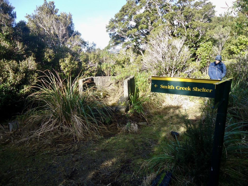
From the old Dobson Hut site you begin the descent downhill – following the sign to Smith Creek Shelter and Tauherenikau Valley. Although soon after beginning the descent there is a short section of the track that continues uphill for a bit, to the highest point of this Loop walk (656m). You can see great 360 degree views above the treeline here – over to Marchant Ridge and the Wairarapa.
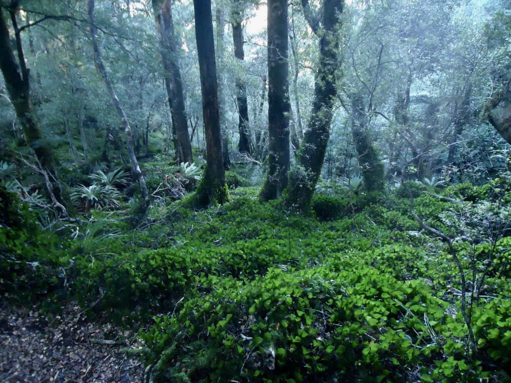
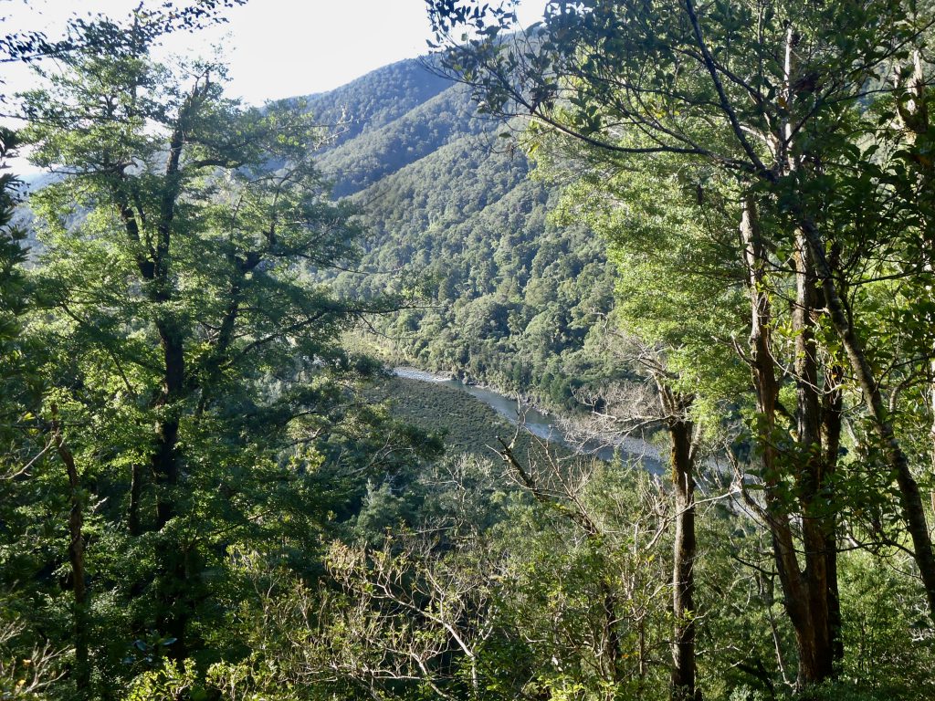
With the highest point of the Loop walk at 656m and Smith Creek Shelter located at approx 192m elevation, it’s a steep 464m approx walk downhill over the next 40 mins – one hour (2km approx). Nearly all of this is under the trees, and there were quite a lot of tree roots along the way. There are gorgeous views of the Tauherenikau Valley and River on the way down.
Smith Creek Shelter looked like a hut with a stage/ bunk platform inside. From here it was just a few minutes walk to the confluence of Smith Creek and the Tauherenikau River. It was lovely sitting on the smooth rocks beside the River for lunch. Very picturesque and with beautiful clear, clean fast flowing water.
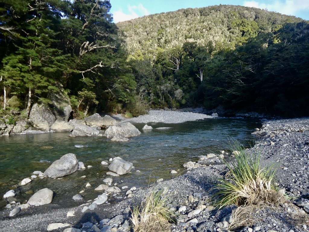
From here there is the option of walking past Smith Creek Shelter, a further 20 mins up the River to a swingbridge, but we were running short of time so decided to keep walking the Loop back to the carpark. This last section of the walk was on a well graded track.
Shortly after we began following the lower Dobson Loop Track (beside Smith Creek) back to the carpark we came across a slip over the track- which we were able to negotiate quite easily, even though the ground was damp (and muddy/ slippery in some places) due to recent rainfall. It took a bit of climbing and careful foot work, but was not dangerous.
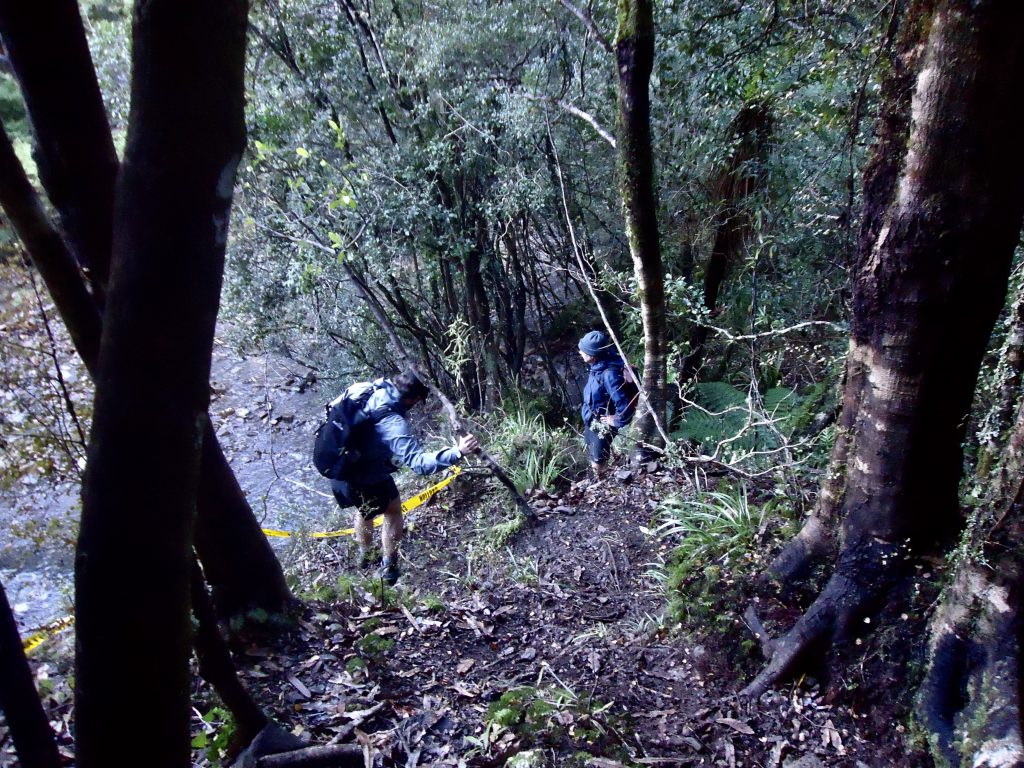
On this lower Loop track there are a number of unbridged streams and creeks that can potentially feed into Smith Creek. So if there has been recent heavy rainfall it’s important to consider this from a safety perspective. There had been rain in the days before our trip but there were no flooding issues.