
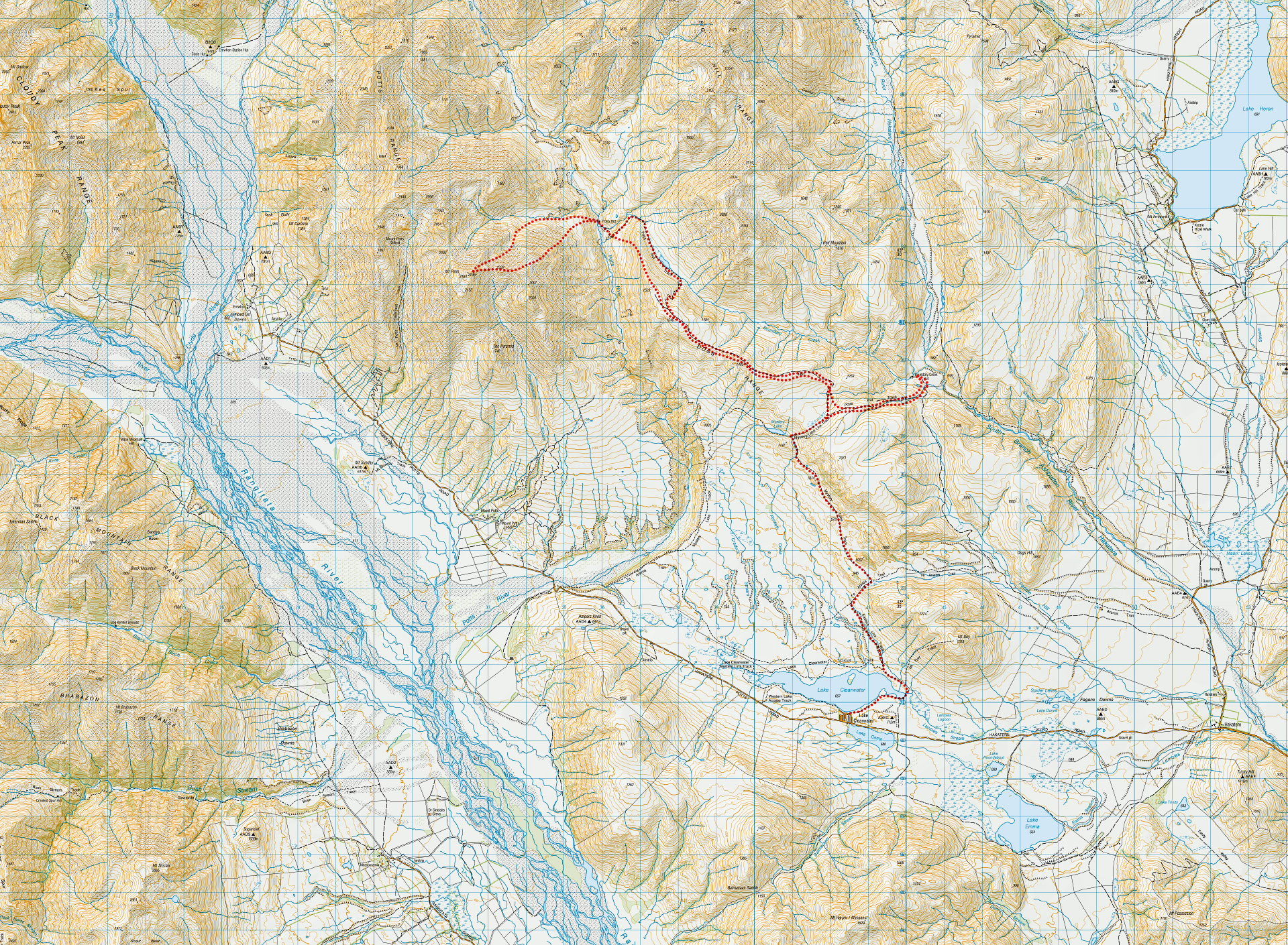
Mt Potts and Dogs Range – frozen boots and bobsleds
A 4 day hiking loop trip through spectacular mountain scenery of the Hakatere Conservation Area in winter with icy conditions
Mt Potts and Dogs Range – frozen boots and bobsleds
‘The good news is that we have found your luggage. The bad news is that it’s still in Wellington.’
Uh oh. I’m now at Christchurch Airport after a 6:30am flight trying to figure out where my gear has gone. I now have no alpine gear and the next flight it can be sent on would arrive just before midday. It seems I can no longer be an alpine dinosaur! (I have a fairly overactive imagination and think crampons look like dinosaur feet so now I’m a dinosaur whenever wearing them—see here).
I stand there for a moment thinking through my options: wait for my gear; get hire gear; or just replan the whole trip.
I ring Matt and we decide to go with the last option to make the best use of our limited time. He grabs a spare walking pole for me before driving to the airport to pick up a rebel dinosaur who doesn’t have her dinosaur feet anymore (see here for more on rebel dinosaurs). Our original plan of the Huxley Valley and a climb up to the spine of the Southern Alps will have to wait. We decide that we will now go tramping somewhere a bit closer to Christchurch that hopefully won’t require alpine gear. As Matt is now living in Christchurch he has some good suggestions and we decide on a loop in Hakatere Conservation Park to climb Mt Potts—he did the trip last year with Tony but fortunately didn’t mind returning to the area.
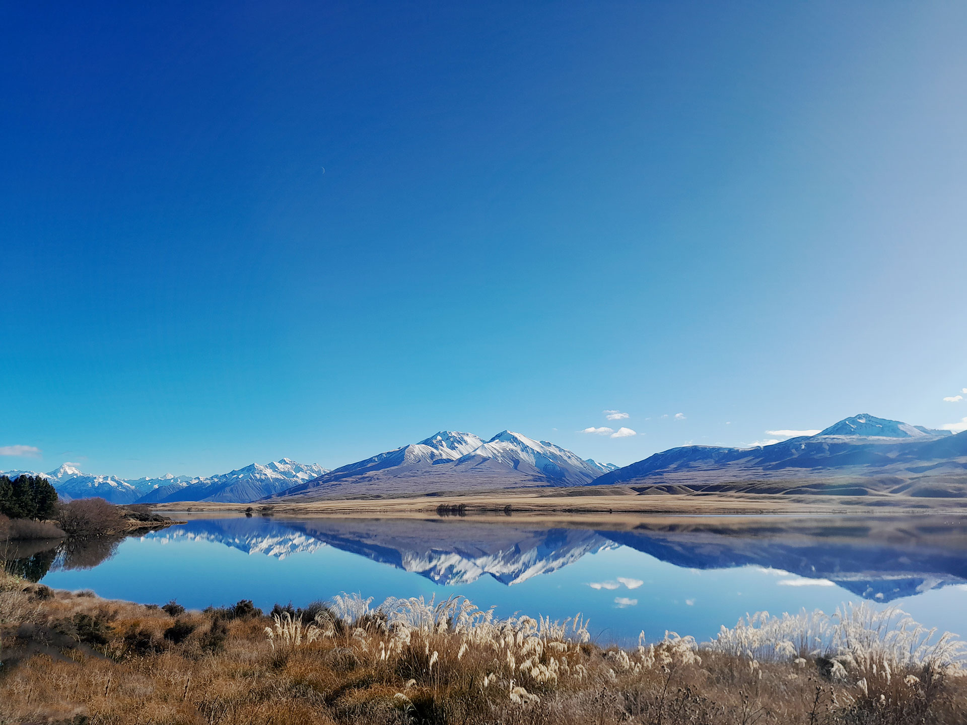
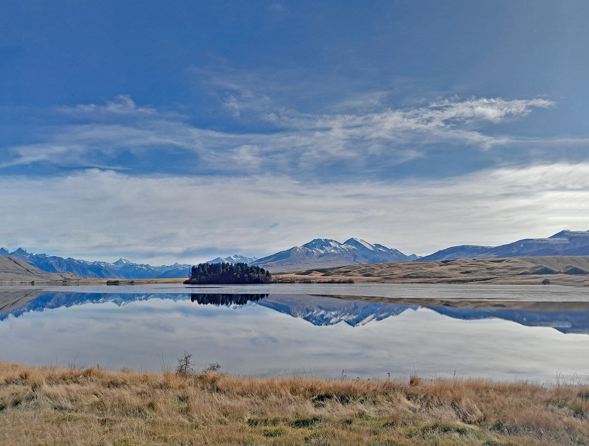
Our starting point is Lake Clearwater. Despite its rather unimaginative name, it is absolutely beautiful. I notice the reflections of the surrounding mountains in the lake seem a bit odd. I’m trying to think about how to adequately explain this observation to Matt before I realize it’s because the lake is partially frozen! It is then I notice a bird sitting on top of the lake rather than in the lake itself and I start to laugh. It had never occurred to me that the lake might be frozen. Coming from the North Island, a frozen lake is not something we typically see. Matt patiently waits while I do some serious gear faffing that includes re-threading my frayed boot laces with new ones. I joke to him that it looks like I’ve used my old boot laces as dental floss. I’m a bit slow as I’ve only had 3 hours sleep. I had to work the evening before my early flight but Matt generously takes this all in his stride. I think he is rather entertained by the utter chaos that my level of disorganisation has amounted to on a rather sleep deprived brain.
Finally, I’m ready to start tramping. The ground is frozen solid underneath us with a slippery layer of mud on top and the puddles are frozen over. We both try to avoid going for a slide. Matt says that on his trip last year there was snow down at the carpark and he also went snow-shoeing around the lake, something I would like to try at some point. On the Eastern Link Track he finds us a well-trodden shortcut straight up the guts rather than taking all the switchbacks and it gets our heart rates straight up. Apparently, there’s no such thing as a warm-up sometimes! We head towards Mystery Lake which like all the tarns we have walked past, is also frozen. We try to break the surface of one tarn with a rock but the rock just goes skating across it while making a strange noise.
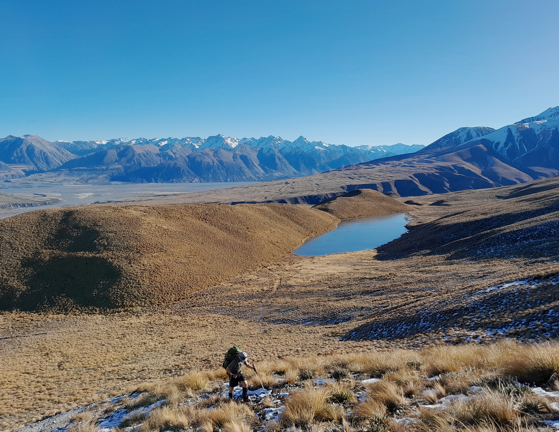
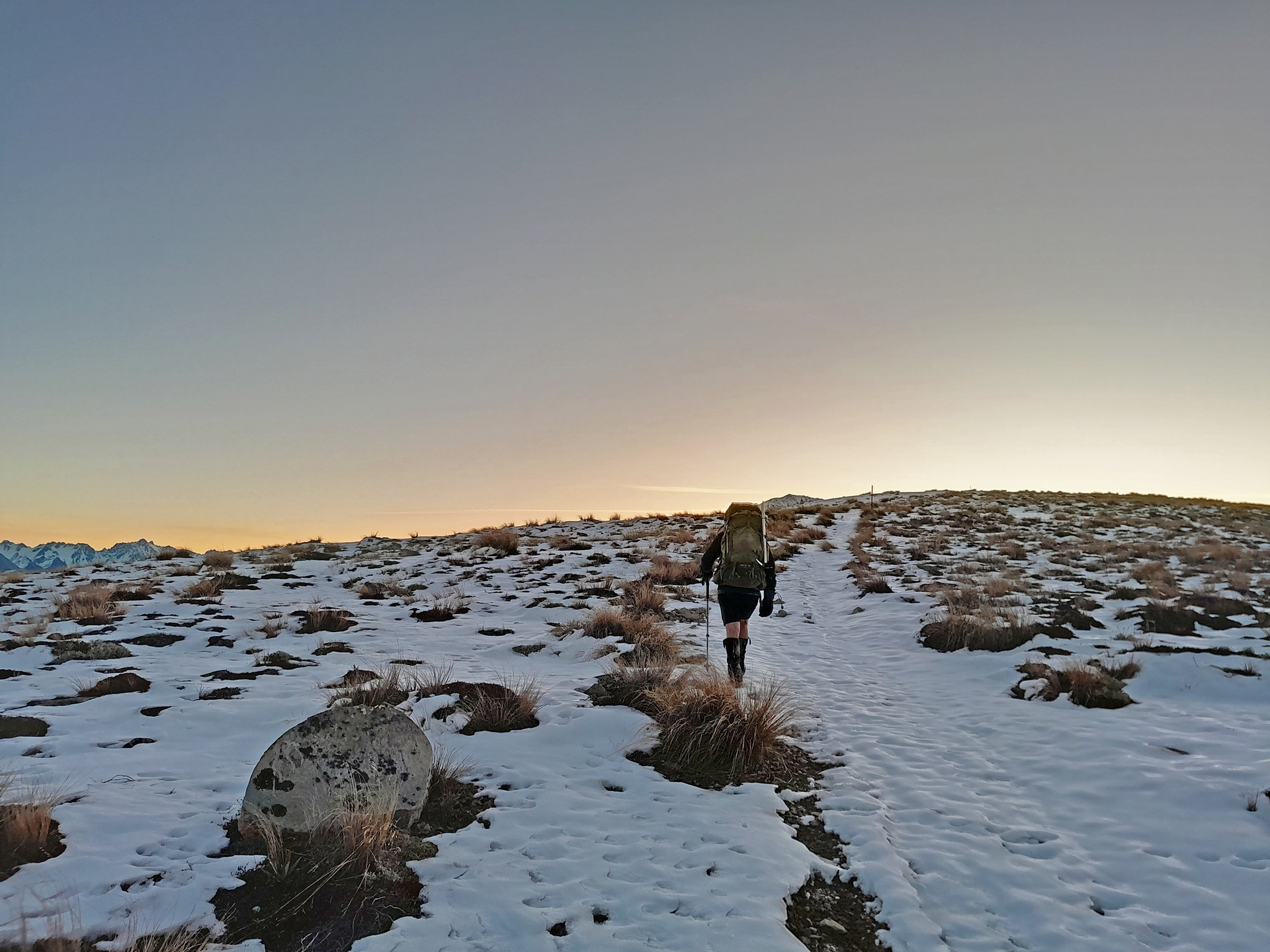
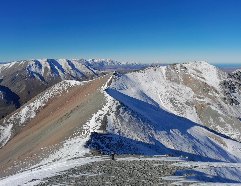
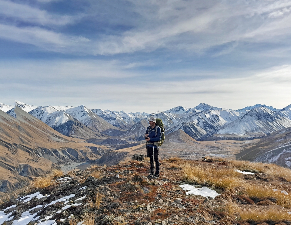
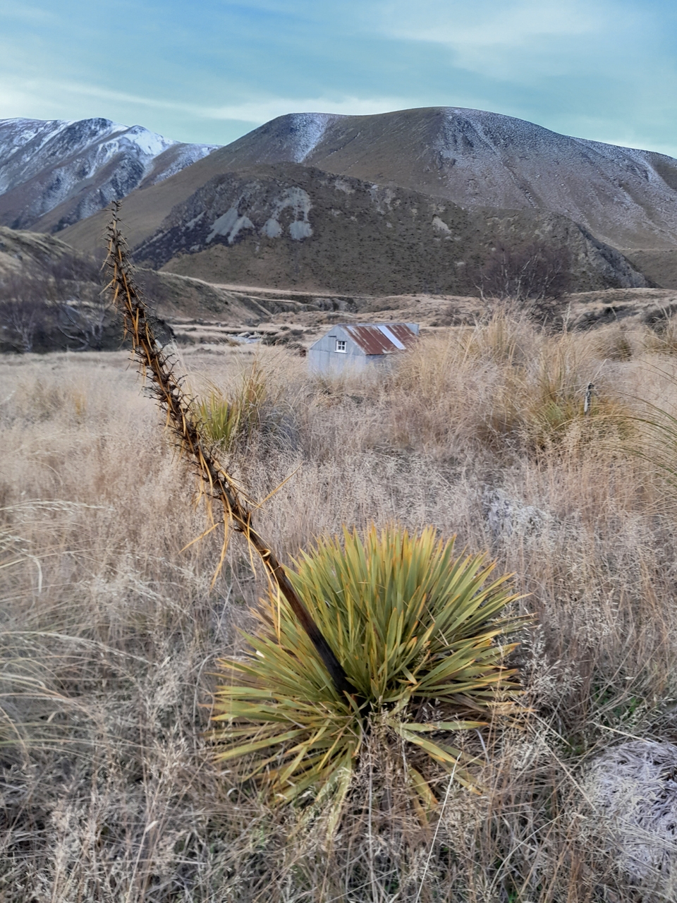
As we come off the Mystery Lake Track, I’m not particularly impressed when Matt easily jumps across a deep creek and I end up falling into the frigid water. At least we have a climb coming to warm me up again! Up on the Dogs Range (who comes up with these names anyways?!) Matt points out the Two Thumbs Range and Mount Sommers to me. We now have a layer of snow to walk through but luckily it isn’t very deep. I’m following animal footprints as that lets me assess how deep I will sink with each step. I’m sure Matt is following my footsteps wondering why on earth I can’t just walk in a straight line. It’s the animals, I tell him, they’re not walking straight and they clearly wouldn’t pass any sobriety test.
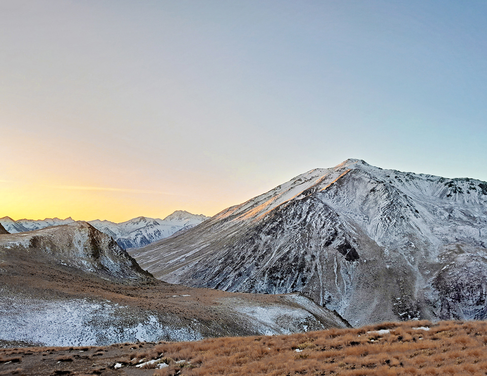
As the sun sets, we get a beautiful alpine glow over the Potts and Big Hill Range to our North and the Two Thumb Range to our West. Walking down the zig-zag track to Potts Hut we have to carefully navigate around patches of ice—these are easy to spot with our headlamps and fortunately it’s a clear night. We just missed out on the fun of having a full moon but we have a beautiful starry sky that more than makes up for it.
Matt and I nearly think there’s someone coming up the hill towards us (another crazy person!) until we realise that it’s just the reflective tape on the track marker poles shining back at us brightly in the lights of our headlamps. It makes it very easy to follow the track in the dark although we still have a rather hilarious moment when I’m looking for the next marker pole down by Potts River before realising that the hut is right in front of us. Well, actually the thing I thought was the hut was the toilet but it was close enough! I’m very glad to be able to finally hop in my sleeping bag as it’s been a long 24 hours and I fall asleep instantly.
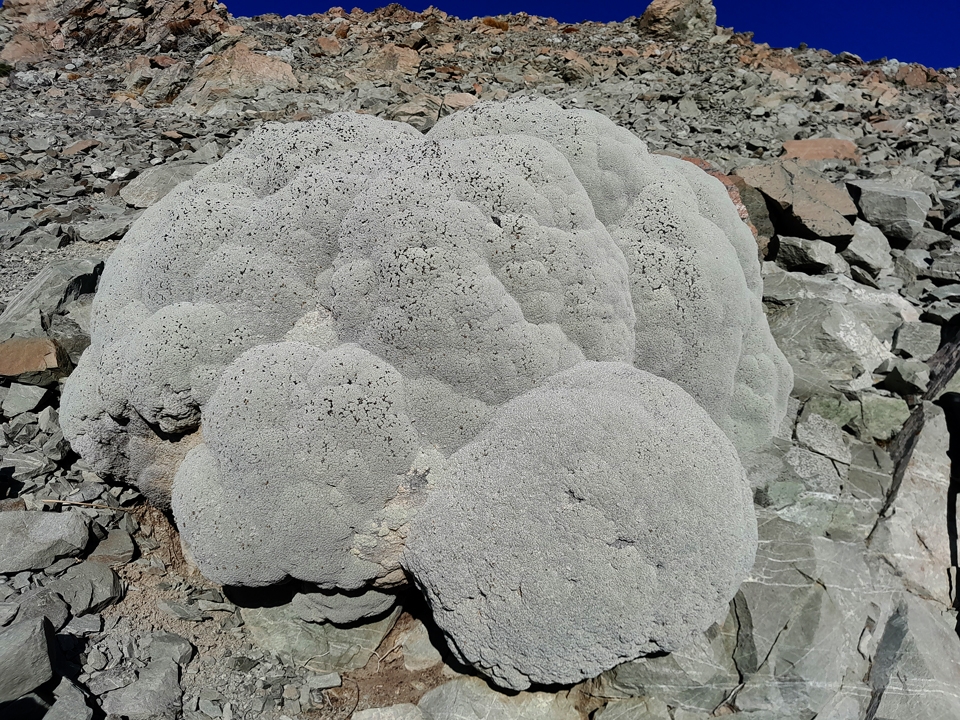
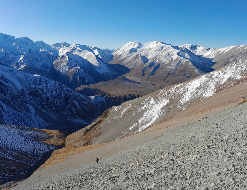
The next morning we head out the door with just day gear for an off-track mission. Our feet get frozen instantly crossing the Potts River before we start scrambling up the spur behind the hut towards Mt Potts. The tussock then turns into scree and it becomes hard work. I pick out a huge vegetable sheep that I feel is a good place to have a break and put my head down and smash out the climb to it. Despite the sheer hard work of climbing up scree that tries to send you back down the hill like a game of snakes and ladders, I am loving it as it’s another bluebird Canterbury day. As we climb higher we hit more snow and eventually make it to 2,060m on Mt Potts, about 100m under the summit, before the snow becomes hard and we decide to call it a day as it isn’t safe to continue up the final climb without crampons and ice-axes. There is a massive ‘slide for life’ risk. The mountain will be there another day and making safe decisions is our priority.
After sitting there for a while just to take in all the views and quietness, we start moving again as we’ve got a fun scree slide to go zooming down! I wait for Matt to start and pick a different line from him as I’m going to really send it! Back at Potts River we gather a bit of firewood but get back to the hut only to discover there’s no wood saw. That’s not much help. We do the best we can and get a fire going for a while with the limited wood we can break with our hands and feet.
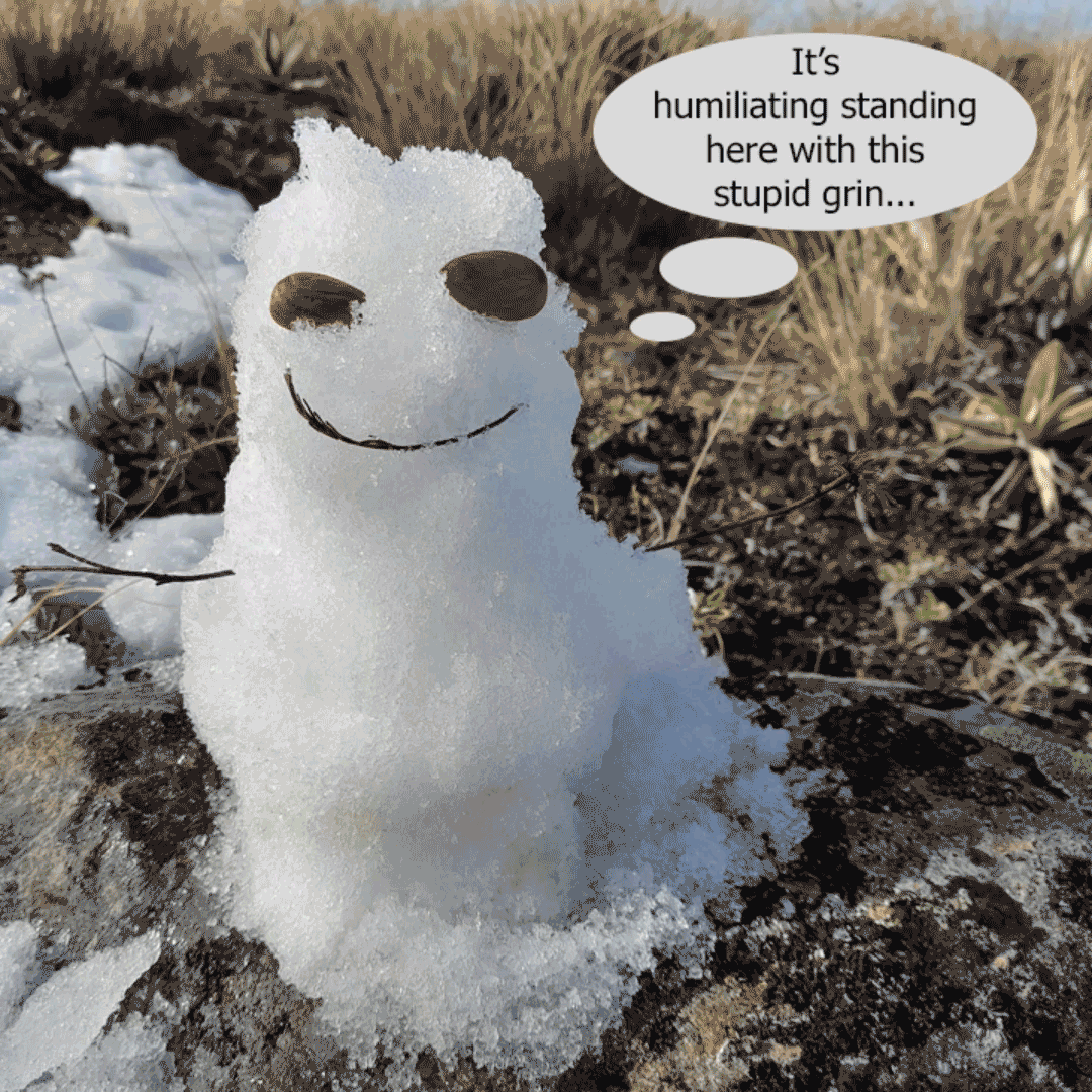
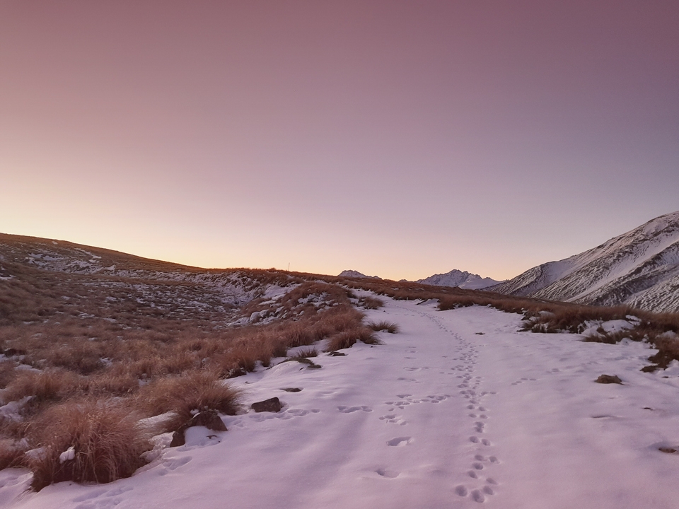
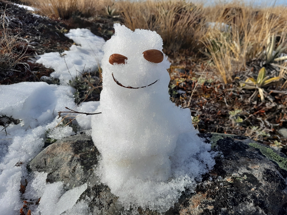
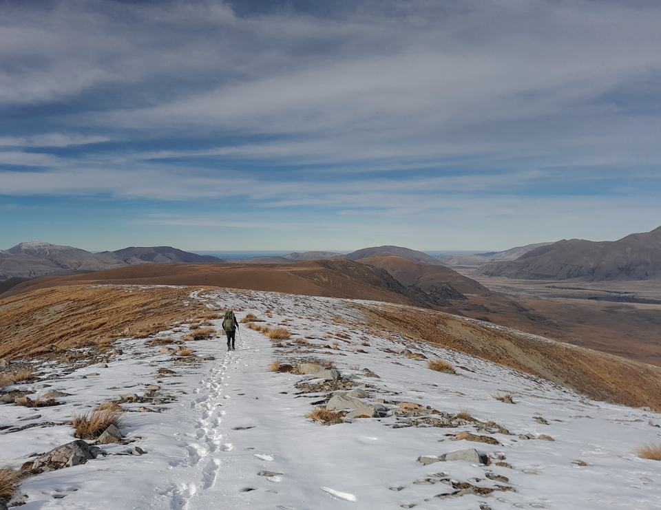
In the morning Matt and I wake to find our boots and socks have frozen overnight. We boil up some water to defrost them before once again heading towards the Dogs Range. We climb back up to the Dogs Range by taking a more direct off-track route. At lunch I get distracted and have fun building a mini snowman I fittingly called Mr Potts. It is another beautiful Canterbury day—I wonder aloud to Matt if Canterbury is always like this and if I should consider moving as I have always loved Christchurch. But then I remember I have responsibilities that include a job—it’s very easy to forget about all that when out in the hills.
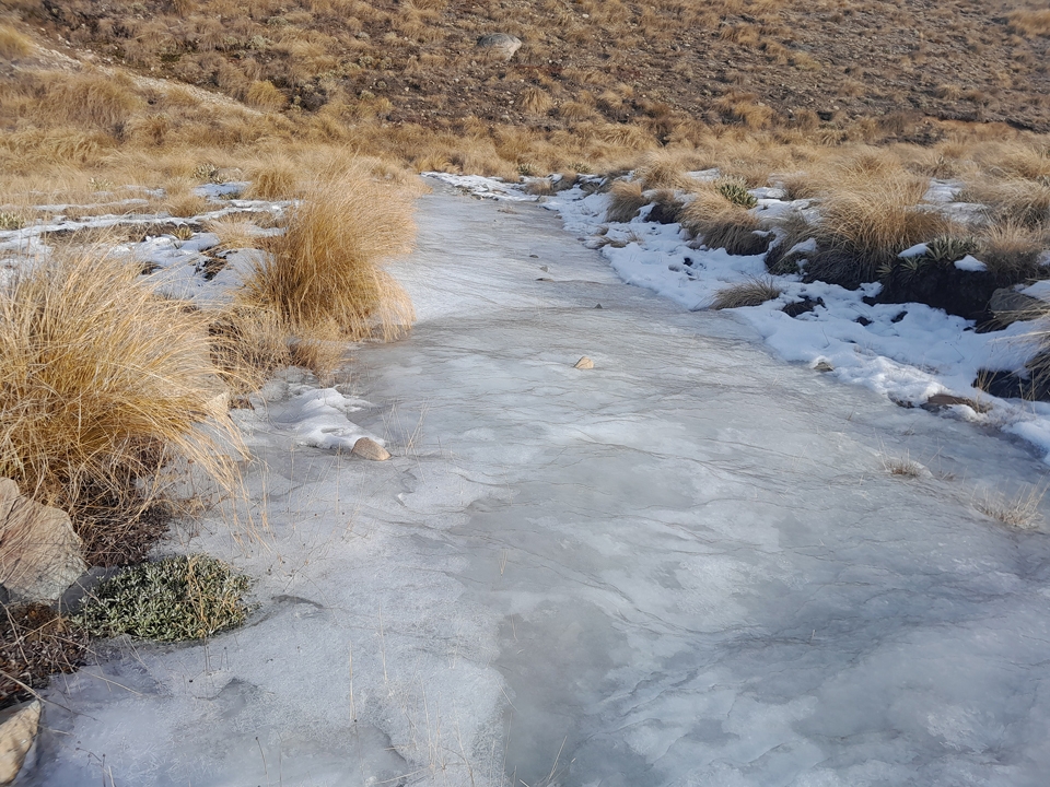
Heading back down to the Boundary Creek Hut Junction there is a wide expanse of ice that covers the entire track for about 100m or so. Matt calls it the ‘Bobsled’ because one step on it would be total carnage, sending you to the bottom of the hill with a no return policy. Luckily, we can easily avoid this ‘Bobsled’ by simply going off track around it and this time I manage to jump across the creek without falling in.
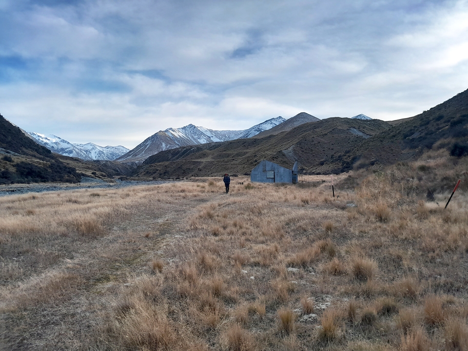
It is another climb before the long descent to Boundary Creek Hut that involves more ice avoidance dances in the shady spots on the track. We arrive at Boundary Creek Hut before 4pm and immediately put on more layers as the temperature is dropping fast as the sun goes down. I am wearing so many layers that I think Matt is surprised I can even move.
We have fun reading the hut intentions book, and I come across Joe and his dog, Floyd, who Tony and I have followed around in many hut books. I head outside to take a few photos, including one of a friendly giant spaniard that seems to capture everyone’s imagination when they see this photo on my return. I had just been explaining spaniards to my manager, Jackie, and now have a good photo to show her. She reckons the spaniard looks ‘quite stunning in a terrifying sort of way’, which I think sums them up perfectly. While they are prickly horrors and I have spent way too much time walking through villages of them that are nearly taller than me; or when race directors have deliberately made us run through them just for a laugh, they really are quite fascinating to see, especially the giant ones in the South Island.
I stay out for a while enjoying the stars before the cold sends me fleeing back inside to my warm sleeping bag. We are all tucked up in bed by 7pm which works well for me since I start night shifts the next night.
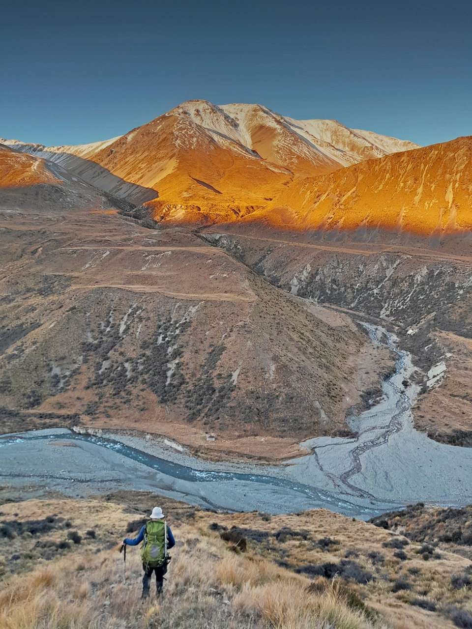
By 8am the next morning we are on the move after pouring hot water on our frozen boots and socks yet again. We are walking on a rough 4-wheel drive track through lots of tussock that really does look quite magical in the early morning light ahead of us. A few falcons zoom past us as we discuss the merits of the bush versus tussock country. As we hit the Mystery Lake track junction we see the first people we have seen in 4 days. They are out on a 4-wheel drive buggy doing predator control work to get rid of the pesky possums.
It’s an easy walk back down to the car by Lake Clearwater with me stopping a lot to take photos as it’s another gorgeous day and I really don’t want it to end and go back to work. Can I just stay here? I overpacked and still have food for about 4 days in my pack but Matt reckons my managers may notice I’m not at work. I’m not exactly convinced but follow Matt anyways.
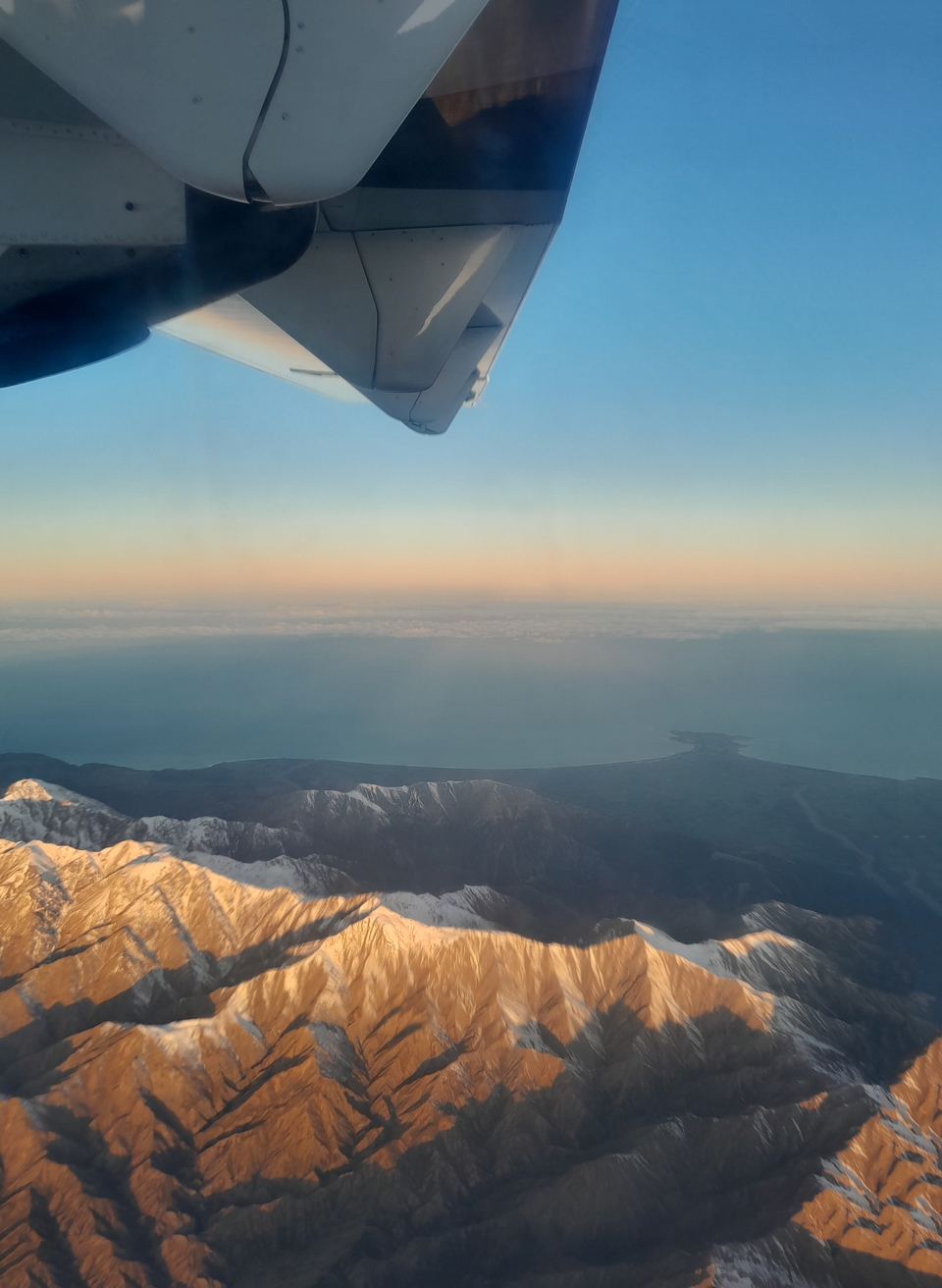
We get back to the car before 1pm and Matt drops me off at the airport just in time for me to jump on an earlier flight with Air NZ, catching the last of the sun on the Kaikoura Range and then the sunset as we fly into Welly to finally reunite me with my alpine gear that has had a very boring four days at the airport.
- Stats from Sarah’s watch
- Day 1: Lake Clearwater carpark to Potts Hut
- Distance – 23.6k
- Elevation – 1,153m
- Elapsed time – 8h
- Day 2: Potts Hut up Mt Potts (to 2,060m)
- Distance – 8.6k
- Elevation – 1,255m
- Elapsed time – 8.5h
- Day 3: Potts Hut to Boundary Creek Hut
- Distance – 15k
- Elevation – 900m
- Elapsed time – 6.25h
- Day 4: Boundary Creek Hut to Lake Clearwater hut
- Distance – 16.7k
- Elevation – 248m
- Elapsed time – 4.5h
More Sarah photos: https://photos.app.goo.gl/BrnQ1fotvypVnoVW9
Another Hakatere winter tramp:
Stumpy Stream