
Saturday – 10 May
On the weekend of 10 – 11 May, my mum, our new friends, and me decided to walk to Pāua Hut.
The hike started at the Catchpool Carpark (Remutaka Forest Park). We had our photo taken by the sign at the start of the track and then walked along to the “bird machines” – where there was information about a male and female kiwi, a Bellbird, a Tui and a Riroriro (Grey warbler)!
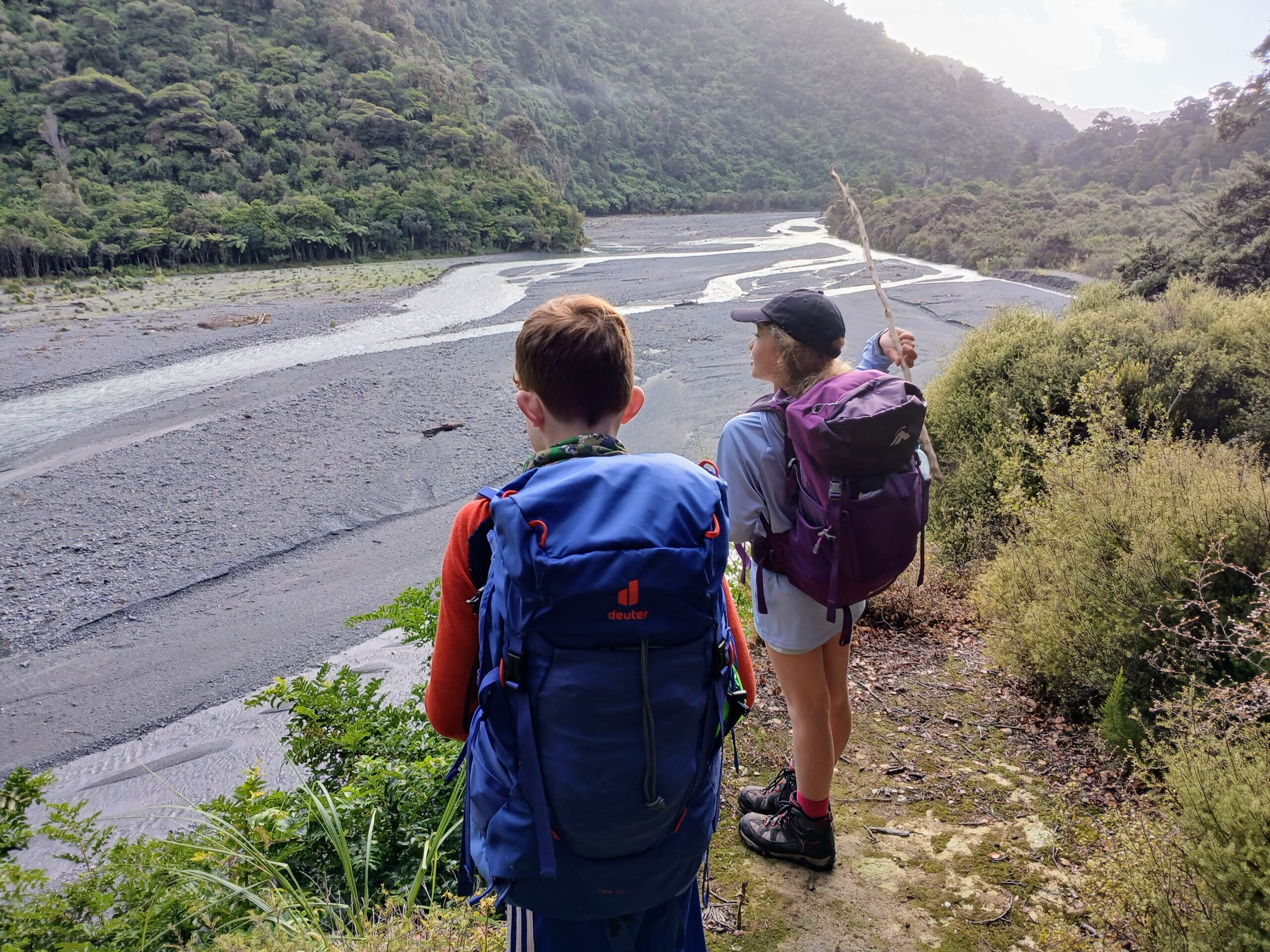
Once we reached Midway Bridge, we got a lolly refill! and I also found a strong enough stick to use as a walking pole. After reaching the Orongorongo River, we had lunch (I had wraps with salami, avocado and barbeque sauce) and built a dam.

After (partly) finishing building the dam, we had a river crossing lesson. This involved throwing a stick into the river to gauge the river flow. We saw that the stick was moving too fast down the river and the river water level was also very high, so we decided to go and look at Turere Lodge and allow time for the river’s water level and flow to hopefully slow down.
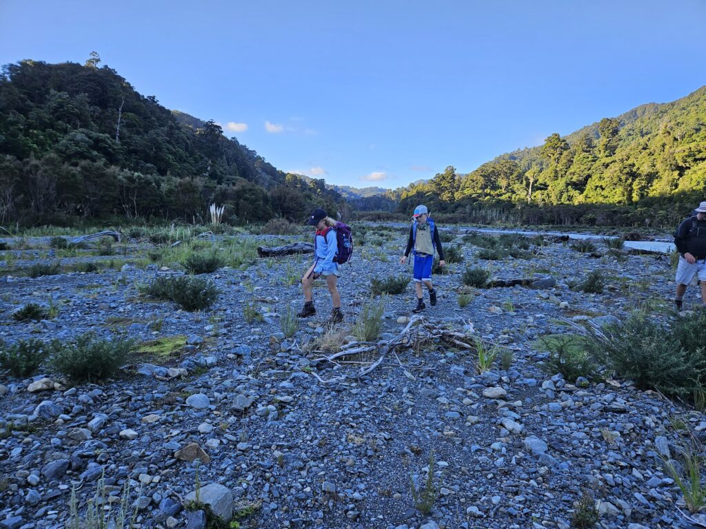
Once the river’s pace had slowed and the water level had lowered, we went back and my mum’s friend taught us how to cross the river. We all linked arms, walked into the river and then shuffled diagonally towards the other side. We repeated this process about ten times until we got to Paua Hut. The Hut was really nice – it had toastie makers and coffee plungers!
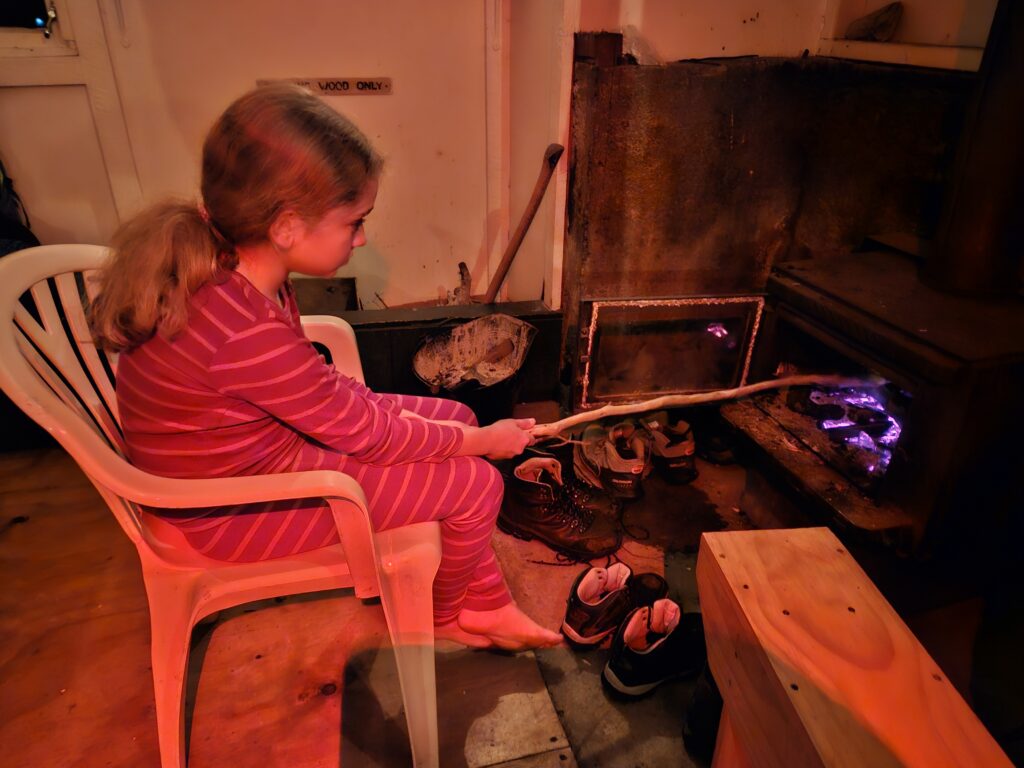
We unpacked our gear and played monopoly bid (a card game) once it got dark. We had some toasted marshmallows, chocolate pudding with custard and after playing spotlight we went to sleep.
Stats:
- Distance – 8.6 km
- Elevation gain/loss – approx. 305 m
- Elapsed Time – 5 hours (including breaks)
- Depart Catchpool Carpark– Arrive at Orongorongo River 1pm (5 km and ~215 m elevation gain): 10.45 am – 1pm, including snack breaks)
- Orongorongo River – Turere Lodge return (approx. 2.2 km and ~ 90 m elevation gain): 1.30 pm to 3 pm (including afternoon tea)
- Orongorongo River to Pāua Hut (approx. 1.42 km): 3 pm to 4 pm, including multiple river crossings!
Sunday – 11 May
In the morning we finished our game of monopoly bid, packed our bags and left the Hut. We crossed a section of the Orongorongo River in front of Pāua Hut. Once on the other side, we walked up Browns Track – which, at the halfway point, had a cool tricky bit to climb up. Once we made it to the start of the Cattle Ridge Track, we got a lolly refill and at the halfway point on Cattle Ridge we saw two red mushrooms. After this we followed a small track and then arrived back at the carpark.
We finished our trip off by driving to a dairy to get ice cream!
Stats:
- Distance – 6.3 km
- Elevation gain/loss – 521 m
- Elapsed Time – 4.5 hours
- Cross river, took Browns Track to Cattle Ridge track junction: ~ 800m and ~200 m elevation gain: 10am – 11am
- From Cattle Ridge junction along Cattle Ridge to Butcher Track junction: approx. 4 km, ~321 m elevation gain: 11 am – 1.15 pm (including lunch)
- Butcher Track junction to Orongorongo Track junction (approx. 1.4 km, and ~340 m elevation loss): 1.15 – 2.15 pm
- Orongorongo Track junction to carpark (approx 400 m): 2.15 – 2.30 pm
- Note from trip leader: our initial plan had been to return to the carpark via the Orongorongo Track. But given we returned via Baker Track / Cattle Ridge Track, the trip turned into Easy Medium grade territory (in particular, due to the condition of Baker Track and the additional elevation gain on Day 2!).
Great to see the family group getting out again. Looks like the kids had a blast.