
We started our long weekend adventure on Thursday afternoon, catching the Interislander to Picton. Thankfully, the recent technical issues plaguing both the Interislander and Bluebridge ferries (and recent cyclones!) were not an issue, and it was a perfectly smooth sailing. We drove to St Arnaud and pitched our tents at the DOC campground at Kerr Bay ($20). Great facilities, hot showers (tokens purchased at the office) and a kitchen supplying hot water from the boiler. Poor old Sam spent a cold night in a sleeping bag that kept unzipping itself! In the morning, we drove up to the Mount Robert car park and started our Travers-Sabine adventure!
Travers-Sabine is a full loop – skirting Lake Rotoiti, following the Travers Valley, going up and over the Travers Saddle, and then down the other side of the Sabine Valley. It is an 80km journey that DOC suggests spending 4-7 days to complete – with an optional detour to Blue Lake. It is a well-marked track. Some streams are bridged (other streams could rise after heavy rain) and there is a great mix of river travel, scree crossing, beech forested ascents and an alpine pass. There is an abundance of bird life and flora and fauna, and the mountain scenery at the saddle is second to none. We started on Good Friday morning, at 8am, and finished at 3pm on the Monday.
Day 1: Mount Robert car park to John Tait Hut
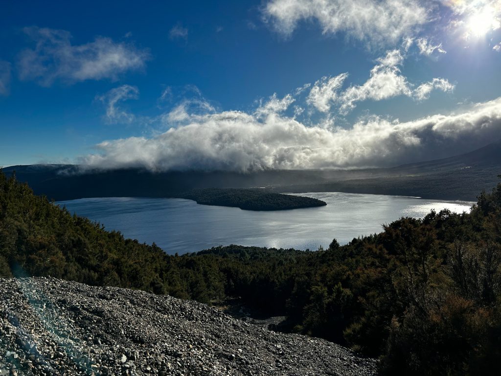
There is the option to take a water taxi to either Sabine Hut or Coldwater Hut (depending on which direction you do the walk), but we decided we would be purists and do the full loop. Starting at the Mount Robert car park, we had a wonderful introduction to a stunning trip, with plenty of bird song, as the sun’s rays shone through beautiful beech trees (the birds, in fact, were somewhat of a highlight around the lake, with an abundance of Tui, tītipounamu/Rifleman, South Island Robin, Tauhou/silver eye and Piwakawaka). We started on Paddy’s Track from the lower carpark, and our first jaw-dropping view was of Lake Rotoiti.
The track then veers down to the Lakeside Track after about half an hour. Pretty easy going, well maintained and very well-travelled.
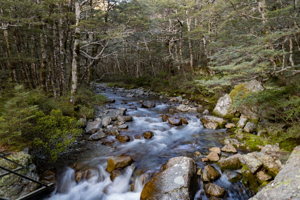
As we ventured around the lake towards Coldwater Hut, I was reminded of how walking in Nelson Lakes NP has a certain rhythm……up and down roots sidling beside the river, up and over flat grassy river flats, up and down river trail, stream crossing, grassy river flat, up and down river trail… is the general flow! Despite its proclivity for being mainly flat-ish, this type of travel is not to be underestimated. It can be pretty tiring – as we found out later that day! Nonetheless, beautiful it was, as always.
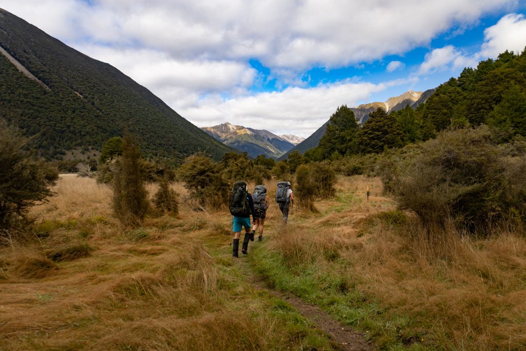
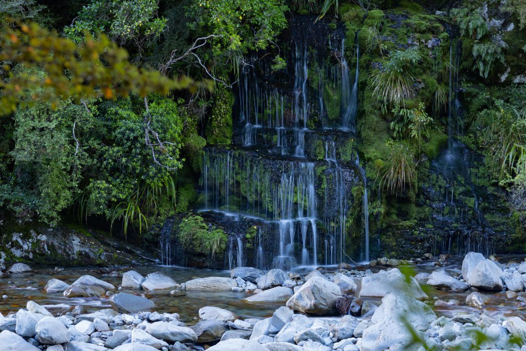
As we moved further up the valley (up and down, round, up and down, round….you get the picture!) our views for the morning had us glimpsing the St Arnaud Range to our left and the Travers Range to our right. We marvelled at the array of mushrooms and fungi along the trail (it was a mushroom fancier’s paradise) and the variety of beech trees. A couple of hours into the trail, we reached Whisky Falls. A pretty impressive waterfall and an impressive gnarly tree trunk! We reached Coldwater Hut at around 10.45am – perfectly timed for morning tea.
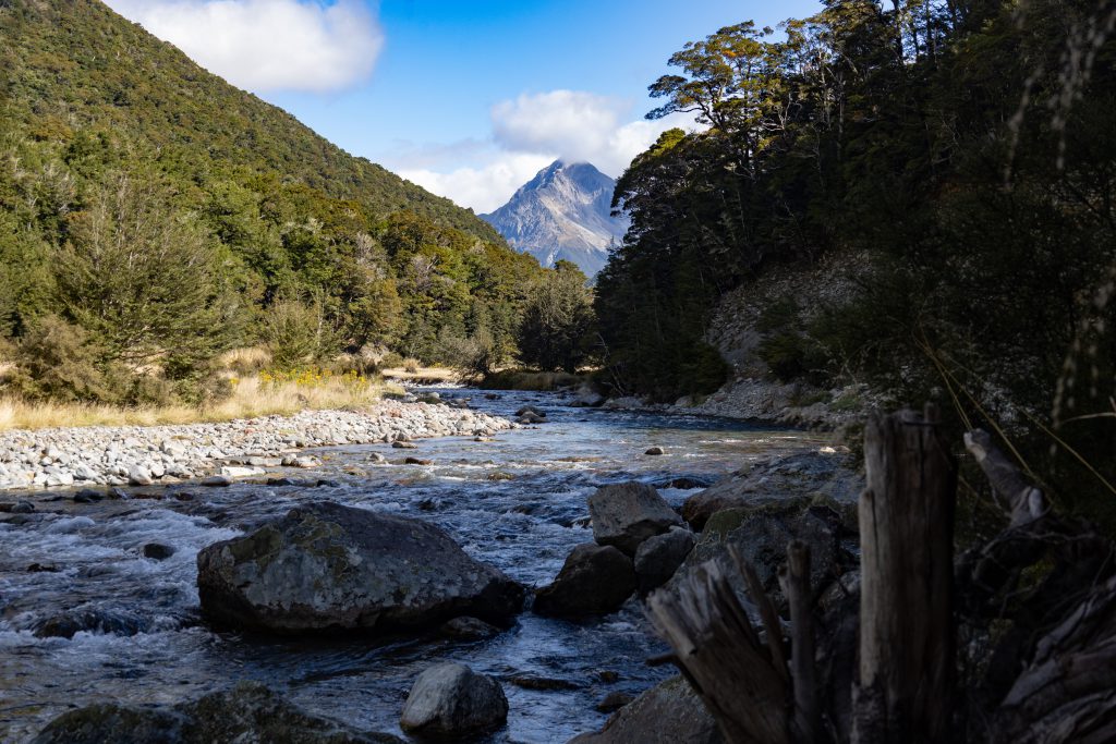
After a military previsioned, coordinated and executed break, we were off back into the rhythm of the trail, heading towards John Tait Hut. Shortly after Coldwater Hut, the track gradient changes from flat and undulating to a more sustained rise as you venture closer to Mount Travers.
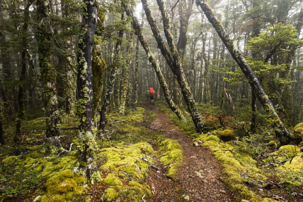
In the mid-afternoon sun, we emerged onto scree slopes, crossed more streams and boulder fields and entered a subalpine moss covered beech forest. The stuff fairy tales are made of.
After reaching John Tait Hut at 3.30pm, we had a snack and a rest. I could have happily kissed the person who asked: “should we stay the night here instead of carrying on to Upper Travers Hut?” – as I had been plagued with sore shoulders for the past hour. It seems sore things were plaguing more people than just me, and so we contentedly decided to stay at John Tait Hut for the night. This was great, because John Tait Hut is a lovely cosy serviced riverside hut with 27 bunks, a great fire place and plenty of flat camping spots outside. It was here that we started a debate, review and taste-test of the variety of dehydrated meals we had all brought along and we met a lovely fella doing a 7-month tramping meditation odyssey. Also at the Hut was Sonia, a German volunteer hut warden – on her first warden mission. Sam triumphantly fixed his sleeping bag zip. We all went to bed toasty-warm from the heat of the fire, excited about tomorrow’s views.
Day 2: John Tait Hut to West Sabine Hut (over Travers Saddle)
It’s always a great start waking with anticipation for sunshine, tussocky open tops, and an alpine pass. This day certainly had it all. We started early, as it was going to be a long day walking to West Sabine Hut – our destination for the night.
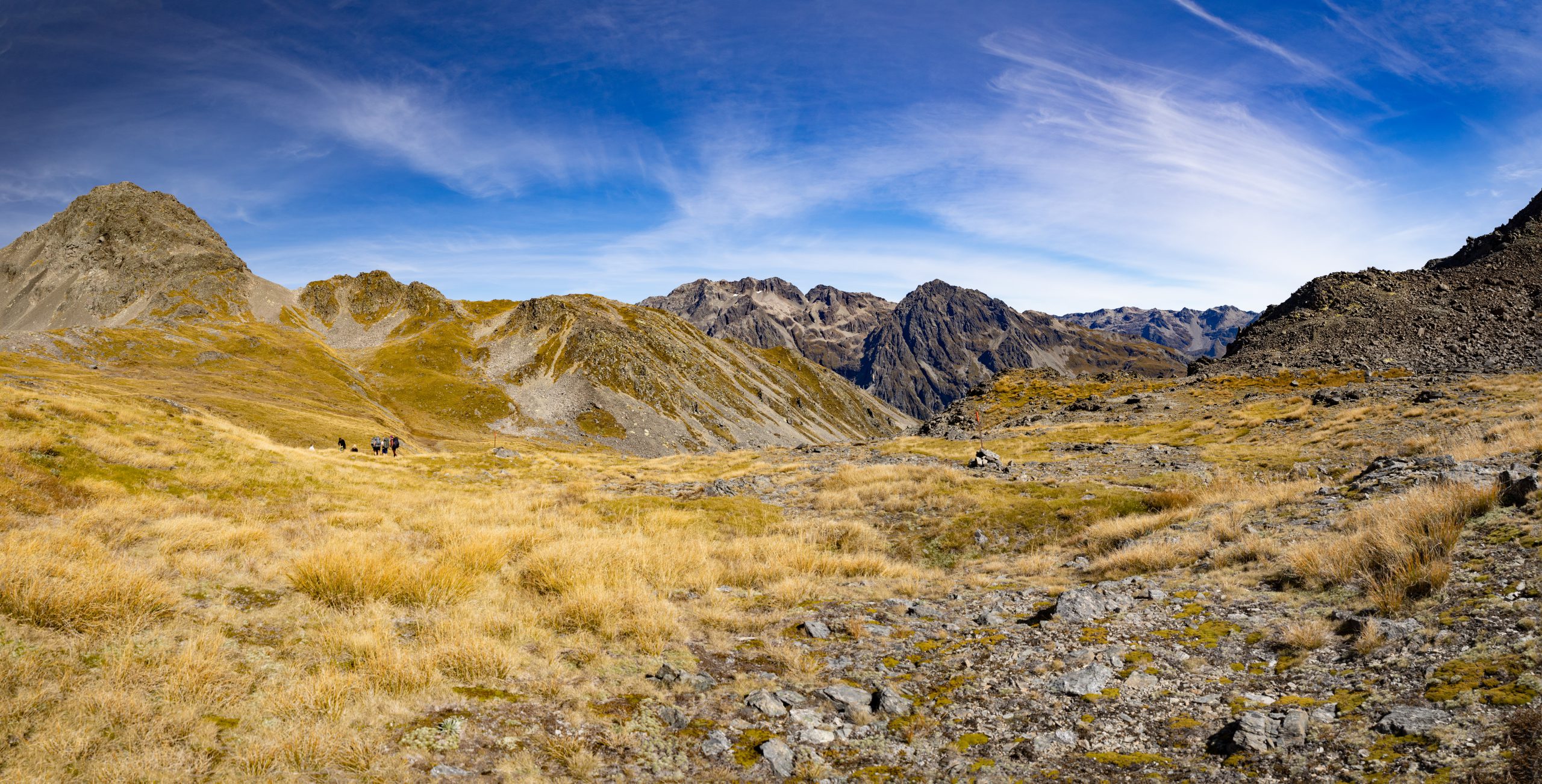
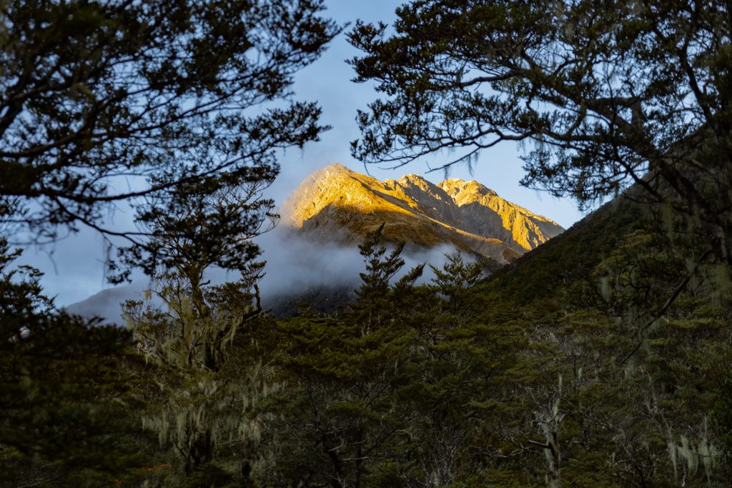
From John Tait Hut we went up and over Cupola Creek chasm, and up, up and up through stunted beech forest. Not far from John Tait Hut, the gradient of the track increases, culminating in a steepish climb to the open tops, leading to a beautiful mountain cirque, in which Upper Travers Hut perches. The Hut, nestled in morning sun and dewy tussocky flats, is perfection. It has 24 bunks and sits at 1320 metres elevation (and can get pretty cold without a fire, Sonia told us). It is, however, located in the most beautiful alpine basin, enveloped by the Māhanga Range, Mount Travers and the St Arnaud Range. It took us 3 hours from John Tait Hut – bang on with DOC timing! We had a quick break, and were excited to head up to Travers Saddle. The weather couldn’t have been any more perfect. Not a breath of wind, and not too hot. We basked in beautiful sunshine and there was a wispy cloud strewn blue autumn sky.

The trail from Upper Travers Hut to the lip of Travers Saddle is a fairly grunty ascent, as one would expect in an alpine environment. However, it was well marked and well-trodden (being part of the Te Araroa Trail), and not at all technical. Along the way, we stopped at a small rock formation that contained a waterfall, which was beautiful. We reached the Saddle by 11.45am – it had taken about 1 hour 45 mins from Upper Travers Hut. A well-earned lunch was had at a perfect spot – where we could see Mount Franklyn and had a jaw-dropping 360 degree view of the mountains. This, for me, was the highlight of the trip.
Once over the Saddle, there is a very efficient descent. Care is needed not to slip coming down- which would be treacherous in awful weather and ice. As we reached the tree line, the descent reminded my knees that they are the boss, no matter how much I try to seize control (there is a pretty steep and long descent of about 1,000 metres to the river).
Once down by the river, it’s back to the rhythm of the lakes, up and down, around, up, and down. About an hour from West Sabine Hut, travel through the forest seemed to go on forever. The last few kilometres of the day were like a race to the finish line, as there were plenty of people on the track all vying for the highly sought after real estate at the hut (we had tents as back up thankfully). We reached West Sabine Hut, our home for the night, at around 3.20pm, having proudly overtaken some groups of people who had stayed at Upper Travers Hut the previous night. West Sabine Hut was a pretty chaotic affair. So many people trying to get to the small kitchen facilities and to find a space to eat and a bunk for the night. We met some great fellow trampers to hang out with for the night, and we continued our debate and recommendations for dehydrated meals.
Day 3: West Sabine Hut to Sabine Hut
Our third day involved travelling down the Sabine Valley, going from West Sabine Hut to Sabine Hut. Again, there were undulating riverside trails, tussocky river flats, fungi, and beech trees. This was a relatively easy day, and we reached Sabine Hut at around 1.30 pm. We then had an afternoon of tea drinking. The sandflies were not too bad. We were expecting rain that evening, as clouds rolled in at around 3pm. The Hut was full to the brim, with a large multi-family group. The bird life there was truly remarkable…the trees by the lake were teeming with Tui, Piwakawaka and Tītipounamu. Their presence was undoubtedly due to the abundance of sandflies to snack on.
Day 4: Sabine Hut to Speargrass Hut and Mount Robert Car Park
Our final leg of the Travers-Sabine walk was a nice easy stroll out, via Speargrass Hut, to Mount Robert car park. The track to Speargrass Hut starts fairly soon after leaving Sabine Hut and involves a fairly strenuous climb to the spur under Robert Ridge – we climbed a solid 600 metres up to the day’s highest elevation point of 1060 metres. The track climbs to an open alpine beech clearing, which was moody with the forecasted rain coming in. We reached Speargrass Hut (12 bunks) around late morning/early lunchtime, and after a lunch break we headed back into the forest for the last leg of the trip.
The final part of the trip was a relatively easy sidle along Angelus Creek, up and onto the spur to the carpark. The weather started to turn mid-afternoon and the forecasted thunderstorm was spectacular. We made it to the car park at around 3pm, completely soaked to the bone. After getting our cold butts into some warm gear, we went to St Arnaud Lodge for hot chips, coffee, and the most amazing caramel slice I’ve seen in a while! Then, once back in Picton, pizza heaven awaited! Another smooth sailing over the Strait got us into Wellington sooner than expected, and in bed by 12.30am, dreaming of our next adventures. Our wonderful Nelson Lakes adventure was perfect.