
Due to poor weather, the plan for this trip ended up changing quite a bit. Originally, this was meant to be a Howletts Hut overnight trip in the Ruahine Ranges, but due to this walk having a decent portion of ridge travel and river crossings, we decided to do a loop walk a little closer to home. We began in the Waiohine carpark, went over the Mt Reeves track and came back via Tutuwai Hut and Cone Hut.
We met at the Wellington Railway station at 7.30am, before setting off. Arriving at the Waiohine carpark at 9am, we also met up with my Dad (René) who was tagging along to get some walks in pre Kepler and Humpridge. Setting off, we crossed the massive swing bridge and headed to the left, passing the Cone Ridge turn off and crossing the Coal Stream.
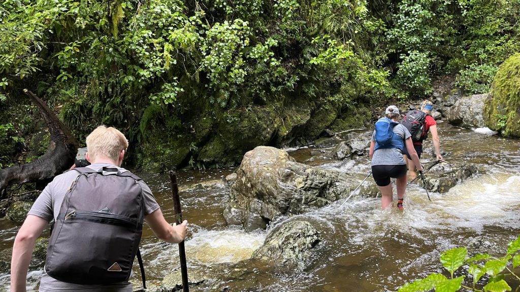
Note: Tereza and I crossed a little bit too high and the track is a few metres further down (straight across from Jack).
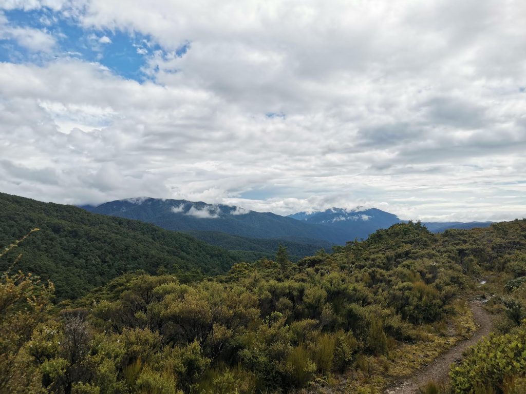
Across the stream, we began our steep ascent up the ridge. After just over an hour, we reached the turn off that takes you down to Waiohine Valley Road – the track from this road end is currently closed due to land access issues. After a quick snack, we continued on and broke out onto the ridgeline. We hadn’t anticipated any views due to the weather, so this was a pleasant surprise.
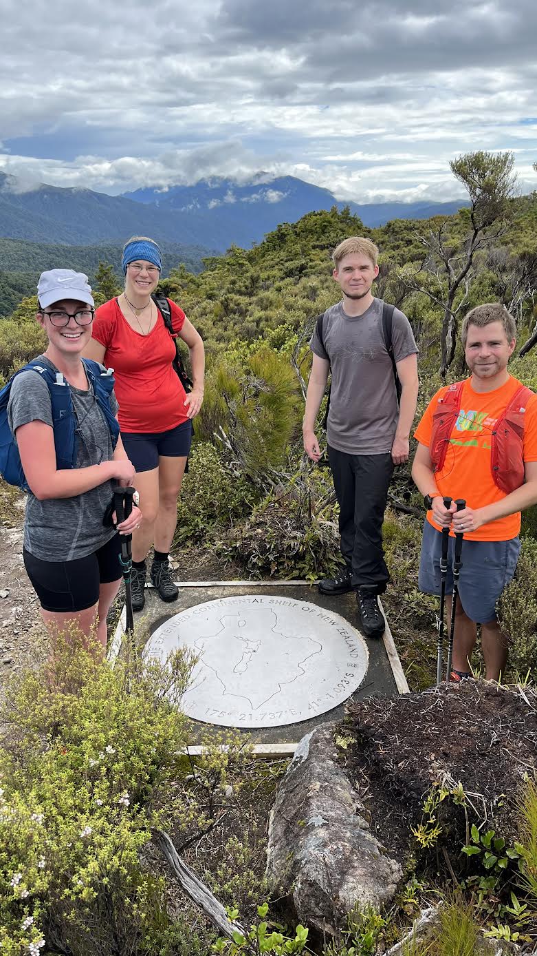
We weren’t along the tops for long before we came across the Centre of the Extended Continental Shelf of New Zealand marker. This is just before the point 785 marker on topo. This was pretty exciting, and the main reason that I had chosen this route. A few more details about this marker can be found here.
After the marker, we then continued along the ridge and had a little snack stop at the top of Mt Reeves.
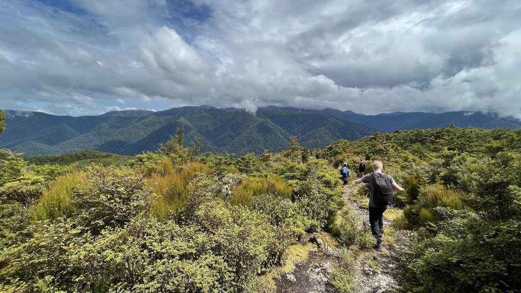
This was the highest point of our walk, and following this, we had a fairly quick descent down to Tutuwai Hut. At the hut we had our lunch and enjoyed filling up our water bottles as it was quickly becoming a very humid day. Leaving the hut, we then had the easiest section of the day, walking along the river from Tutuwai Hut to Cone Hut. Due to heavy rain in the previous days, the little streams along the way had a decent amount of water in them – which resulted in refreshingly wet feet. A few of us also refilled our water bottles from the Tauherenikau River, as we found the Tutuwai Hut water quite smokey.
After just under an hour of flat walking, we reached Cone Hut and had another snack and water refill (from the river, as the Hut tank water isn’t great!). We then turned right and climbed up to the ridgeline, avoiding the Saddle. This took us about 45 minutes, with several stops, as climbing in the humidity with no wind was a struggle.
Once at the top, we then had a gentle stroll along the ridge, heading back to the carpark. This section is very nice, with it only getting a little steep in the final 500 meters or so before the bridge.
Travel times (including breaks):
Waiohine Gorge to Tutuwai Hut – 4 hours 15 minutes
Tutuwai Hut to Cone Hut – 45 minutes
Cone Hut to Waiohone Gorge – 2 hours
Total time: 6 hours moving time, 7 hours elapsed time, 18km, 1,200m of ascent.