
Day 1: Friday 12 January – Poads Road to Waiopehu Hut
This trip was planned as a Medium-Fit trip in and out of Mid Otaki Hut via Poads Road. However, when it became clear a few other people couldn’t make the trip, and Mon and I wanted to visit South and North Ohau Huts as well, we decided to expand the trip and make it a bit more of an ambitious bush-bash.
We left Wellington at 4pm on Friday, having already eaten dinner. This allowed us to start walking from Poads Road at 5.30pm, with a good chance of making it to Waiopehu Hut by dusk. It was a very humid afternoon as we climbed up to the junction by Pt 515. Fortunately for us, the humidity dropped from there onwards and the going was much more pleasant (and gently sloping) as we climbed up the ridge towards Waiopehu Hut. The track is well marked and muddy in places, but not excessively – probably the result of a very warm, dry week.
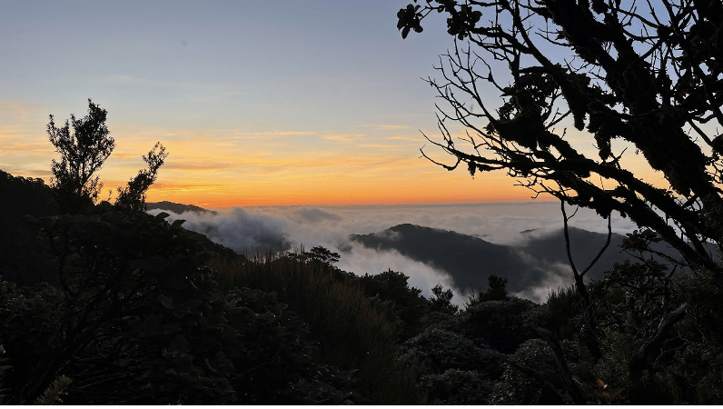
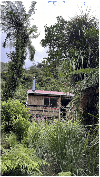
As usual Waiopehu Hut provided lovely views out towards the Kapiti Coast and sunset. We arrived just after 9pm to find one other person (doing the TA), and got to bed pretty soon thereafter.
Day 2: Saturday 13 January – Waiopehu Hut to South Ohau Hut (via the scenic route)
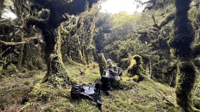
The next morning we had a relative sleep in and began walking at 7.45am. We knew it was “the big day” and we were rested and prepared. I had forgotten how quickly after Waiopehu Hut you gain the summit of Mt Waiopehu. After checking the map here we backtracked slightly and found our way relatively easily across trampled boggy ground onto Oriwa Ridge. Pink markers here and there were greatly appreciated, but fail to indicate which direction to travel. During this section we aimed to keep to the ridge. From time to time we found sections of what looked like relatively obvious track, but it vanished as quickly as we found it. Much discussion of ‘confirmation bias” (finding what we wanted to look like a track) ensued and our general principle was “when in doubt [at a fork] take a right [closer to the ridge line]”.
After a short break at Pt 1015, we carefully navigated the corner and came to the expected clearing where the old Oriwa Biv water tank (important to note that it collects rainwater and does have a working tap) and a hydrology station are located. Thick leatherwood made the next few minutes more unpleasant – despite being incredibly dense and unyielding, there were clear markings to indicate that it was the established path to gain Oriwa summit (Pt 1085) a short distance away. Despite this, it would have been a great deal easier to have crossed the grassy flat and scoot west of the leatherwood, through the beech forest, to join the track some 20-30 metres on.
Things got a bit more frustrating from here. We knew we needed to find the South-East spur to descend to Mid Otaki Hut. The first time, we went a short way past the summit on an obvious path, then dropped down to see if we could find a spur, only to quickly find ourselves kind of bluffed out by a gully and bush-bashing. So, frustrated, we scrambled up a steep slope to regain the track and re-assess our route. The second time, we felt we needed to continue further down the track (closer to Pt 985) and then drop down. But our GPS was showing that we were heading North-West – in the opposite direction to where we wanted to go. Frustrated, we swallowed our pride and admitted we needed to head back to the summit (which in reality was only 5-10 minutes away) to regain our bearings. We estimated that we lost about 45 – 60 minutes due to these two “detours”.
Dumping our packs at spot height 1085, we hunted for the ridge, finding it about 40 metres before (north) of the high point. A pink marker confirmed the route. Our spirits lifted and we continued down the spur looking for tell-tale signs of human presence – a footfall in the mud, occasional blue diamond markers, or – our favourite – a worn and recessed section of log. All while Mon shared her latest project: creating a ‘Tramper’s Paradise’ song to the tune of ‘Gangster’s Paradise’.
We navigated the spur turns carefully. While it still took over 90 minutes to get down the spur, before too long we could hear the welcome sound of Murray Creek as we increasingly (and steeply) dropped down to meet it and the Otaki River. While it had been an “interesting” section of bush, we were pleased that we were not going to be going in and out the same way.
Having hit Otaki River, we crossed it and made our way through a nice, relatively open section of bush, until we came across Mid Otaki Hut, at approximately 2pm. It is a very well-maintained 2-bunker, in a lovely spot right on the river, with a bench out front and easily accessible swimming holes. If I needed to pick a hut to spend a week at in the Tararuas (getting choppered in and out with togs and some good books of course!) it’d probably be this one.
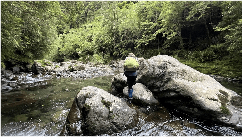
At approximately 2.30pm we returned into the water, knowing we had about 4km of wading upriver ahead of us. Most of this time was quite pleasant, with my main frustration being some heavy foot falls on the unforgiving rocks jarring my knee. We quickly lost count of the amount of times we needed to cross the river, but this was never perilous and the highest the water got was wading through thigh-height pools of gently flowing water (shorts hardly got damp!). Having been a dry week, the river was not high and we took advantage of stretches of grass so we could make faster time – rather than rock-hopping.
We did not know what awaited us at the top of the river on the return to the main Butcher Saddle / Dora Track. We assumed it would not be bad and started discussing options for a medium level trip to the lovely secluded spot where Mid Otaki Hut is located. There were a couple of lovely grassy sections next to the river that would be perfect for camping, and we took the liberty of noting down the co-ordinates of the location. A first day from Poads Road to that camping spot via Butcher Saddle or Dora Track (approx. 8hrs), a second day down to the hut and back to the camping spot (approx. 6hrs) and a third day back to Poads Road (approx. 8hrs). This, we thought, would make for a lovely long weekend, offering lots of opportunities for swimming and relaxation.
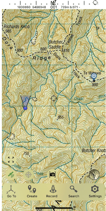
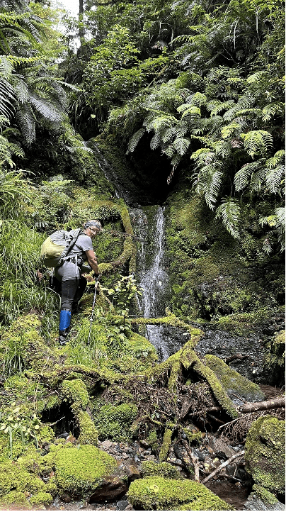
Sadly, there was no good track to lead us back to the main track. We intended to take the middle stream until we reached the “g” in “Dora Ridge” on the topo map. And then we’d bush-bash 60 metres to Butcher Saddle. Upon seeing the stream, we quickly saw it was too narrow, so opted for the next stream up-river. This, according to our map, would take you almost the whole way up to Dora Track – about 400 metres from Te Matawa Hut. This was much wider than the first stream, but we quickly reached a two-tiered waterfall and after a brief attempt at trying to climb a slippery log, we were forced to back-track. Fortunately there was, on the left of the stream (several meters before the waterfall) a steep bank with the ghost of a track that climbed essentially vertically for about 15 metres before reaching a ledge. Gritting our teeth, and searching for good handholds, we clambered up. We then gathering our bearings and resolved to bush-bash up the spur between the two streams (which takes you to the word ‘Dora’ on the Topo map).
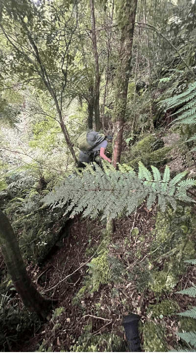
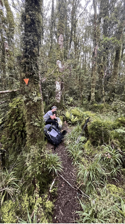
Having been on the go for close to 11 hours in humid weather, it took about an hour to cover this relatively short distance. We took a few brief breaks to gather our breath before forcing ourselves up the next steep section – navigating around a bluff or clambering over or under dead, fallen trees. Our image of a nice track for other club members to navigate down to the river vanished, as part of the aforementioned lovely Medium trip vanished. However, the GPS did not lie – we were making steady progress towards the track and we were very pleased to see an orange marker in the distance that indicated a return to relatively normal tramping conditions.
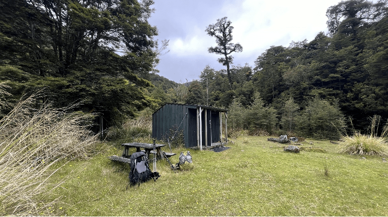
Fortunately, we had navigated to a few minutes from the Yeates Track turnoff. This was much closer to where we wanted to go than if we had followed either stream to their origin. As we dropped down Yeates Track, the humidity increased, and we joked how, if anyone else was at South Ohau Hut, that we could confuse them by saying we had left Waiopehu Hut over 12 hours ago and had taken the scenic route. However, we had the Hut all to ourselves. So after a well-earned Real Meals dehy dinner, we went to sleep.
Day 3: Sunday 14 January – South Ohau Hut to Poads Road (via North Ohau Hut)
We began at 8am and were immediately in the river. The first kilometre or so was relatively straightforward, but the river increasingly became a gorge with large boulders to navigate. Walking poles were an absolute god send here, but there were still a few slips on rocks and some clambering. We noted that a club trip to South Ohau Hut had recently been cancelled. Given it was billed as an Easy-Medium level trip, we thought it was probably a good thing it got cancelled, as we could see that a trip to South Ohau Hut was more suitably categorised a Medium level trip, given the technical river travel.
After about two hours we reached the junction to North Ohau Hut. We had heard there were deeper pools of water up this stream, so considered leaving our packs at the junction. However, we then decided it was better to proceed with our packs, lest the weather got worse (it wasn’t raining but the clouds were growing darker and the wind was picking up). We needn’t have worried – the river level was relatively low and while there was a gorge section beyond a large slip on the right-hand bank, the going was more straight-forward than the gorge heading in to South Ohau Hut. It took us about an hour to reach North Ohau Hut, so we were pleased we had brought our packs for the two-hour detour. And it made the lunch break at the Hut that much better.
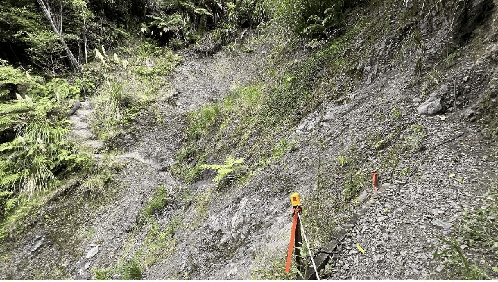
The river broadened out following the junction and we made faster time. We noted a couple of good camping spots – one with a picnic table! A big orange marker was easy to spot as we exited the river, made our way over the swing bridge and came across two slips. Both slips were straight-forward to navigate and there were ropes at one of the slips, which was very helpful.
We made it back to the car by 3.30pm, had a quick visit to Burger King in Levin to celebrate the end of our successful tramp and we were back in Wellington shortly after 5pm.
In conclusion, it was a rewarding weekend. Over three days the elevation gain is not substantial, but the extensive sections of off-track navigation, bush-bashing and (at times technical) river travel should not be underestimated. Being a party of only two people we were able to benefit from minimal breaks and inefficiency, and moved reasonably fast, without rushing. In saying this, the middle day was still long, and could easily have been longer with poorer navigation skills. For these reasons we would classify this loop as a Medium-Fit level trip.
Statistics (taken from Daniel’s Garmin watch)
| Day | Start | End | Elapsed time | Moving time | Distance (km) | Ascent (m) | Descent (m) |
| 1 | 1731 | 2107 | 3:36 | 2:52 | 10.16 | 937 | 181 |
| 2 | 0746 | 2028 | 12:42 | 10:22 | 24.04 | 647 | 1,337 |
| 3 | 0759 | 1528 | 7:29 | 6:34 | 18.73 | 230 | 399 |
| Total | – | – | 23:47 | 19:48 | 52.93 | 1,814 | 1,917 |