
Tagged: Arete Hut, Carkeek Hut, Carkeek Ridge
- This topic has 0 replies, 1 voice, and was last updated 4 years, 10 months ago by Tony Gazley.
-
AuthorPosts
-
-
Tony GazleyParticipant
“Hiking is not escapism; it’s realism. The people who choose to spend time outdoors are not running away from anything; we are returning to where we belong.” (Jennifer Pharr Davis)
I needed to recharge my batteries after night shifts so Tony and I decided it was time for another one of our adventures. Funnily enough the weather was looking best in the Tararua Ranges so we decided to follow that good weather. Carkeek Hut has been like the holy grail for me as it is one of the most remote huts in the Tararua Range with no formal tracks to it and getting there in just a weekend is a bit of a mission unless you are really zooming along. I also had never been to Arete Biv despite getting close enough to give it a wave on a SK Main Range tramp so we hatched a plan to visit both these huts which I was super excited about.
We had a very relaxed start time from Poads Road. Before we even started the climb up Gable End Ridge, we came across a big slip—the track suddenly disappeared right in front of us. Luckily there was a route above it and someone had helpfully put some rope in to hold onto as the route went across the top of the slip. It was a good honest climb up Gable End Ridge but we were rewarded with superb views down to Ohau and Levin and all the way across to Kapiti Island. It really was a fab day. After the long haul up to Richards Knob it seemed like an equally long descent down to Butcher Saddle—what goes up must go down apparently.
After Butcher Saddle we had to use our headlamps for the final section of the track to Te Matawai Hut. We had the hut to ourselves which we expected given it was mid-week. Last time I was at Te Matawai the hut was surrounded by snow and the water tank had frozen. No sign of any snow this time; the only thing I found was pesky possums. Tony laughed when he heard a squeal after I opened the door of the hut and found myself face to face with a hungry looking possum. He or she hadn’t read the “no junk mail” sign by the door.
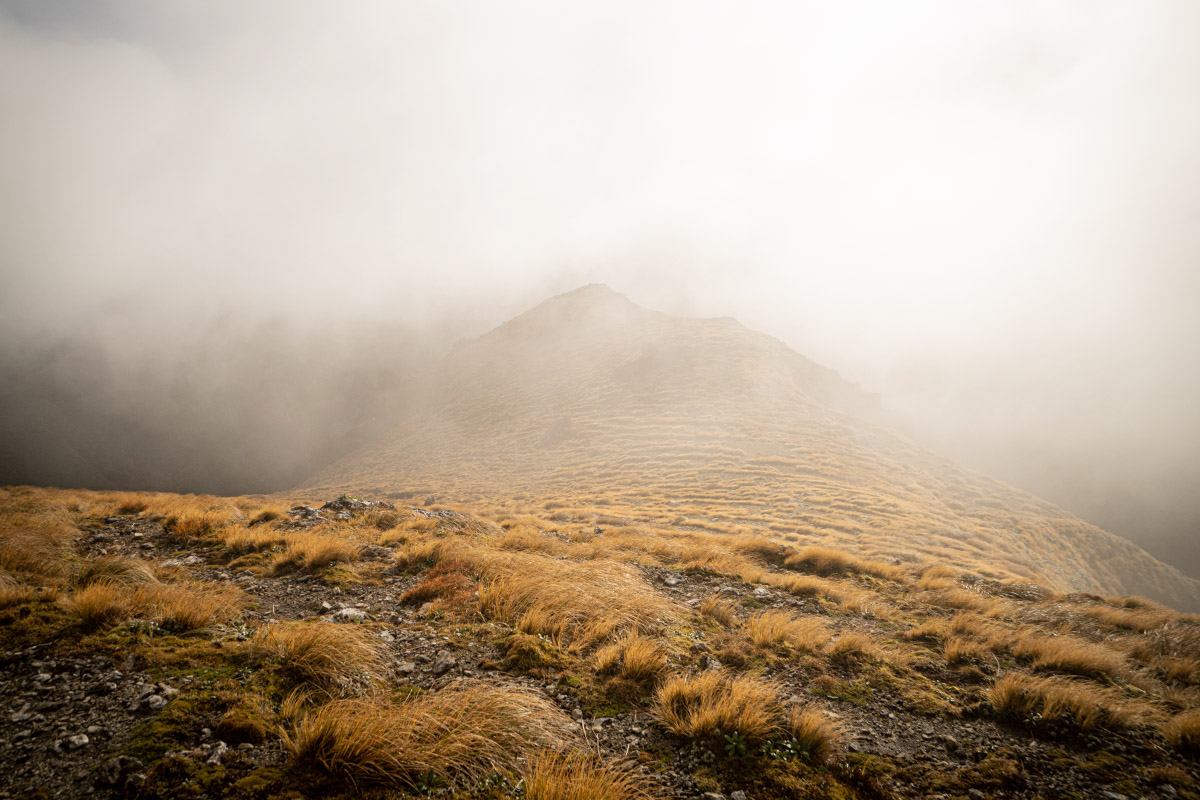
The next morning it was raining heavily so Tony and I decided to be lazy and curl up in our sleeping bags and go to sleep again, waiting for the rain to pass. We eventually got started around 12:30pm when the rain had eased off. It was claggy on our way up but it would clear occasionally to give us views back down to Te Matawai Hut. There was a solid wind chill factor up on Pukematawai so after layering up we got moving quickly towards Arete Hut. The route was pretty slippery with mud from all the rain. On Arete we had to pull out the map and compass along with the GPS to find our direction of travel as visibility was non-existent with all the clag.
It was during our descent to Arete Biv that we got misled by an old marker pole that apparently led to the old Arete Biv site. It was now starting to get pretty cold and we decided we would stop at Arete Biv rather than pushing on to Carkeek Hut but first we had to actually find Arete Biv! After realising that we were possibly a bit geographically embarrassed, we stopped and the GPS confirmed that we were 200m north of hut on the same contour—this explained the steep terrain above Arete Stream that we were looking down on. After backtracking we eventually found the correct marker poles leading to the current Arete Biv.
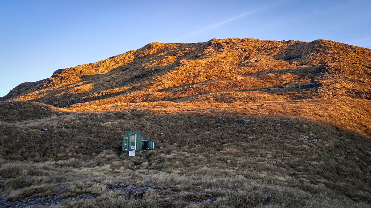
Arete Biv is only a small 2 bunk hut so it’s not super cold like some of the bigger huts and we warmed up quickly once we had dry layers on. The clag was so thick that even though the toilet was less than 50m away from the hut you couldn’t actually see it. A hilarious sign on the wall boasted about how DoC was introducing solar powered WIFI into the Tararuas and you only had to hold your device as high as possible in the air and walk around and around in circles until connection was achieved. The password in Te Reo essentially translates to pulling your leg. I know one or two people who have been fooled by these posters.
The clag was back the next morning again but the weather forecast predicted it would clear later in the day and as we climbed up to our turn-off point to Lancaster it started to do exactly this. Tony pointed out to me the U shape of Park Valley and Waiohine Valley—both had in the recent past been glaciated. This had first been discovered by Leslie Adkin and who now has only a small Tararua peak named after him. We both thought that he should have been rewarded with a much more significant peak as it was an impressive finding for his time—and he was ridiculed for many years by other geologists before it was eventually confirmed.
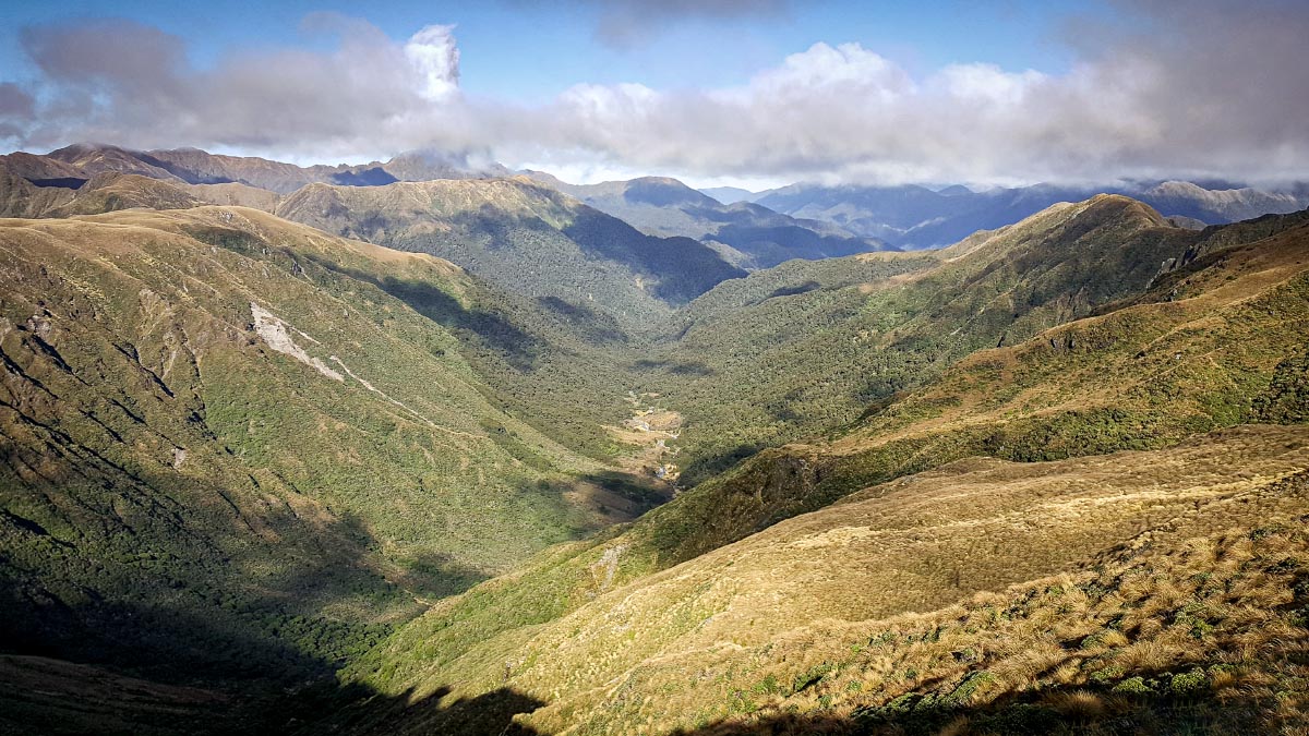
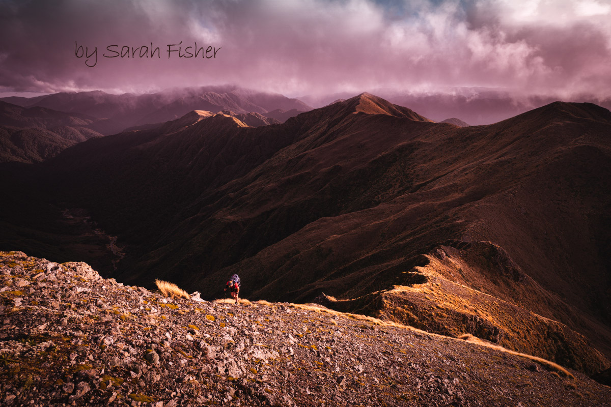
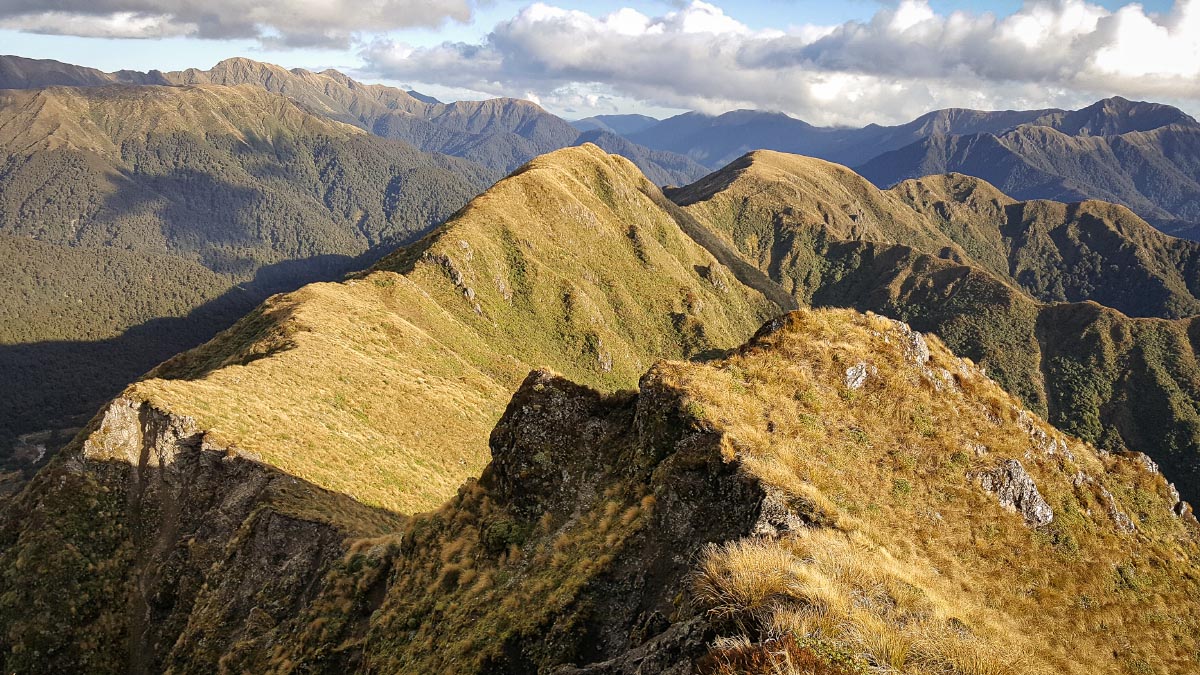
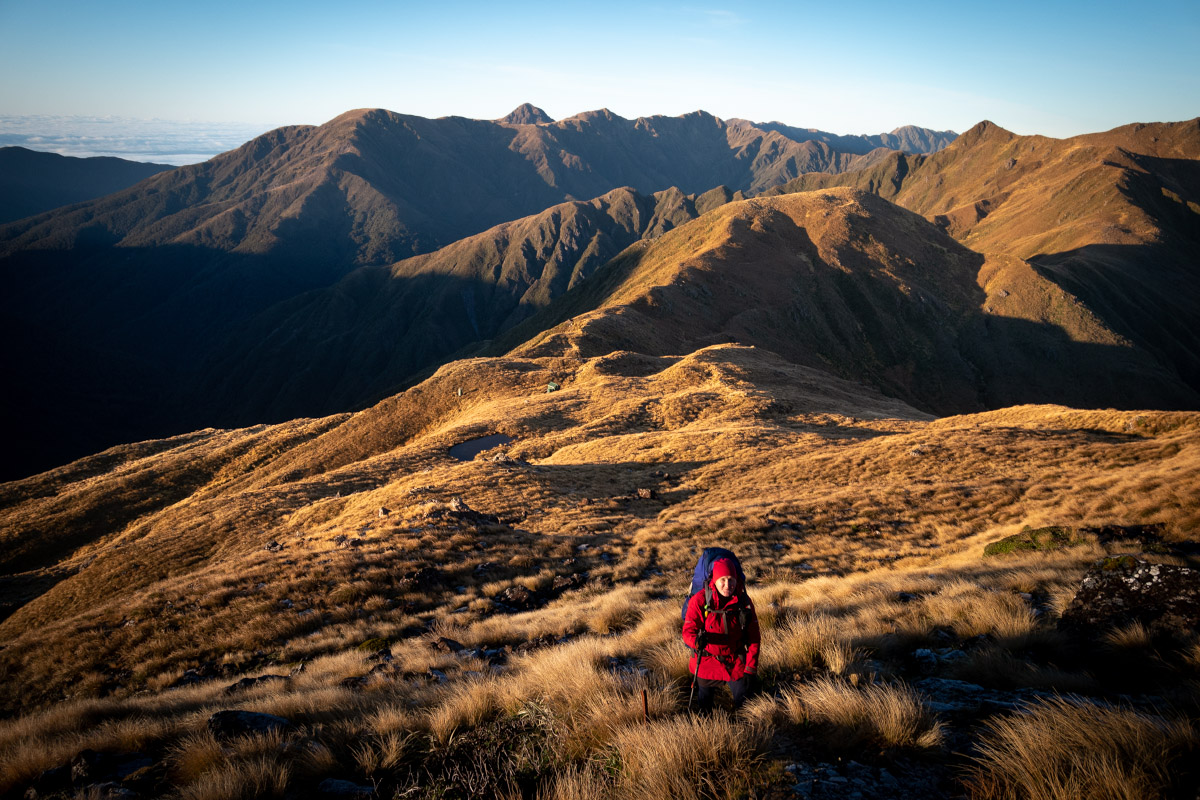
It was turning into a real bluebird day up there and the clag had now completely cleared—we had amazing views over towards Tarn Ridge, Waiohine Pinnacles and down along Carkeek Ridge. Tony sent me on my way at Thompson Peak and said he would see me again in four hours while he sat on the ridgeline taking photos.
Around Carkeek Peak there were a few bluffs but it was still easy to negotiate down. Finally making it to Carkeek Hut was a pretty special moment. Not only because Carkeek Hut had been my Tararua holy grail hut for a few years but because of what I had achieved that afternoon and what it represented. A year ago, I wouldn’t have had the confidence to do anything solo off track but now here I was going solo in the Tararua Ranges.
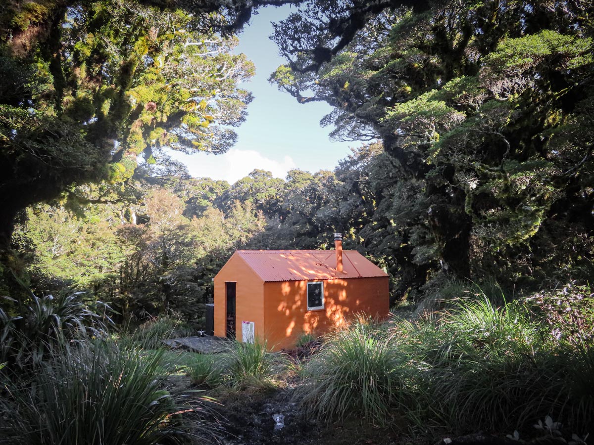
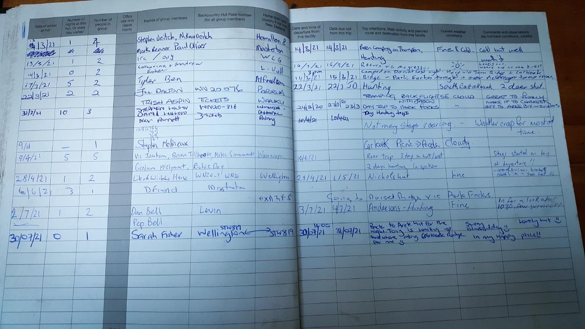
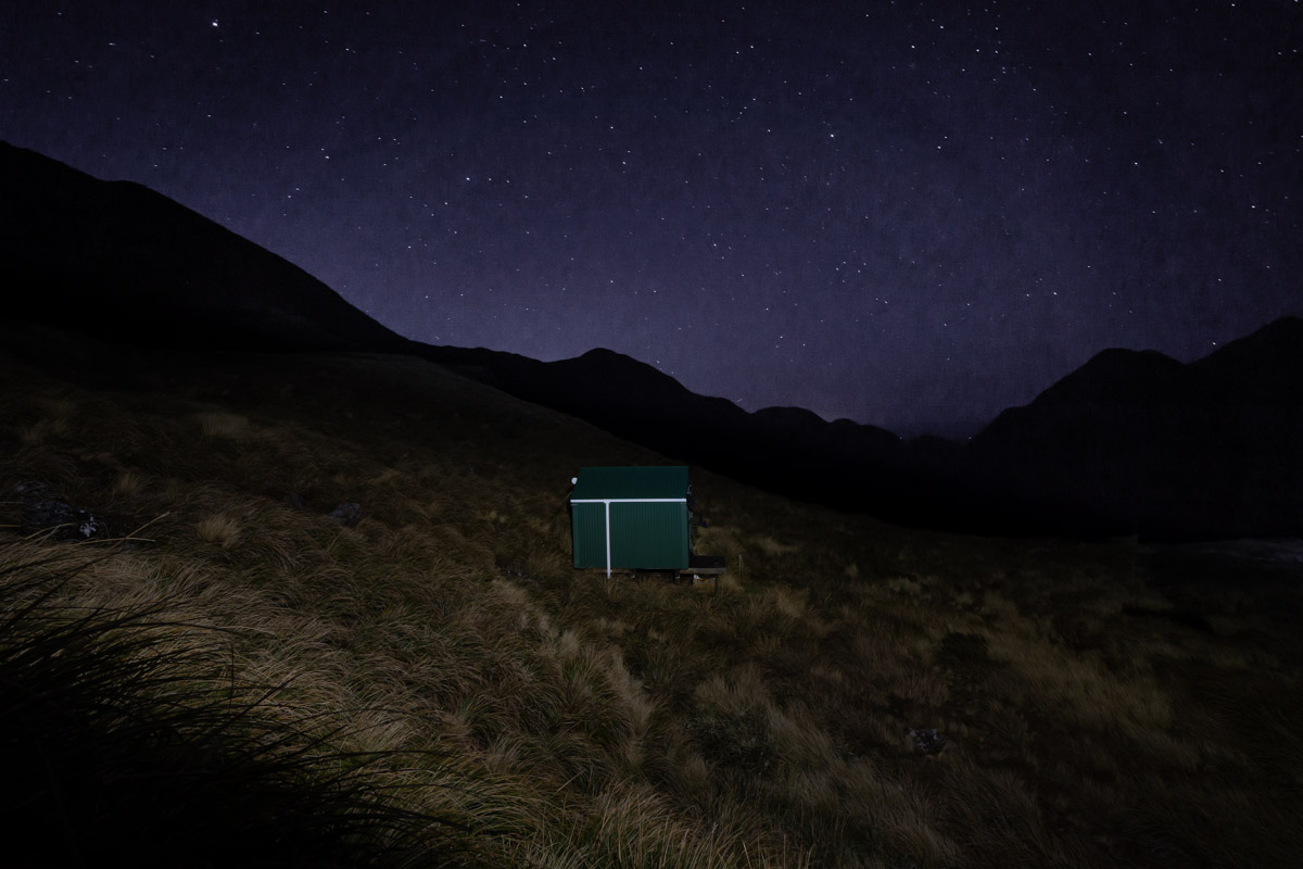
I had a late lunch at the hut and filled in the intentions book—I was so overexcited about finally making it there that I got my entries in the wrong column! I found fellow club members Emily, Illona and Megan in the hut book too. The hut also revealed a few more secrets—behind it was an absolutely beautiful goblin forest that no photo does justice. It’s something that you have to experience for yourself. After taking the obligatory photo at the hut I was back on my way to find Tony. As I came over Carkeek summit I could see him standing all the way over on Lancaster waiting for me. I was bouncing by the time I caught up with him, who had enjoyed his time sitting on Thompson taking photos. We saw the start of the sunset as we wandered back to Arete Hut for another lovely night. This time we had a clear view down to all the lights of the Wairarapa and a beautiful starry night.
On Saturday we woke to bluebird day although it was so cold that the puddles outside the hut had frozen. The ground was pretty slippery with the ice/frost so we took it slowly climbing back up to Arete while enjoying the superb visibility once again—Bannister looked pretty epic and we gave Mitre a wave. The view back down to the Biv and its tarn was very picturesque—it almost looked like we were in the South Island! We met our first lot of people in four days just under the Pukematawai junction. They were heading over to Holdsworth via Tarn Ridge Hut. They were carrying ice axes which I joked to them they would only be using for self-arresting in mud as rather unusually for winter there was not a single bit of snow which I had been a bit disappointed by.
The descent down to Te Matawai Hut was a bit of a slog. It is overgrown with Toitoi so much that we couldn’t see the track and never knew where our feet were going to land. It was far more difficult going down than the climb we had up (the DoC time here is also completely inaccurate). I was relieved when we finally emerged out of it even if it was straight into a bog! I was very glad when Te Matawai Hut finally loomed in front of us and we got to have a break here minus pesky possums.
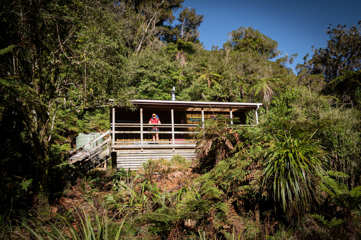
At Butcher Saddle we turned off down the Yeates Track so we could make a bit of a circuit and not walk back out via Gable End Ridge. This track doesn’t get a lot of travel so there was plenty of playing under and over trees which I delighted in. The final section of the track descending down to South Ohau Hut was pretty steep and muddy so I took it slowly and lived up to my reputation of “Downhill Nana.” We stopped at South Ohau hut for lunch—the last time I had been here was 2015!
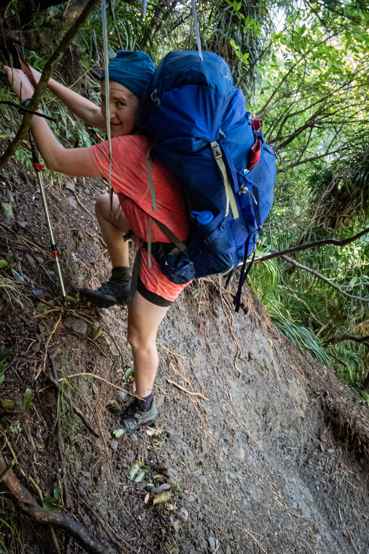
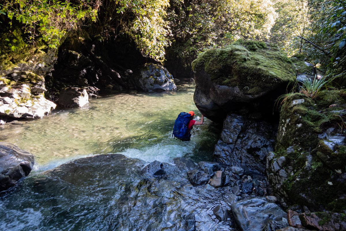
It was then straight into the cold river. I knew the first part of our river journey would be through a bit of a gorge. The water had reached the hem of my shorts at times as we clambered over boulders and crisscrossed the river. In one section there seemed no alternative but to have a very deep wade—unfortunately it was deeper than I expected and suddenly I found myself fully submerged going for an “unintentional swim.” Once over the shock of the coldness of the water I swam to a rock which I managed to haul myself up on and cling there like a limpet while trying to get my breath back from laughing much to Tony’s amusement. However, Tony was less than impressed when a minute later the exact same thing happened to him despite his longer legs.
We met our first person on the side of the river not long after—he had been up to North Ohau then decided to go up to South Ohau to make it a longer day. We bumped into another solo person much later—he had a fishing rod and seemed a bit blasé—asking us what time it was because he had lost track of time…. We weren’t quite sure what to make of this as it was getting late in the afternoon and he still had a long way to go to the hut—he wouldn’t have made it to the hut before darkness and we didn’t envy him for having to travel in the dark up the river—we guessed he might just sleep out somewhere alongside the river.
We finally saw the track marker indicating for us to jump out of the river and back on the track. Tony, in his excitement, tripped over a rock and went down heavily—luckily, he always seems to bounce when he falls and he bounced straight back up again. It was nice to be back on a track again as a few hours of river travel can be a bit tiring mentally. Once on the track again we zoomed along and made it out of the bush and back to the car just as it started to get dark—and not before I did a few loops around the carpark to get my watch reading 21km for the day!
Day 1: Poads Road to Te Matawai Hut via Gable End Ridge
Distance: 16km; Elevation: 1,424m; Time: 6h
Day 2: Arete Biv
Distance: 5km; Elevation: 728m; Time: 2h
Day 3: Carkeek Hut day trip from Arete Biv
Distance: 17km; Elevation: 1,390m; Time: 6h
Day 4: Arete Biv – Yeates Track to South Ohau Hut and out via the River to Poads Road
Distance: 21km; Elevation: 452m; Time: 7h:50.
-
-
AuthorPosts