
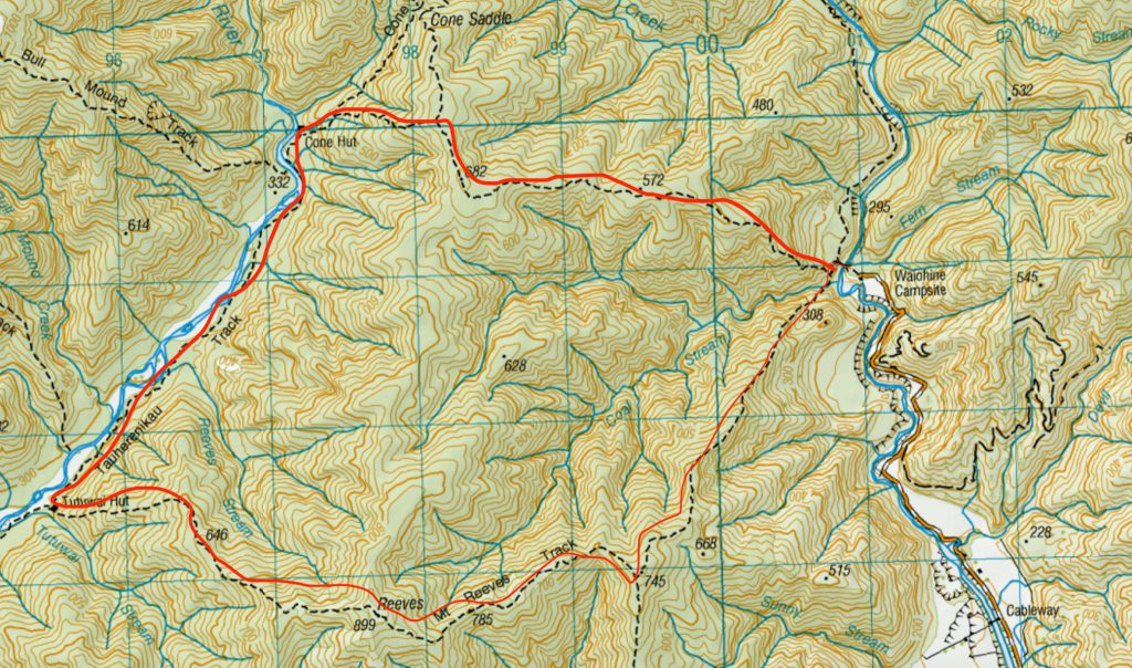
We departed from Wellington Railway Station at about 7.30am for the drive over the Remutakas and past Greytown, to the Waiohine Gorge carpark entrance of Tararua Forest Park. It was a lovely sunny winter day.
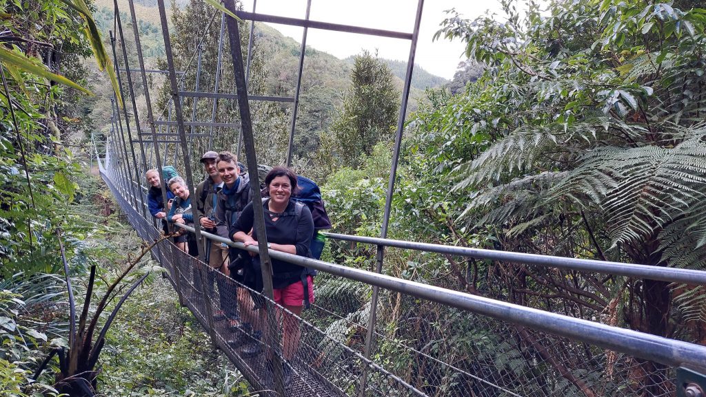
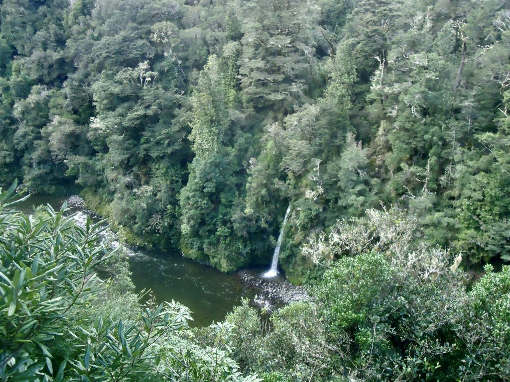
We started our walk at 9.20am – going straight across the Waiohine Gorge suspension bridge. There were great views up and down the Gorge from the bridge and if you look over your right shoulder on the way across, you get a good view of the very pretty Fern Stream waterfall.
There was some rain due later that day, so Tony decided to start our Loop walk by crossing Coal Stream – which is unbridged – just in case the forecasted rain caused the water level to rise to a more dangerous level for our return trip the next day. So on the other side of the suspension bridge we veered to the left. After walking for no more than 15 minutes, there was a fork in the path and we took the path which led uphill. But after a while we realised we’d taken the wrong path – as there was no sign of Coal Stream. Hence we backtracked to the fork in the path and took the lower path instead.
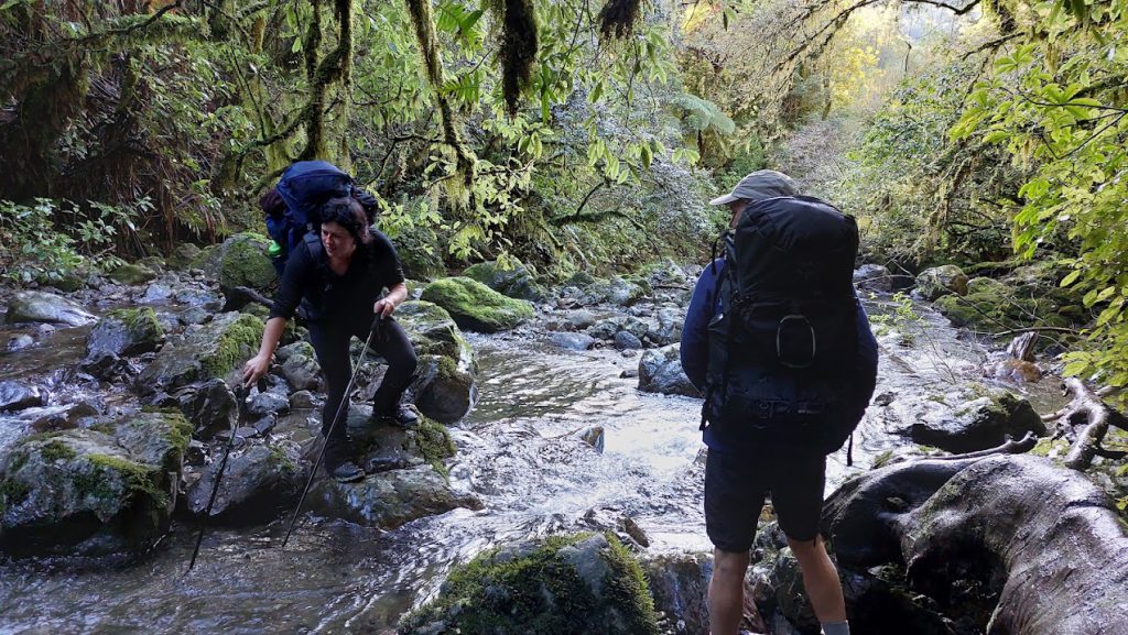
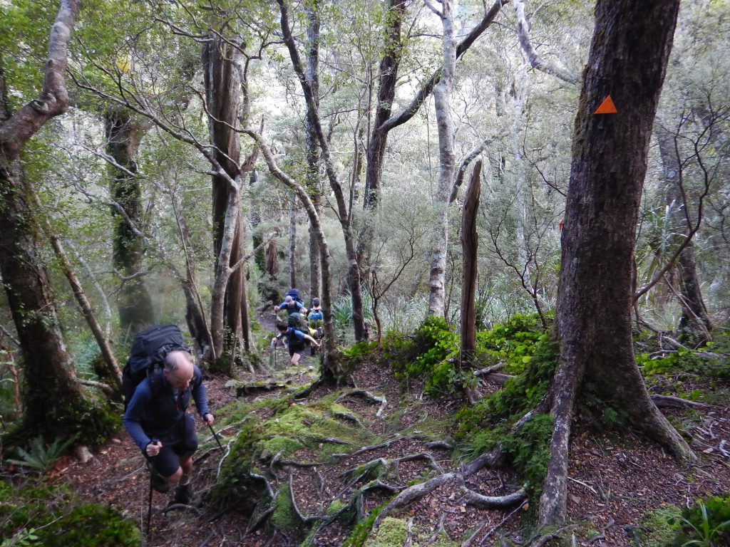
When we reached Coal Stream it was a nice surprise to see how pretty the area is. It’s sheltered with overhanging tree branches covered in moss. The crossing is fairly straight forward and didn’t take long, but expect to get wet feet. We found walking poles helpful to judge the depth of water in places and to help balance ourselves. As soon as you cross the stream you need to climb up a bank, and then there’s a fairly long, steep climb (approx 600m) to the ridgeline. This is the steepest section of the Loop – so it was good to get this out of the way right at the start. It was quite muddy on the way up in places and there were lots of tree roots – quite helpful as they helped form steps, making it easier to ascend the steep parts.
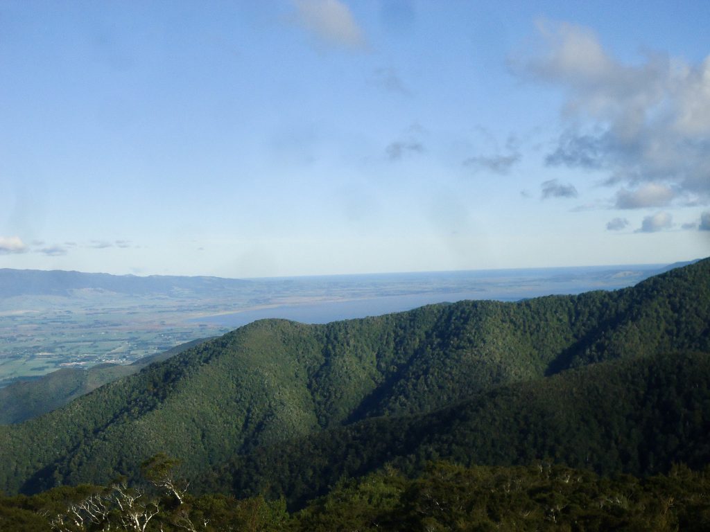
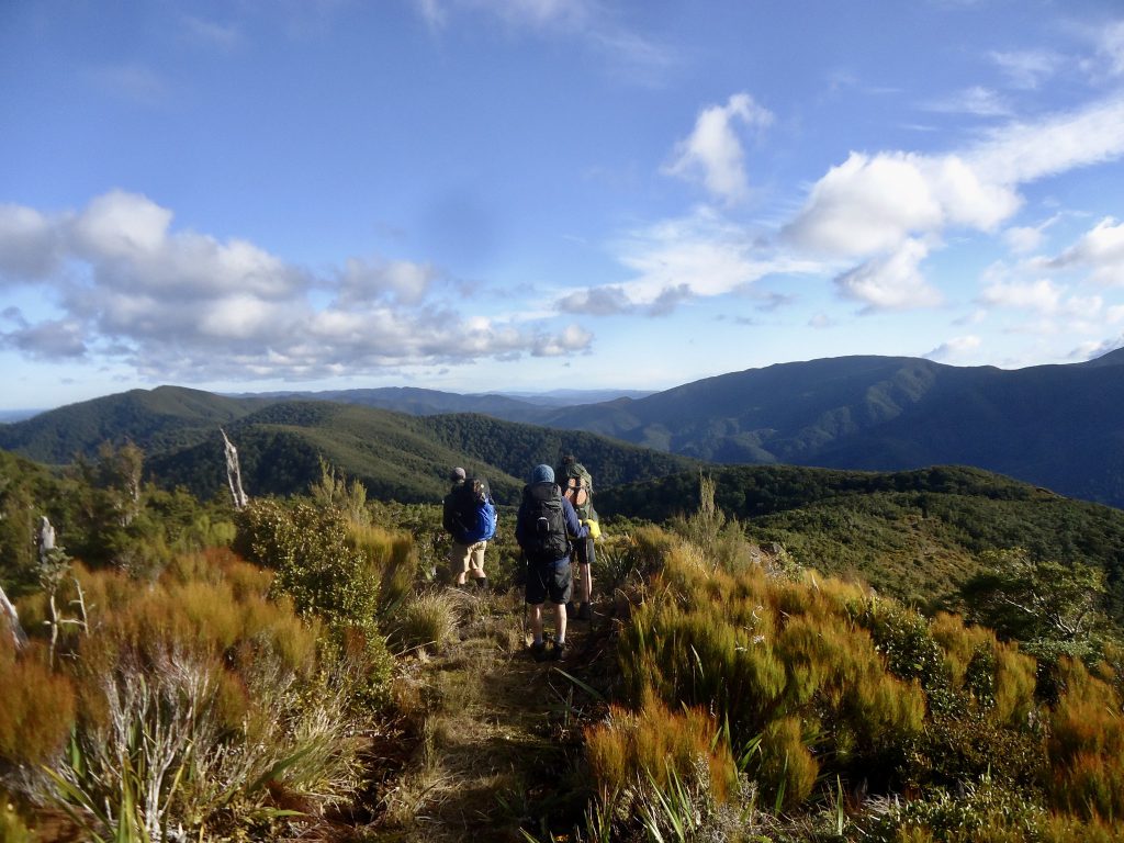
There are no views out to the distance on the way up – you’re in dense bush. So when you get up onto the tops (on Mt Reeves Track) it’s the first opportunity for some good views. On the tops we found a few spots where we could walk through the bush and out onto rocky outcrops – on one side of the track we could see the Tararua Peaks and Mt Holdsworth in the distance and on the other side we saw open grassy pasture with some of the Wairarapa townships dotted in the distance. We could also see Lake Wairarapa, Palliser Bay, and glimpses of Wellington Harbour. It was great to be in the sunshine on the tops as it was quite cold in the shade of the forest – especially as soon as we stopped for breaks.
It was exciting to come across the plaque indicating the Geographical Centre of NZ on the ridgeline, at the side of Mt Reeves Track (below the 899m elevation point indicated on the topomap). There are no signs along the way mentioning the spot, so we were concerned we might miss it. But the plaque is set in concrete on the left hand side of the track – and there’s no way you can miss it.

Continuing on along the tops on Mt Reeves Track, there were great views down to Tauherenikau Valley on the right, where Tutuwai Hut and Cone Hut are situated.
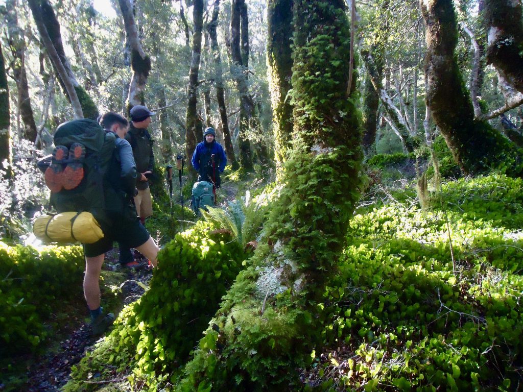
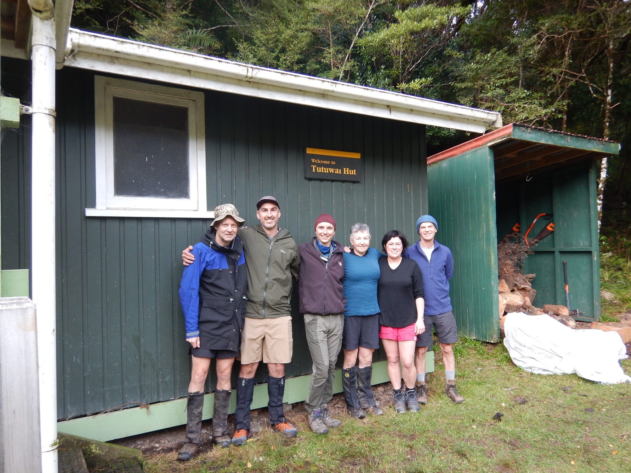
We then came to the bushline and began the descent down to Tauherenikau Valley and Tutuwai Hut (which is located at 300m elevation). There is some really lovely foliage during the descent – lots of umbrella and kidney fern and trees with branches and trunks covered in moss – reminding me of the look of the forest in Fiordland. The final descent to Tauherenikau Valley is very steep – and it would be helpful to have walking poles (and strong knees!) for this. Tutuwai Hut is right there as soon as you get down to the flat ground.
We were stoked to find that we had the Hut to ourselves. Jane and I immediately went to down to the Tauherenikau River to explore – it’s about a 5-10 minute walk from the Hut.
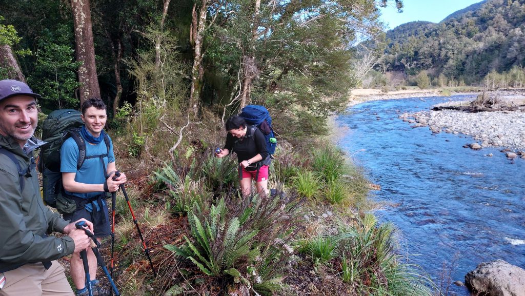
The next morning we continued on our way to complete our Loop walk. It takes just over an hour to walk along the Valley to Cone Hut. It’s a nice walk right beside the river, and again, some stunning lush forest. Quite muddy on the track in places too – although someone has put sections of punga fern in places along the track to help make the track easier (and less messy) to traverse.
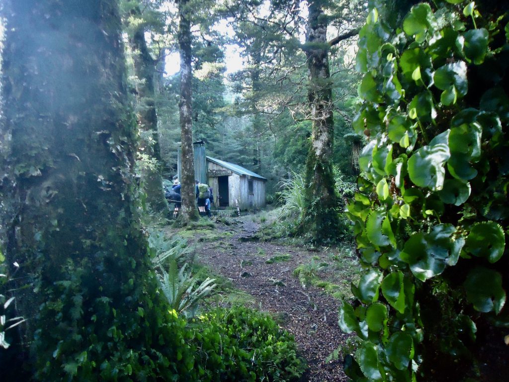
It was interesting arriving at Cone Hut – a very distinct looking hut (due to its slab wall construction) and is the second oldest hut in the Tararua Ranges. It’s situated in a very pretty dense forested area close to the river and it’s actually free to stay there. There is no sign pointing out where the toilet is – but if you stand in front of the hut, facing the door, you can find the toilet if you follow the path into the bush off to the right.
From Cone Hut we began the climb (of around 350m elevation) up to the ridgeline, on our way back to the Waiohine Gorge Road road end. It’s about a 5km walk from Cone Hut back to the Road end. It wasn’t as hard going as our climb had been the previous day. Again there were a lot of visible tree roots along the way and it was muddy in parts.
It had been quite a laidback and very enjoyable Loop walk, with a great group of people. We had not been in a rush – instead we enjoyed exploring and taking in all the great views and forest scenery.
Timings
Day 1:
9.45 am – 3.50 pm
Total: just over 6 hours (incl breaks)
Day 2:
9.20 am – 2.15 pm
Total: 5 hours approx
Does anyone know the full words to the song:
There’s a hut in Tauherenikau with a fine foratuti,
A room with a view of unusual beauty, Oh pass the roll over, pass the roll over,
Pass the roll over each man in his turn.
Tony Somerset of NZ died last Friday in Lewes. He taught me the song in Nairobi in 1970 and I want to sing it at his memorial service in August.