
Are we on the right track?
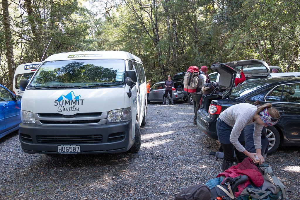
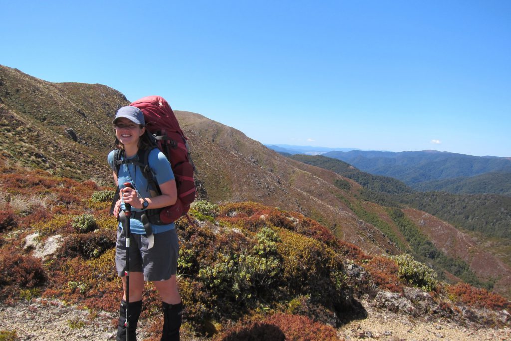
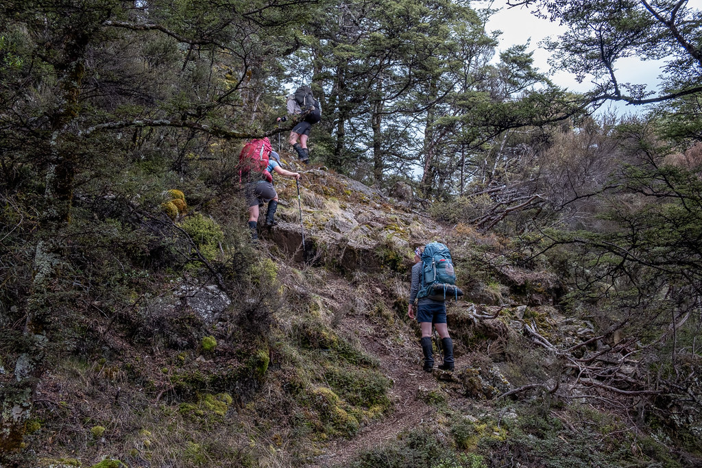
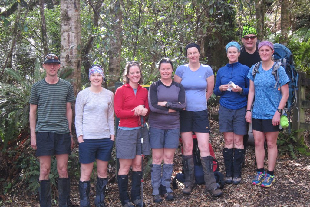
Our journey began with a traffic jam at Kaimanawa Road end. Being Labour Weekend, every man and his dog (literally – we were joined by a gorgeous kelpie) was out tramping. After a skillful 100 point turn, our shuttle driver deposited us at the beginning of the Umukarikari track. Minimal faff and a group photo, and we were off.
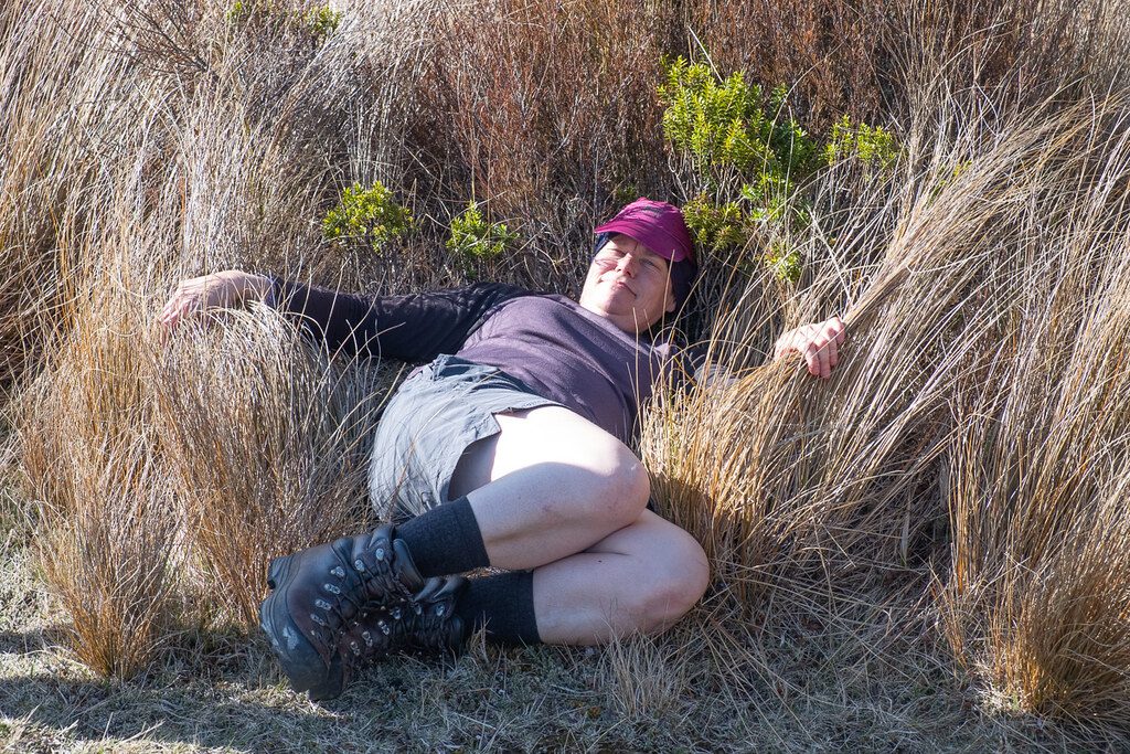
The gentle gradient of Umukarikari, the well-formed track, and the large number of other walkers out enjoying the sun made me feel like we were on a “great walk” – not at all what I had expected from a relatively anonymous forest park! Our first stop just before the bushline enabled us to sun screen up, and enjoy some cake we had taken from the Lodge that morning (except for Illona – why didn’t she take the cake?)
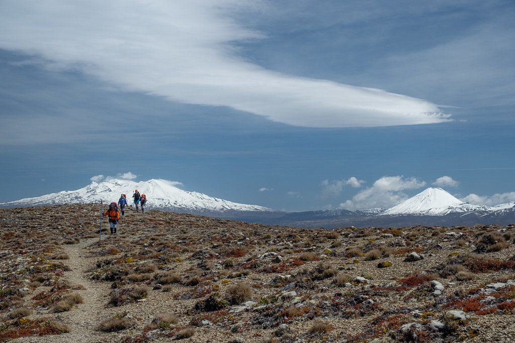
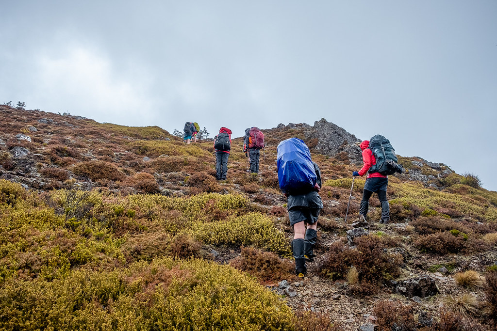
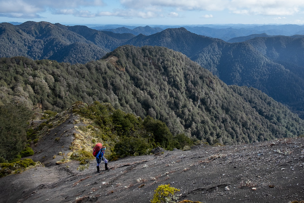
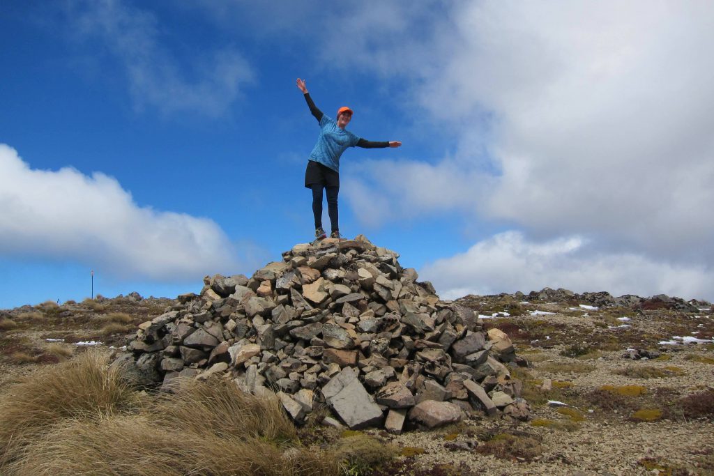
Then came a tops section where we were treated to spectacular views of Ruapehu and Ngauruhoe to the west, as well as some interesting cloud formations above which only Tony G will ever know the name of, even though he wasn’t on the trip. Lunch was had in a pocket under Umukarikari Peak, and not long after that, we could see our night’s destination, Waipakihi Hut, nestled in the river valley below us. A steep descent and a splash through the river saw us arrive at possibly the busiest hut I have ever seen – there were people everywhere! The hut was full, people were claiming places on the deck, and tents had already gone up behind the hut and across the river valley. The kelpie, who arrived a bit later, sat patiently on the lawn by his owner, unbothered by the refugee camp popping up around him.
Our groups were split into two for food: omnivores and vegetarians. I was not-so-secretly stoked to be part of the vegetarian group, as we had Illona, and were treated to a delicious palak paneer for dinner. After a cup of tea and an impromptu inspection of Marie’s food bag, we all slinked off to bed.
Distance: 11.7km Time: 6 hours
The great water shortage
Marie started the day early for her bedmates by whipping off the fly at 6am so they could see the beautiful day unfolding. The rest of us emerged at a more leisurely time, and we ambled away from the hut at 8am.
Our second day promised to be the longest – and it did not disappoint. We began by drinking as much as our bellies could hold from the Waipakihi River, as there looked to be no water sources until our destination for the night, Cascade Hut. I filled up with just under 2 litres and mentally prepared to ration water for the day.

The steep climb up to Junction Top was aided by the early morning shade. Just over an hour in, the in-reach monitor realised she had not turned on the tracking function on the in-reach. The consequences of this were minor (Aimee’s mum would notice a gap on the tracking link, and our track statistics would be skewed for the day), however this was a great tragedy for the in-reach monitor, who takes great pride in her monitoring skills. Needless to say the tracking function was switched on, and remained on for the rest of the trip!
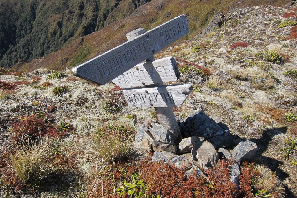
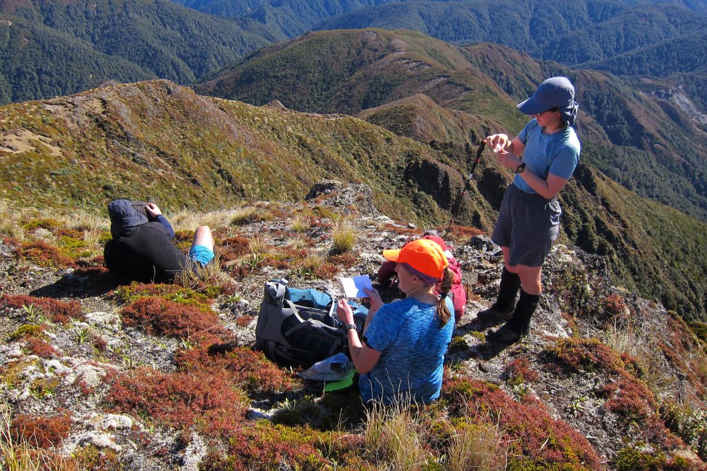
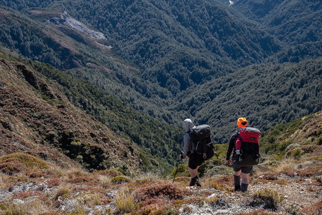
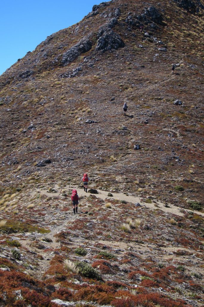
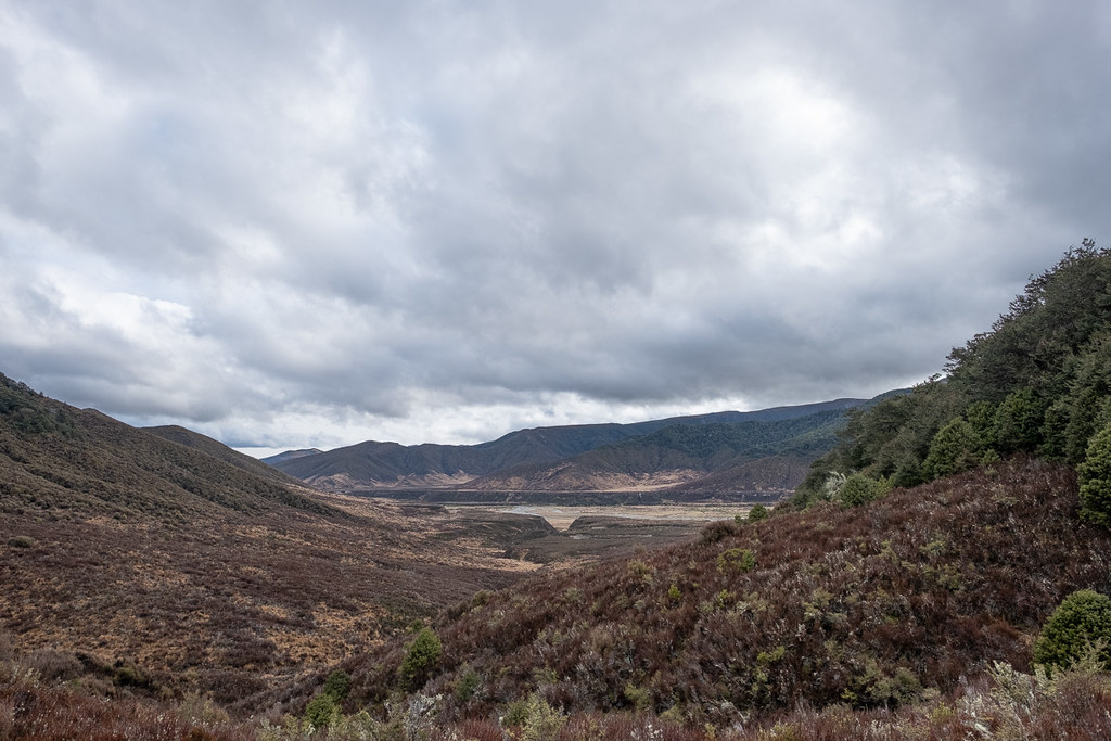
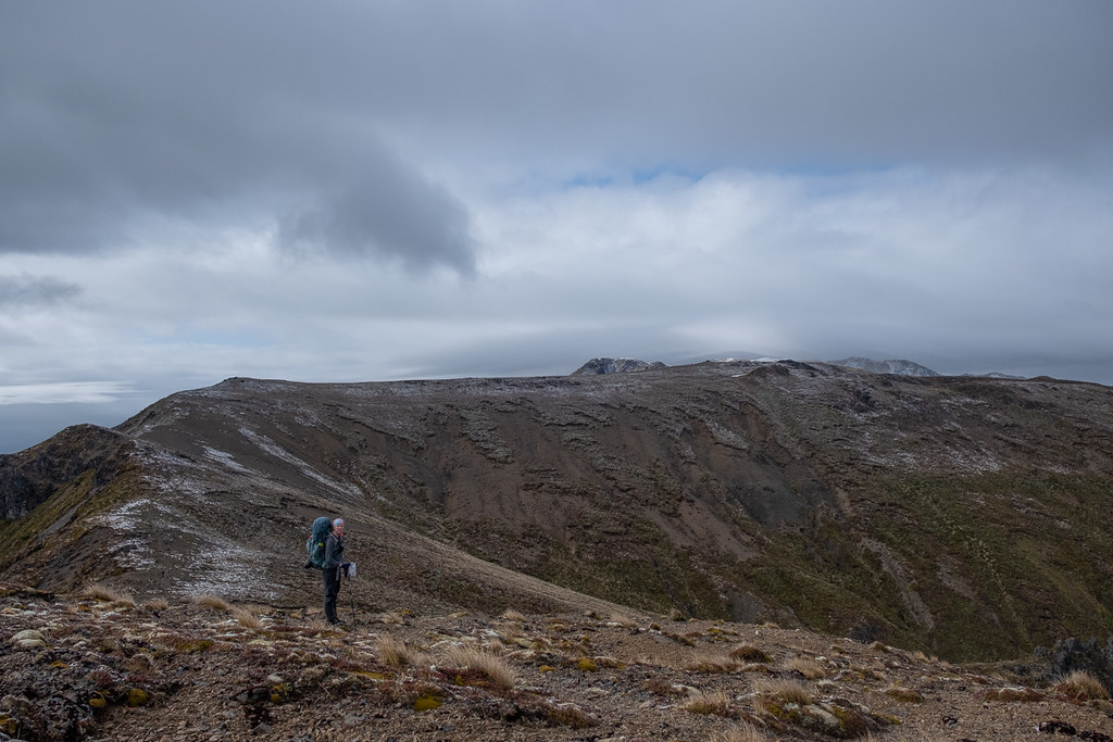
From Junction Top we could survey our route for the rest of the day. This included descending a spur to point 1374 and Ignimbrite Saddle, and wiggling our way through the bush to the exposed tops around Ngapuketurua. Given the great visibility, the navigation was not as tricky as we supposed, and Emily led us through some scrubby bush sections by expertly following a foot track and occasional marker. The combination of small hills, hot sun and angry bush lawyer weakened my resolve for water rationing, and I drunk further and further into my rations.
A lunch stop just before the bushline helped restore me, and up we marched onto the windy and dry tops. I started thinking constantly about water, and how long I could go without it in this heat. At a snack stop before Ngapuketurua, I noted my companions were also running low. Marie made the bold move of swallowing all her water, noting that the track we were about to join bumped up next to a creek, and expecting to refill there. I was less sure, so refrained from downing my last 300 mls. As it turned out, Marie was spot on, and we found a clear fast flowing creek exactly where she predicted. After downing as much water as we could, and some prompting from Marie, weary feet carried us on down the track, and we trickled into Cascade Hut between 7.30 and 8.30pm that night.
Distance: 19km (approx. – in-reach failure) Time: 11 ½ -12 ½ hours
The great water influx
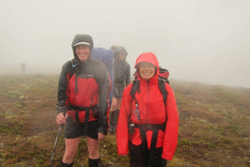
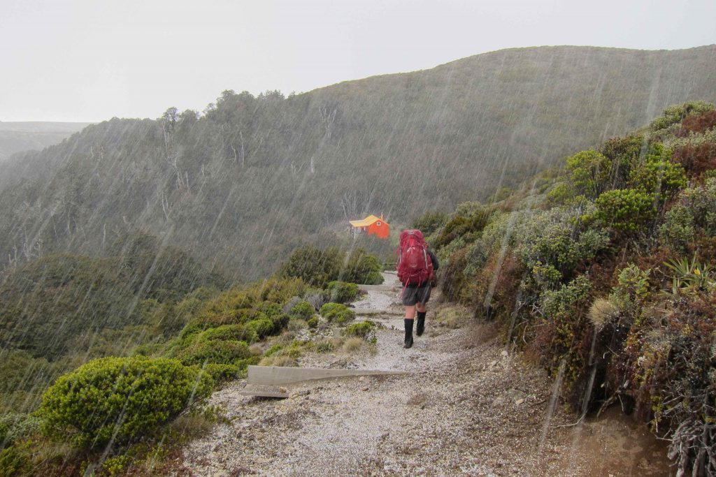
It is a scientific fact that when you are tramping you can’t have too many good weather days in a row. After two glorious sunny days on the tops, we were due our quota of rain, and it came in showers throughout the day.
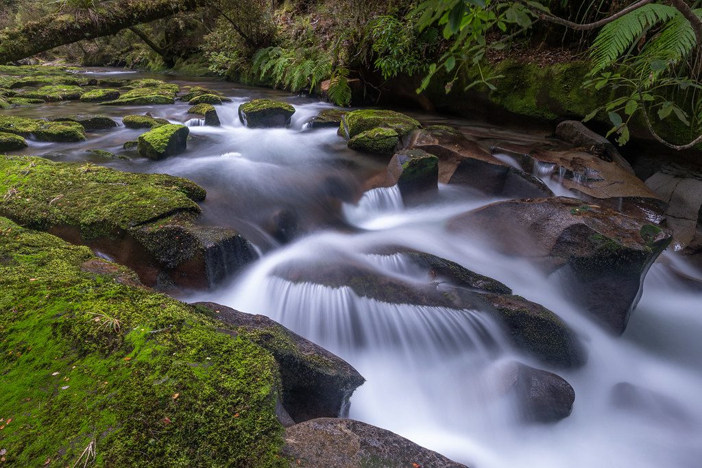
We set out at 7.30am to give ourselves as much daylight as possible. Ian peeled off just before the first junction along Cascade Stream so he could get some professional water photos while the rest of us marched on. We were amused to later hear that Ian succumbed to the same fate as the geologically challenged amongst us, by stepping on some floating pumice, thinking it was solid rock.
We had our first break on the downhill side of Waiatupuritia Saddle, although with the rain starting to get a bit more serious we kept it short, and were soon plodding up to Maungaorangi. There is a track that branches off south down into the North Arm valley, but permission is required to go this way as it is private land. Right on cue, just as we reached the bushline, the rain started to get rather heavy. From that point on we had to balance keeping the group together, while not having people standing around getting cold. Lunchtime was particularly challenging. However after some stops and starts, and lots of little uphills when we were meant to be going downhill, we all regrouped at the junction between Maungaorangi and Oamaru Boyd Tracks at about 4pm.

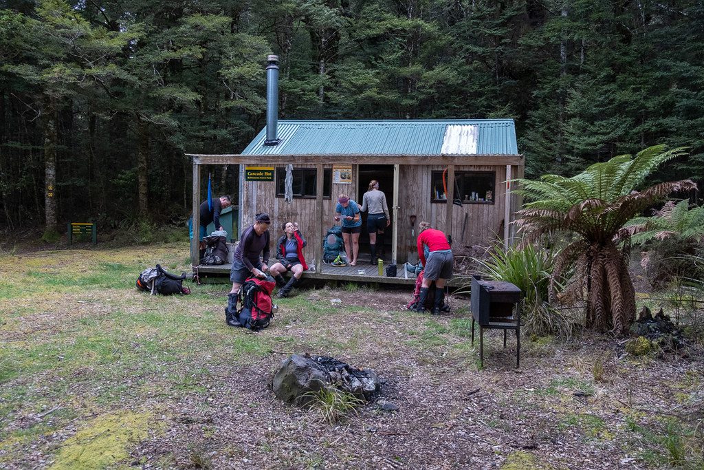
After a biscuit break we plodded on, criss-crossing the Waitawhero Stream a number of times while gently climbing. The last 100m up to the saddle was a grind, but from previous experience I knew once the track turned a bit grassy and shrubby we were close. We were rewarded with the clearing of clouds and a view across the Ngaruroro River valley when we arrived. A quick descent down a spur, pushing through some more tussock, and climbing some big steps meant for people with long legs, brought us finally to Boyd Hut.
After trickling in, the vegetarians rounded themselves up for Emily’s eggplant, pomegranate molasses and bulghar wheat meal, one of my favourites from the club cookbook and highly restorative (salty and delicious) after a long day.
Distance: 17.9km Time: 11 ¼ hours
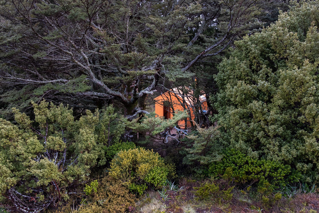
Orange huts abound
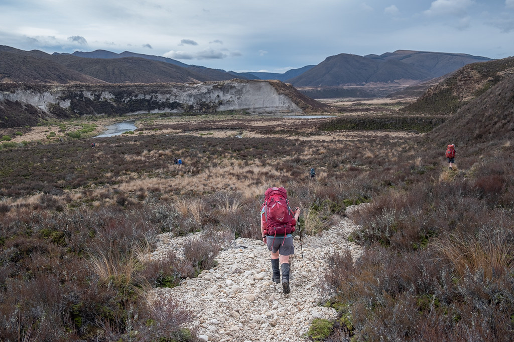
After two big days on the track, we knew we needed to keep the early starts up to get to our destinations on time. So when 7.30am rolled around, it was back on with the smelly and slightly soggy boots, and away south down the Ngaruroro River valley to pick up the track to Tussock Hut.
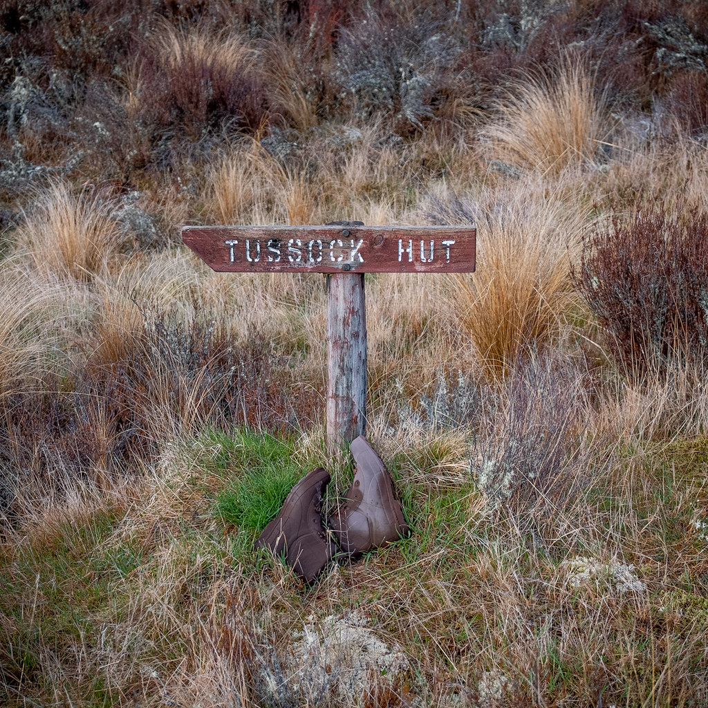
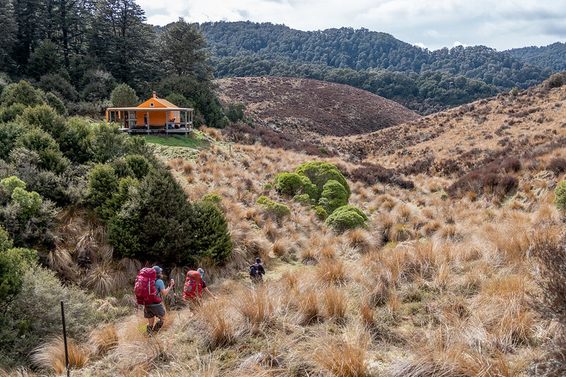
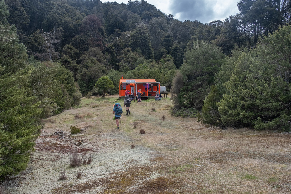
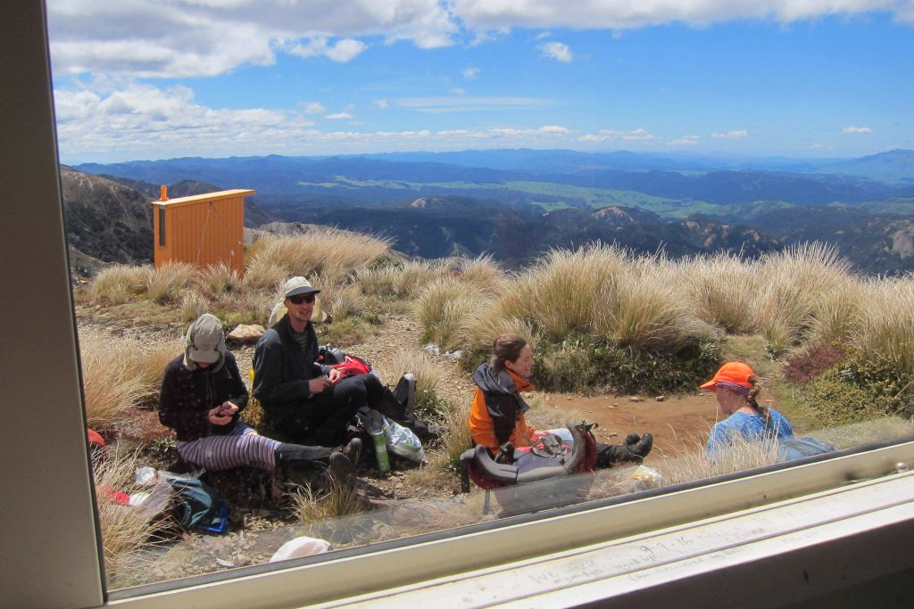
After some easy plodding through the tussock, we rounded some cliffs and began up a spur where the track was very wide, grassy (or beechy when it entered the forest) and very easygoing. We got to Tussock Hut well within the three hours I had mentally allocated to the task, so could enjoy a slightly longer break on the big deck surrounding the hut. Tussock Hut looked like it had been recently renovated, and we all agreed that it took the trophy for the cutest orange hut we had seen.
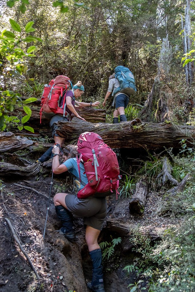
From Tussock Hut, the track sidles around broad tussocky spurs, before the valley narrows, and numerous stream crossings are required. The first of these stream crossings was rather unexpected for those of us who had been dawdling along and not paying any attention to the map. Thinking I wasn’t about to get my boots wet, me and some others chose the “cling to the cliff method” to get round a rocky outcrop rather than splash through the river, only to later realise that my efforts to keep boots dry were all in vain. The many criss-crosses of Harkness Stream slowed us down a bit, as each required some balance and concentration, so we stopped for lunch about three crossings before the turn-off to Harkness Hut.


Harkness Hut itself was reached about 1.30pm. If Tussock Hut won the award for cutest hut, Harkness would get the award for the brightest. The toilet alone was blinding. We spoke to a couple of trampers who had arrived earlier and were settling in for the night, but knowing we had a big climb coming up, snuck away as soon as politeness would allow.
After taking off my boots multiple times to empty them of water only to discover they needed to get filled up again, I delegated responsibility for telling me when we had finally crossed our last river to Emily. She kindly obliged, and when the rather obvious hill appeared, I gleefully emptied boots one last time and filled up on water for the climb.
The climb wasn’t nearly as traumatic as I thought it might be, and by plodding along behind Emily who was excellent at setting a consistent pace, I managed to keep going. Emily and I were the last to arrive at the Te Puke Trig, and got a short view of the surrounds before a hailstorm set in. Together with Sarah, who was up there texting for news of nana-dog, we had to excitedly dash down to the safety of Te Puke Hut before getting too wet!

Te Puke Hut sleeps six, and when we arrived a couple and their spaniel “Choccie” were in occupation. Ian and Megan took one for the team and camped outside, while Craig slept on the deck and Sarah slept on the floor. The rest of us enjoyed the cosiness of a DOC mattress. The vegetarians ate Marie’s yummy pasta dish for dinner, and we were all treated to a fashion show by Choccie who had multiple cute jackets for his tramping trip, and periodically snuffled around in his owner’s sleeping bag to get comfy.
Distance: 14.9km Time: 9 hours
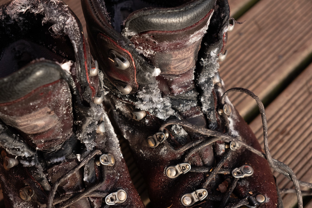
Frozen boots
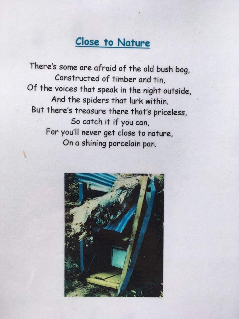
After the freak hail storm of the previous day, it was a cold night, and we struggled to get frozen boots on squishy and sore feet in the morning. However the cold also motivated us to get going quickly, and Marie and I were first away from the hut. Soon the sun began to poke through the mist, and after various small descents into saddles, and climbs up bumps, we arrived at an open tussocky tops area where it was warm enough to remove jackets. It is here that there is a junction with a track leading to Mangaturuturu Hut. Emily, Sarah and I raced down to bag the hut. While down there, Emily discovered a cute poem inside the door of the loo, picturing the unfortunate end of the previous loo.

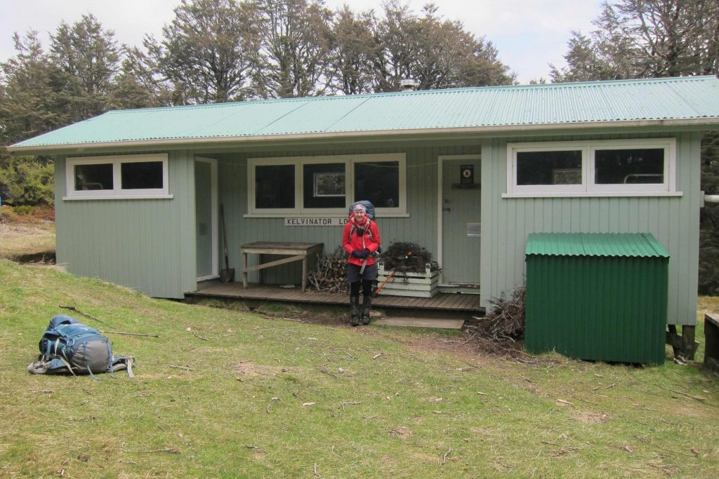
Back on the main track, we had some more small descents and rises before we arrived at the final climb up to Venison Tops/Tira Lodge/Kelvinator Hut. This one seemed to take a bit longer for some reason, but soon we rejoined the others for a leisurely lunch in the sun, in front of one of the few non-orange Kaweka huts.
From Venison Tops/Tira Lodge/Kelvinator Hut, it was a quick descent then a long but reasonably gentle climb up to the next open tops section, where we would find the turn-off to Ballard Hut. This was marked by a giant cairn, and contains a sign that you can turn over to indicate when the hut was full (luckily there was no one else there when we went down!)
After more discussion over sleeping arrangements, Ian and Megan again pitched their tent (beyond the toilet was a good camping spot) and Craig slept under a fly outside the hut. It was my turn on the floor, and after everyone had got into their bunks and evacuated the floor, I could stretch out. I entertained everyone with the story of Jesse, whom I had shared the hut with on a previous trip, and how he squeezed under one of the floor bunks (and had to let some air out of his air mattress to do so). After another delicious pumpkin and lentil curry from Illona, it was trampers bedtime (aka getting into bed as soon as possible after dinner).
Distance: 14.9km Time: 8 hours
Four seasons in a day
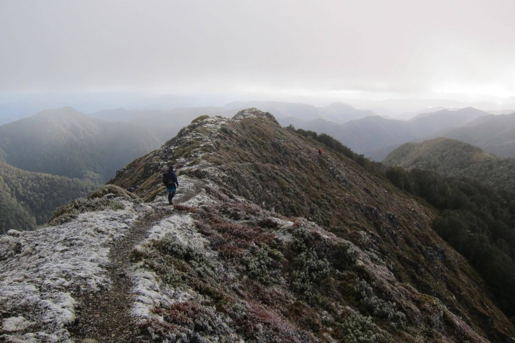
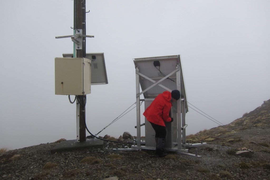
Our last day was reasonably relaxed as we had more then enough time to get to the road end. After packing up and climbing through the mist to the ridge again, we wandered along snow-dusted and chilly tops, with the weather both threatening to get better and worse at the same time. As the track passed under North Kaweka, Marie led us on a wee side trip to the peak, where we found a weather station hidden in the mist. I was convinced that the locked box contained snacks, however we couldn’t get it open. We will never know what treasures are stored for hungry trampers on North Kaweka.
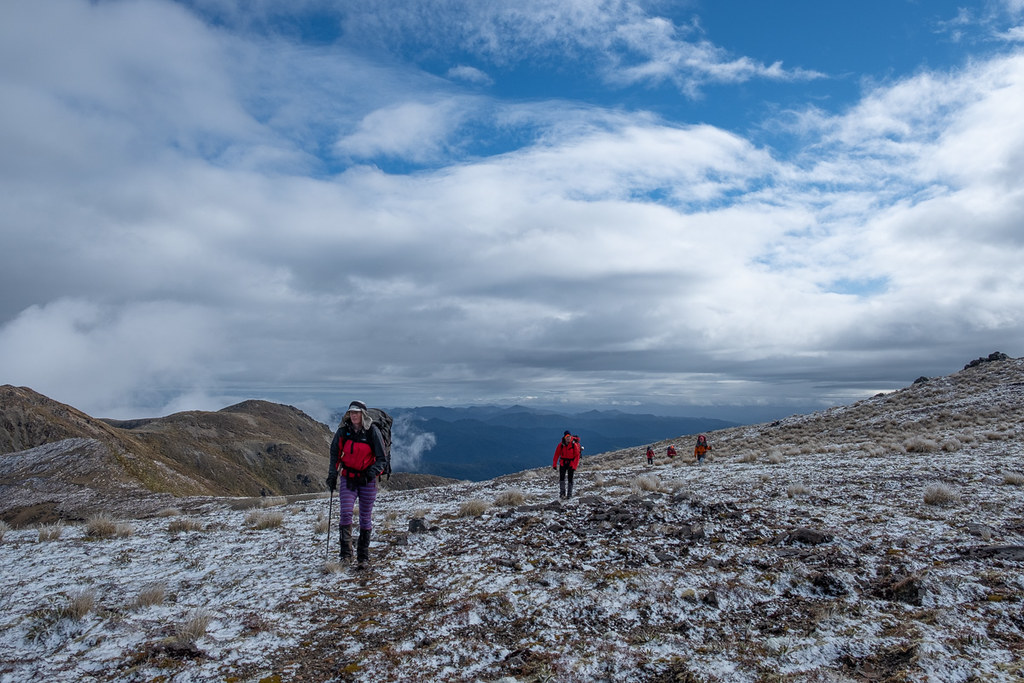
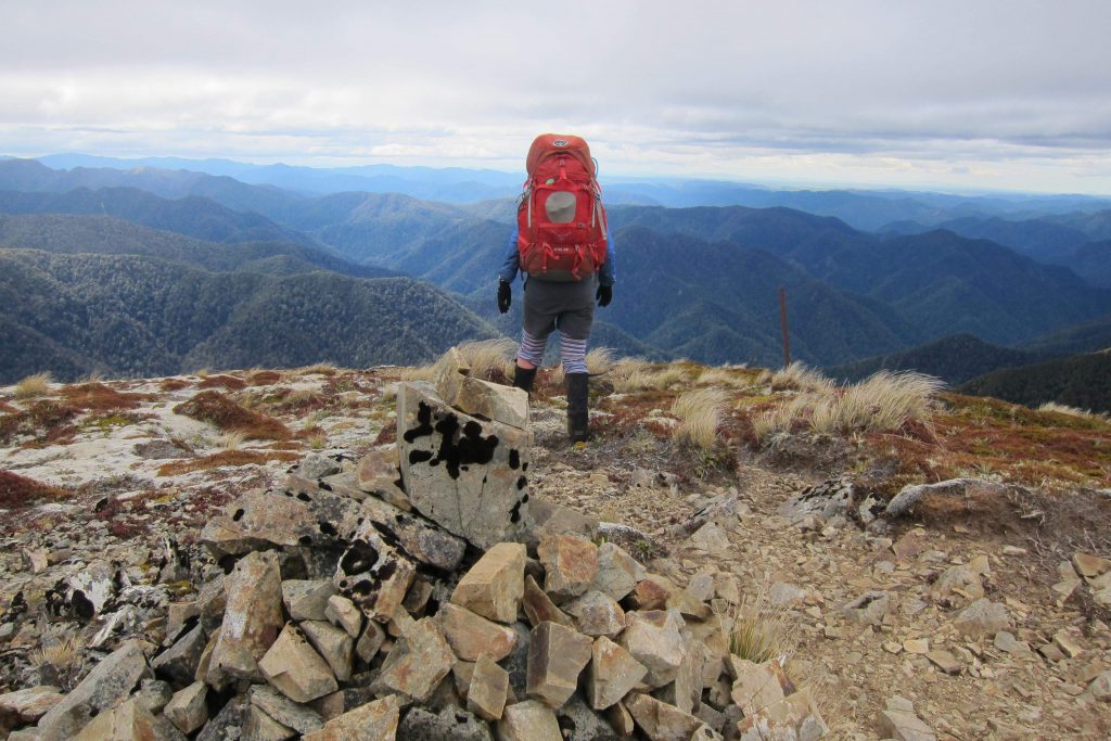
As we approached the junction down to Makahu Saddle, the sun came out for real (only because Illona had put her long johns on). We had a quick side trip to the giant cairn on Kaweka J, a memorial to the Heretaunga Tramping Club members who died in World War II. Marie and Sarah also found a small patch of snow to play in. Then we all began the rather steep descent down to the Saddle and the end of the tramp.

Distance: 9.3km Time: 7 hours
Village Shuttles drove us from Makahu Saddle to Napier. After a shower, it was time to delve into pack purgatory (phrase courtesy of Ian), a chore I dread after each tramp. However, it is not so bad when you have company, and even better when you get delegated the job of finding ice cream rather than doing the washing!
Phone reception was pretty good throughout. We had it at Umukarikari and Ngapuketurua on the first day, at the trig above Te Puke Hut on the fourth day and at a high point South of Ballard Hut on the fifth day. There is no cell phone reception at Makahu Road end.
Great Tramp, some big days in there esp. early on! Hope to do it in reverse this spring although would be starting from Cameron car park and going over Kiri & Manson. Well done.
Bruce
great footage of my favourite place as i spent a lot of time there in my youth