
An overly excited group of eight met at Wellington Airport at 8.15am on a Saturday morning for a flight to Queenstown. Dick and Beverly were already down south and would be meeting us at Queenstown airport. This is one thing I have come to enjoy about WTMC – I knew Noel and Jane, but the rest of the group were strangers and we had all come together through our love of tramping. There was excitement in the air.
After landing in Queenstown we had six hours to explore until our shuttle ride to Te Anau. Luckily we were able to store our packs at the local DOC office. Natasha and Danton went to explore the gondolas while Noel, Jane and I visited the Botanical Gardens and “Patagonia”, where Noel devoured the biggest ice cream I have ever seen.
It was a 2 1/2 hr drive to Te Anau and our driver was very chatty and acted like a local tour guide – informing us about local land features along the way. Blair had booked us in at Lakefront Backpackers for the night (approx $35 each) – which is a place we would recommend staying at. We all went to dinner that night at a local pub where we started getting to know each other a little bit.
Day One – Brod Bay to Luxmore Hut – 3 hrs 15 min (8.2km)
All week it had looked like we were in for some fabulous weather. But typical of NZ weather, the weather turned and 100k winds, sleet and rain were forecast to hit the ridge leading up to Luxmore Hut at about 1pm. We therefore decided to take a boat across Lake Te Anau (10 minute trip costing $25pp) to start the walk from Brod Bay. We’d then be able to start the track shortly after 8am, enabling us to get to Luxmore Hut before the worst of the weather hit. This shaved about 1 1/2 hrs (5.6km) off the total length of the walk (the section from the Kepler Track Carpark to Brod Bay Campsite).
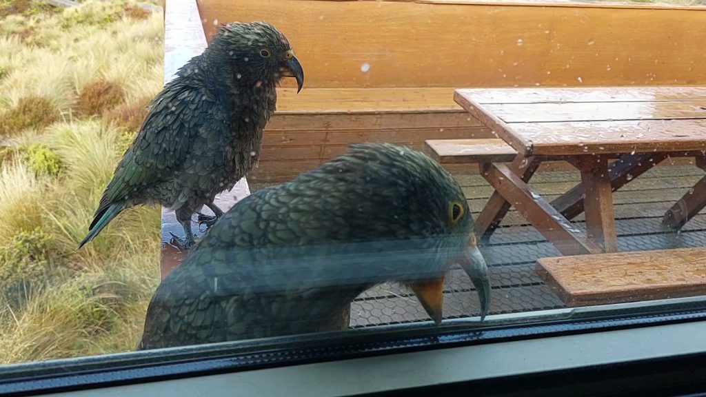
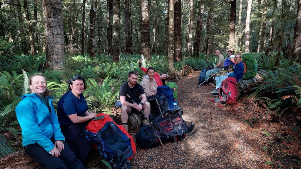
About a dozen steps into the walk I heard a thump. It sounded just like a heavy bird making a clumsy landing. I then noticed that just behind some trees we were walking past there was a KEA! It was a little tricky to spot, as its colouring blended in so well with the trees. On the winding path up Mt Luxmore we also saw South Island Robins, Paewakawaka, Bell Birds, Tui and Kereru. On Day One there is an 800m climb up Mt Luxmore. The track is well graded and we chatted as we walked so it didn’t feel like an arduous climb.
We were well sheltered from the wind as we walked under the tree cover and we stopped intermittently to peel off layers and to snack. With 10 of us in the group, we all focused on different things – I am all about the birds! Jane enjoyed looking at the various fungi. Jacqui loves taking photos regularly along the track to capture a digital story of the trip. Natasha would always find a convenient seat or rest her pack to relieve the weight for a moment. This is the joy of meeting new people and learning together as you move through the forest.
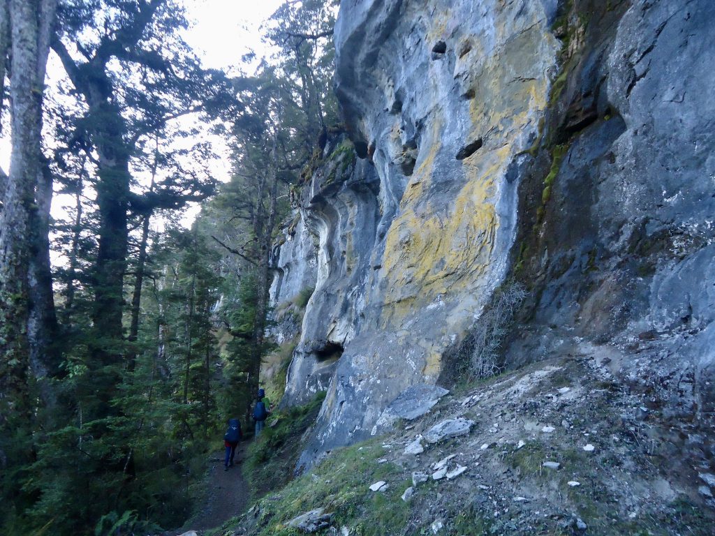
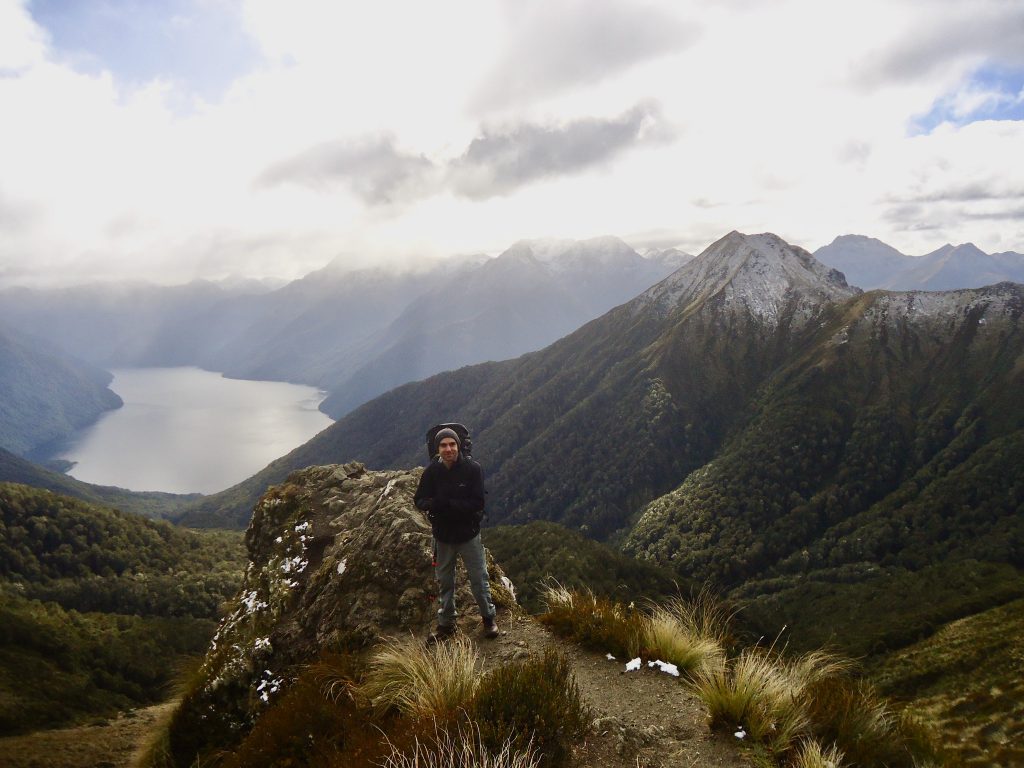
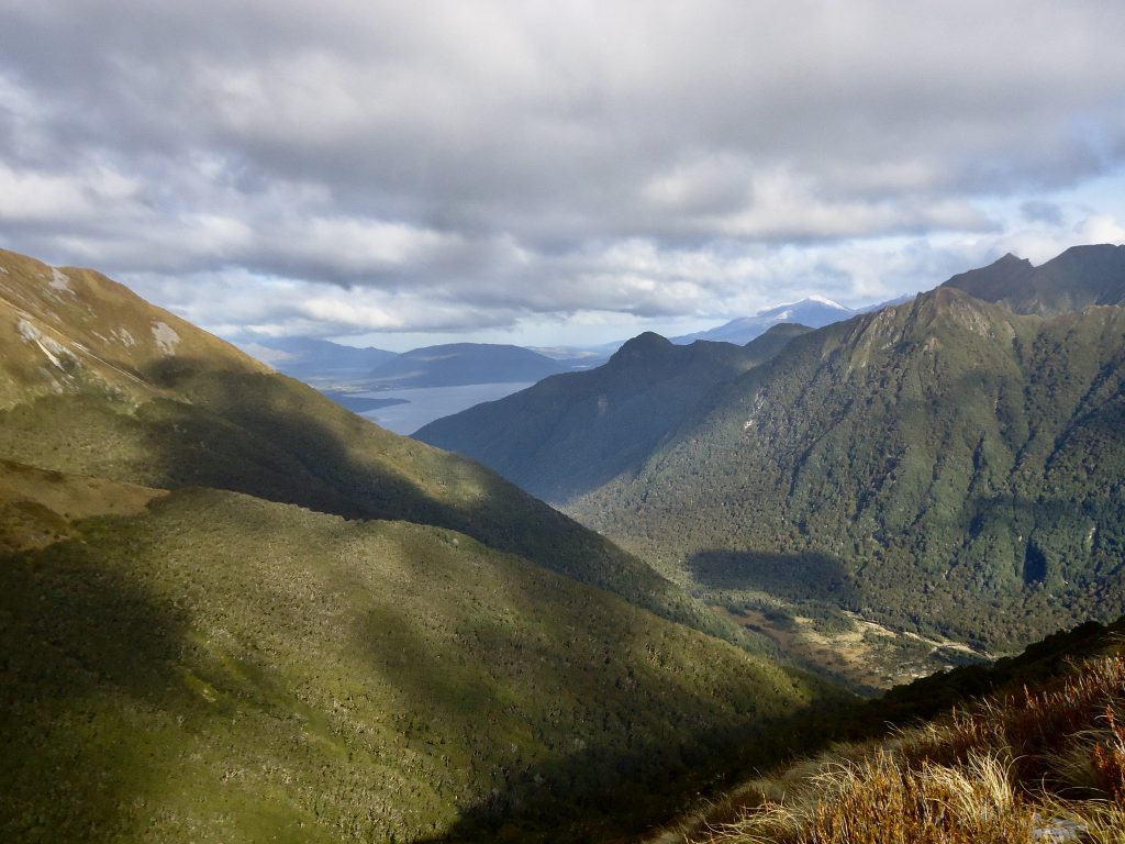
There comes a point in the track where the gradient steepens, we could all feel our breaths get a bit raggedy. There is a lovely section of steep limestone bluffs on the way up and a few flights of stairs to traverse. We stopped here to admire the sheer magnitude of our surroundings and to enjoy one of the few views from the track beyond the tree line to Lake Manapouri. It was somewhere here that Noel said “My eyes are so happy”. This is a phrase that stuck in my mind for the rest of the trip. The whole Kepler Track is one giant feast for the eyes.
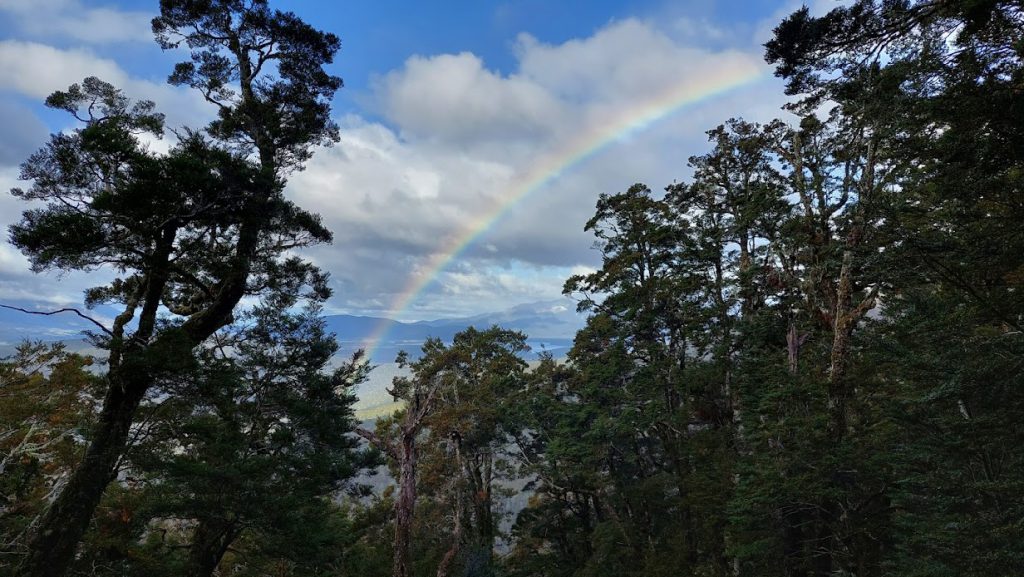
Just as I was feeling like the trail under the trees would never end, it did. Our arrival at the ridge was sudden. With one step we were out from under the trees and on the ridge. The frigid air and rain hit us all here. We ducked back under the trees to don warm layers and rain gear. There is a sign here stating that it’s 45 mins to Luxmore Hut. I only put on my hat and rain jacket. Another layer would have been good. The bad weather was only just rolling in, and there was a strange phenomenon where you looked right and the sky was grey, but the view to the left was sunny and golden. A giant rainbow arched beautifully over the valley below on the left. Despite the cold and wind we all stopped to admire and soak it all in.
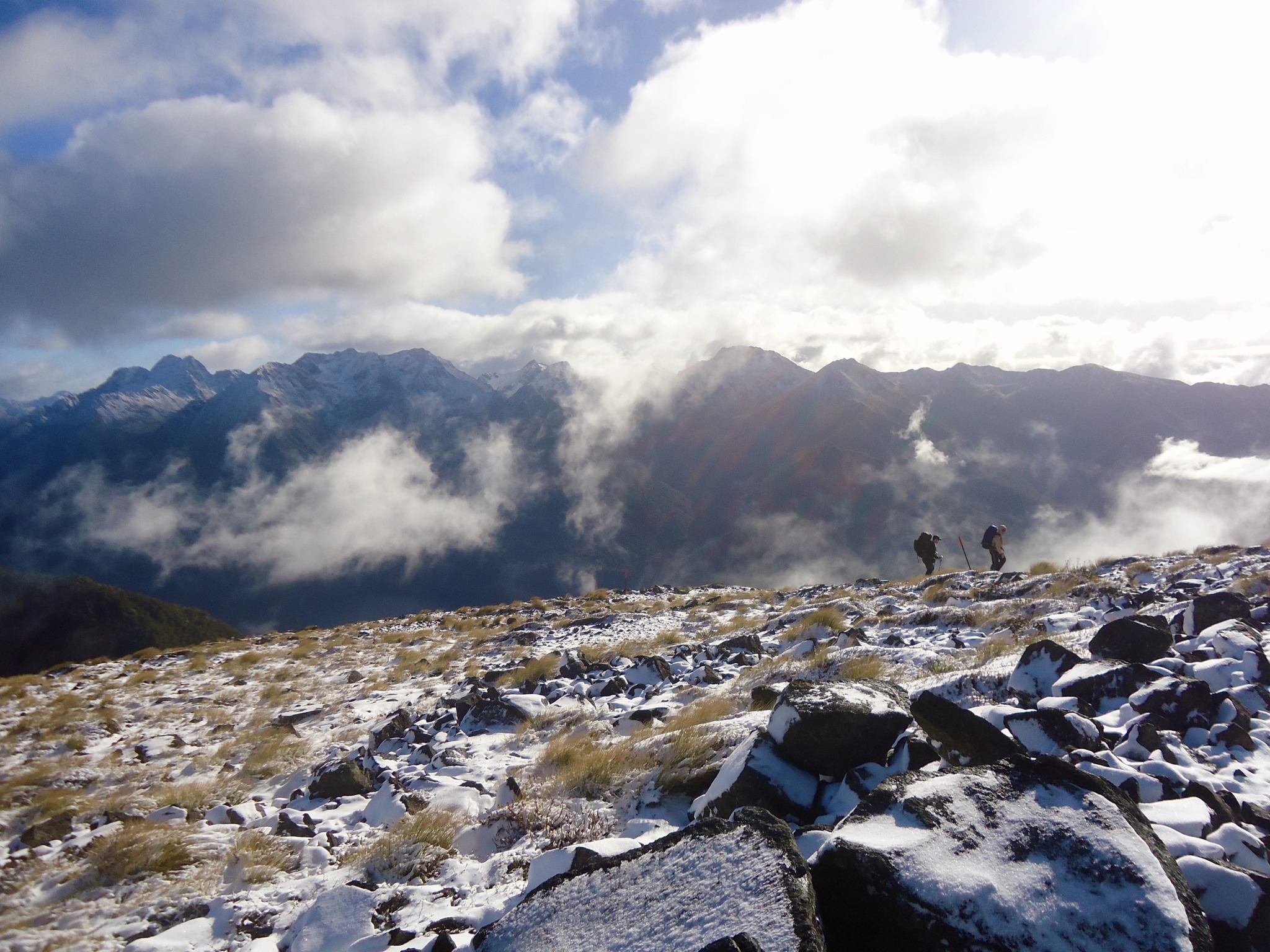
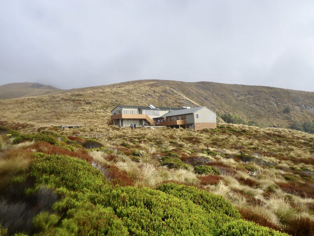
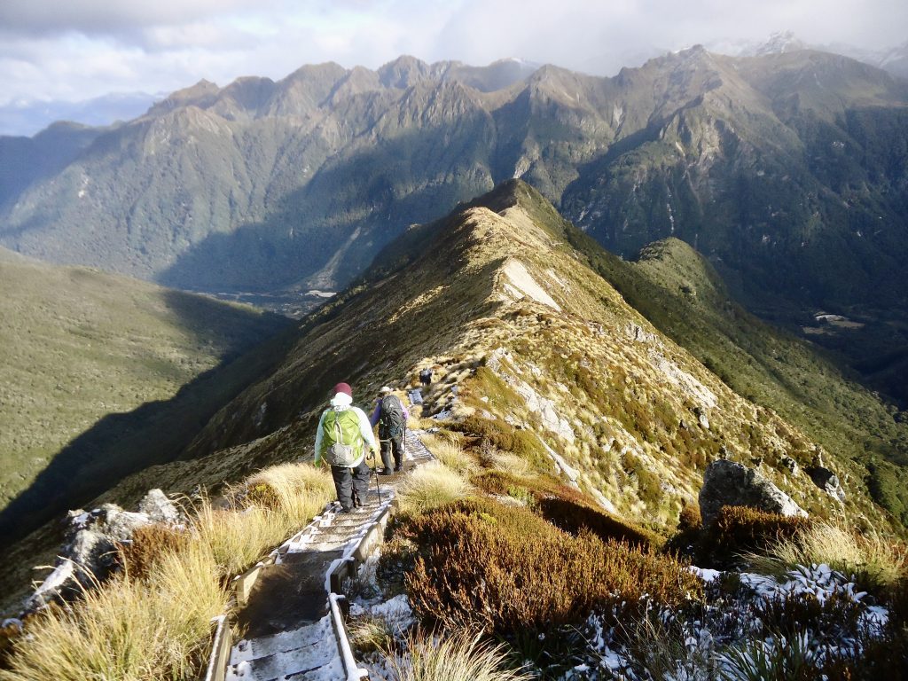
We spread out along the ridge as we headed towards Luxmore Hut. I was keen to get to the hut as I was missing the warm layer I should have put on. The Hut appears quite suddenly, as it is located around a bend. The walk across the ridge to the Hut only took us 30 mins – with plenty of photos taken along the way.
Luxmore Hut is huge! My image of back country huts is ruined for the flushing toilets located inside the hut. Luxury! Just be aware that the sleeping areas are very cold. While the central communal part of the Hut is almost too hot. With the fire going, and 50 people at the Hut that night (yes 50!), it was very hot.
Day Two: Luxmore Hut to Iris Burn Hut 5-6 hours (14.6 km)
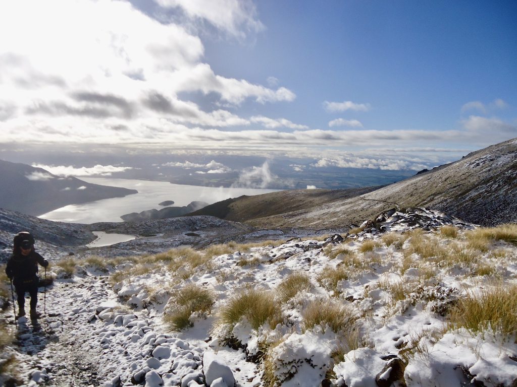
I was the first one up – always an early riser. Nothing better than the first sip of coffee and the crisp fresh mountain air. Better yet was the bluebird day we woke up to – and about a 3cm layer of snow coating the ground outside. It was great to watch the adolescent Kea hopping around leaving the first footprints in the virgin snow. There was enough snow to sharpen the colour of our surroundings and to add dimension to the awe-inspiring landscape, but not enough to make our trek across the tops on Day Two technical or dangerous.
Delays due to photo opportunities became a bit of a theme for the day. The vistas were magnificent. As we climbed higher, we saw mountain ranges beyond mountain ranges for as far as the eye could see. And we never got tired of looking at them.
We arrived at the top of our first climb for the day at around 10.45 am. The gradient was fairly even along the way and not too tough on one’s legs.
The climb to the summit of Mt Luxmore was only about a 10 minute walk off the main track. The wind was biting up there despite the fine weather and it is very exposed at the top ( -2 degrees celcius). It was nice to be wearing gloves! Hands in pockets served well too, but not advisable while ascending or descending the summit.
We left our packs at the junction of the main track and the path up to Mt Luxmore summit. Beverley stayed to keep watch, as anything left unattended was fair game for the Kea. Kea were circling when we arrived back at the junction.
We took our time continuing up and over the next rise to Forest Burn Shelter – the first of two emergency shelters we came across on the tops on Day Two. We had lunch here. There is a toilet and picnic table located here.
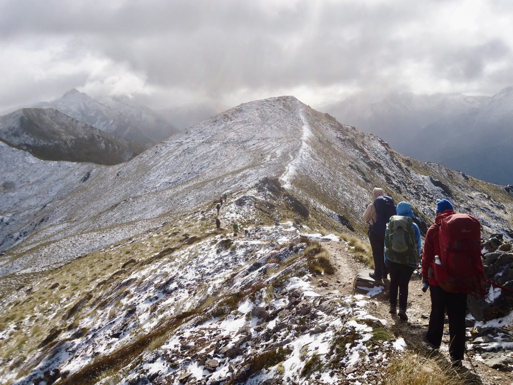
We were all enjoying the views. We stopped often for photos, and while sheltered from the wind it was very pleasant. We stuck together as a group. Someone would then eventually say “I’m getting cold”, at which point we would all move on.
It was about a 90 minute walk between the two emergency shelters. We arrived at shelter two (Hanging Valley Shelter) and had a rest. There is a toilet here too – the last one before the long descent down to Iris Burn Hut.
The descent down the mountain (which involved many steps) was very steep, and was the trickiest part of the trip. Danton lent me his walking pole, as the snow on the steps was slippery and I had visions of slipping down and taking everyone out like a bowling ball in a 10-pin alley. The descent goes on and on and we all found it hard on our knees.
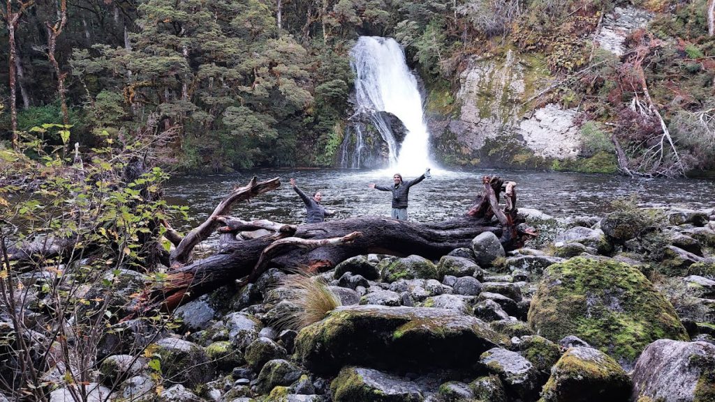
We eventually welcomed the flat forest walk that led us to Iris Burn Hut, where we arrived at about 4.30pm. A few of us headed off to check out Iris Burn Falls, which were about a 20 min walk from the Hut. I went inside for a cuppa and a rest. I was very tired and felt the cold temperature was an extra sap on one’s energy.
There is a DOC ranger based at each hut on the track, and they give very interesting and informative talks about the surrounding area that are well worth a listen. The ranger at Iris Burn Hut that night told us Kiwi had been seen around the Hut and that untagged Takahe had been seen on the track between Iris Burn and Shallow Bay Huts. We were all tired and headed for bed at about 8pm.
Day Three: Iris Burn Hut to Moturau Hut 5hr 15 mins (16.2km)
Make sure you pack bug spray – you will need it here. We were all bitten while gathered in front of Moturau Hut for a group photo. I had a wee stroll down to Iris Burn River to have a look around. The river was freezing but would be a good spot for a swim.
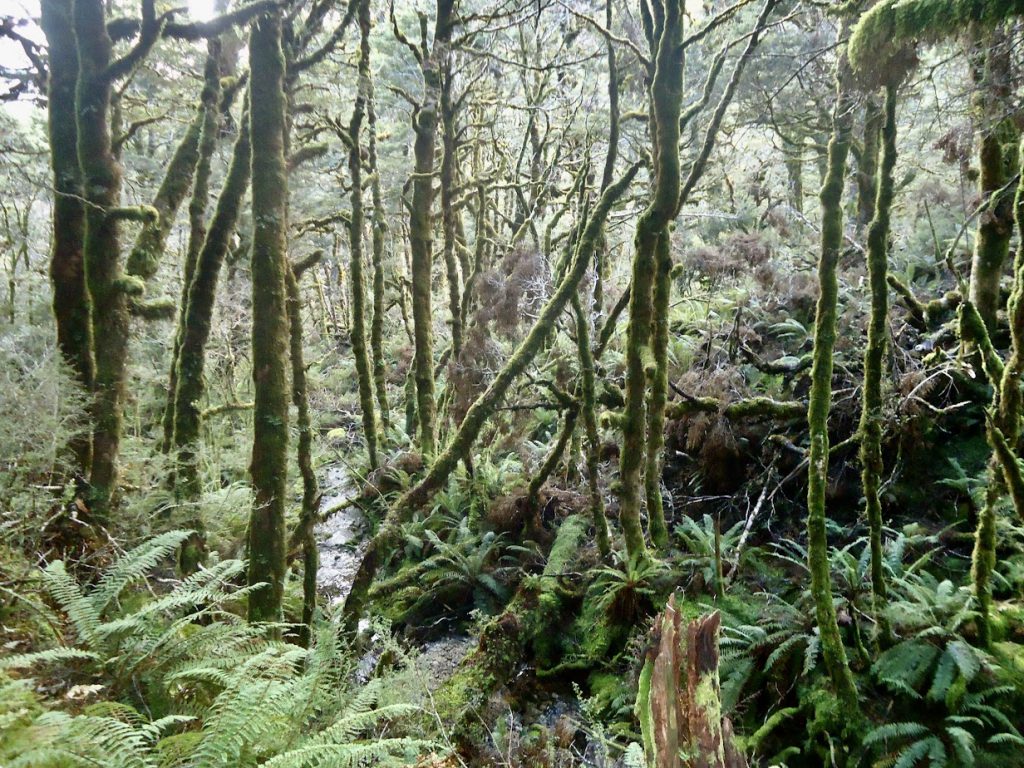
The walk on Day Three was undulating and easy, with the track taking you through the forest for most of the day. If you are into fungi this is the section for you. The colours, shapes and volume of fungi were unreal! I have never seen anything like it. We travelled through the forest with loud exclamations of “Wow! have you seen that one?… have you seen this one?..” It was magical. After seeing the huge variety and number of fungi you can understand how so many fairy tales were born. It was easy to imagine that little villages of pixies, fairies and goblins lived here.


Rocky Point Shelter is about halfway along the length of the track on Day Three – we stopped here for lunch and a good break. And just before reaching the Shelter there is a marsh where you might see Takahe if you are lucky. I saw some Takahe droppings, so they were definitely around.
Shortly after lunch we bumped into a DOC warden as she was walking in to start her week’s posting at Iris Burn Hut. What a great place to work!
While traversing the last few kilometres to Moturau Hut in the forest, we were all dismayed to see that a band of giants, or possibly goblins, had been through and smashed many of the toadstools lining the track.
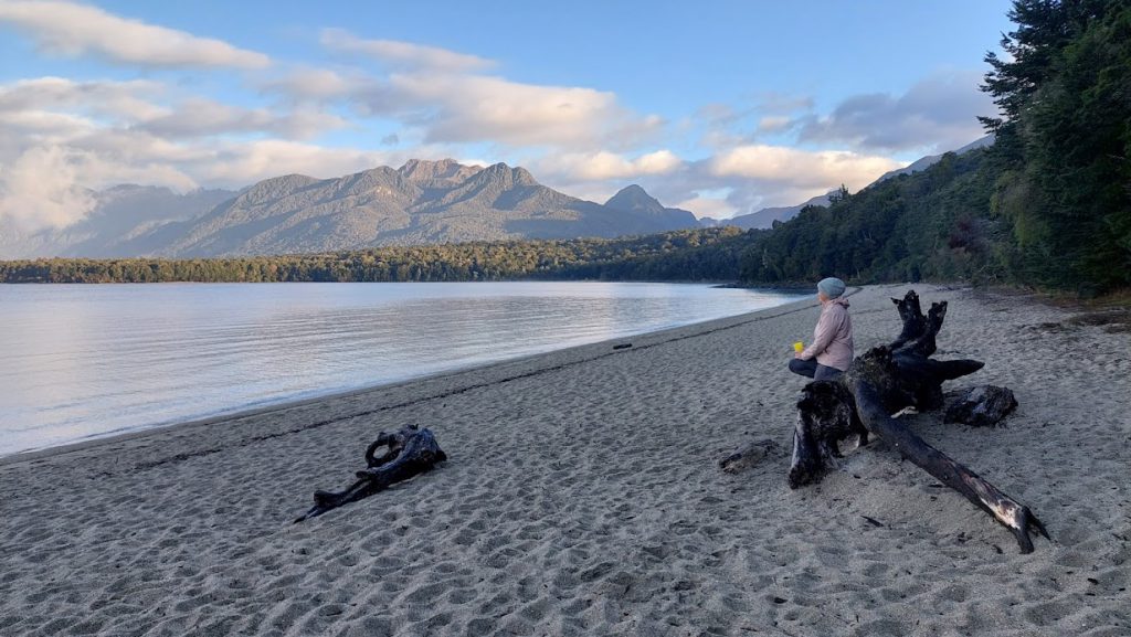
Moturau Hut is located right beside Lake Manapouri. It’s a very picturesque spot. A good place for a swim and make sure you bring bug spray.
Day 4: Moturau Hut to the Gates (Kepler Track Carpark). 16km
On the final day of the walk we split into two groups – one group left the Hut early and exited the track at Rainbow Reach while the other group took their time to explore and would finish the track at the very end – at the Gates, on the edge of Lake Te Anau.
It was about a 90 minute walk from Moturau Hut to Rainbow Reach (6 km).
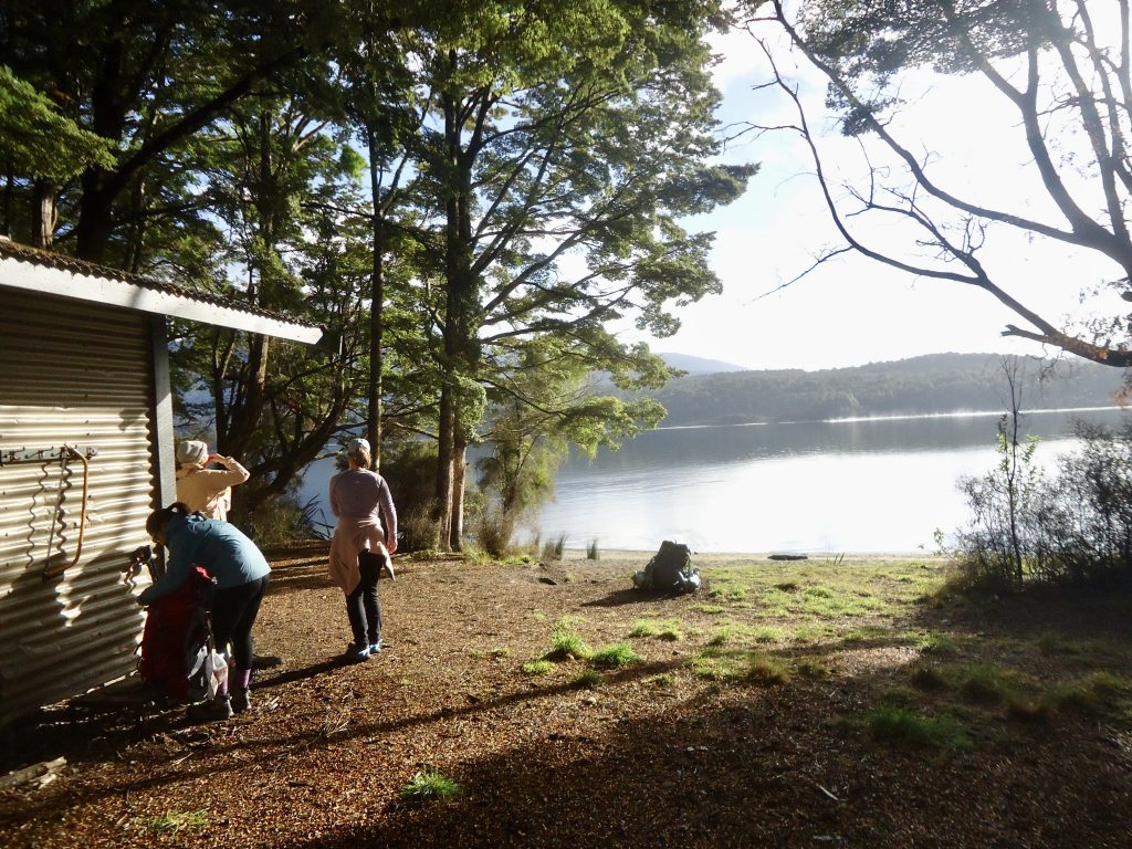
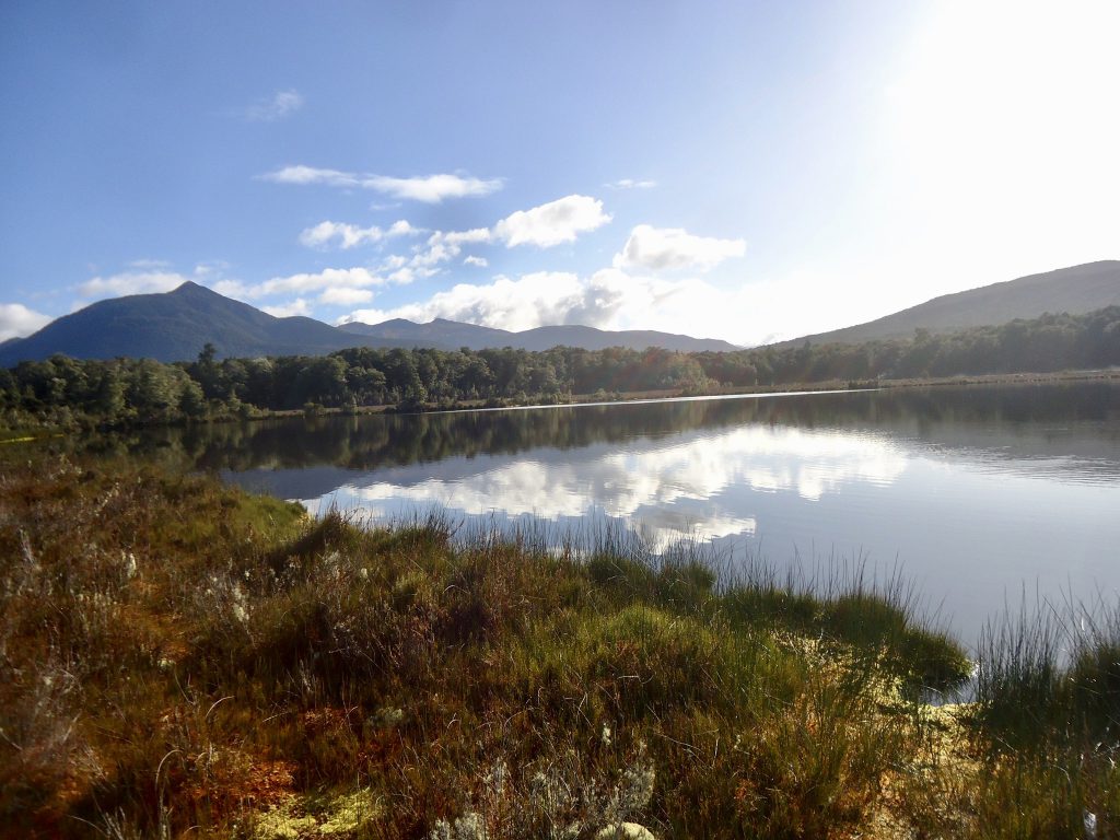
The group that took their time deviated off the main track to visit Shallow Bay Hut and to wander around this part of Lake Manapouri (at Shallow Bay). Again there were lots of sandflies. Shallow Bay Hut is very basic and there is a toilet here too. We also deviated off the main track further along, to traverse a boardwalk out to a viewing platform on a spectacular wetland.
With all our exploring we lost track of time and were very worried that we would not be able to reach the Gates in time to catch our prearranged 3.10pm shuttle transport back to Te Anau. We started moving at speed and then stopped for a quick 10 minute lunch break at the main track/ Rainbow Reach junction. There is a lovely bridge here which crosses the beautiful Waiau River. We wished we had had the time to have a good look around Rainbow Reach but we had to gun it to the Gates.
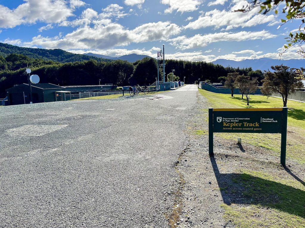
Luckily, in the end, we arrived at the Gates with an hour to spare. It was nice to have time to walk around this area and to read information boards about the history of the dam. You can walk back to Te Anau from here – an additional 5 km. Once our shuttle arrived it was just a 10 minute drive back to the backpacker accommodation in Te Anau.
We all then caught a 5pm shuttle back to Queenstown, arriving at about 7.30pm. Once in Queenstown we went straight down to Fergburger for dinner and then on to Patagonia for ice cream. We stayed the night at Southern Laughter Backpackers in Queenstown – a very short walk to central Queenstown ($40pp) and a good place to stay.
Flight back to Wellington
We all agreed it had been a fantastic, memorable trip that we had enjoyed immensely and we were very grateful to have had excellent weather!