Te Tatau-Pounamu – the other Tongariro wilderness
Te Tatau-Pounamu. A guide to the seldom visited wilderness area on the eastern side of Mt Tongariro in the World Heritage Tongariro National Park
Tongariro National Park holds a prestigious position in the list of the world’s protected natural areas—the park is one of only 29 sites in the world with dual World Heritage status, i.e., having both natural and cultural status. Additionally, it is one of only three World Heritage sites in New Zealand—the other two are Te Wahipounamu in the South Island (covering Fiordland, Westland, Aoraki/Mt Cook and Mt Aspiring National Parks), and the Sub-Antarctic Islands.
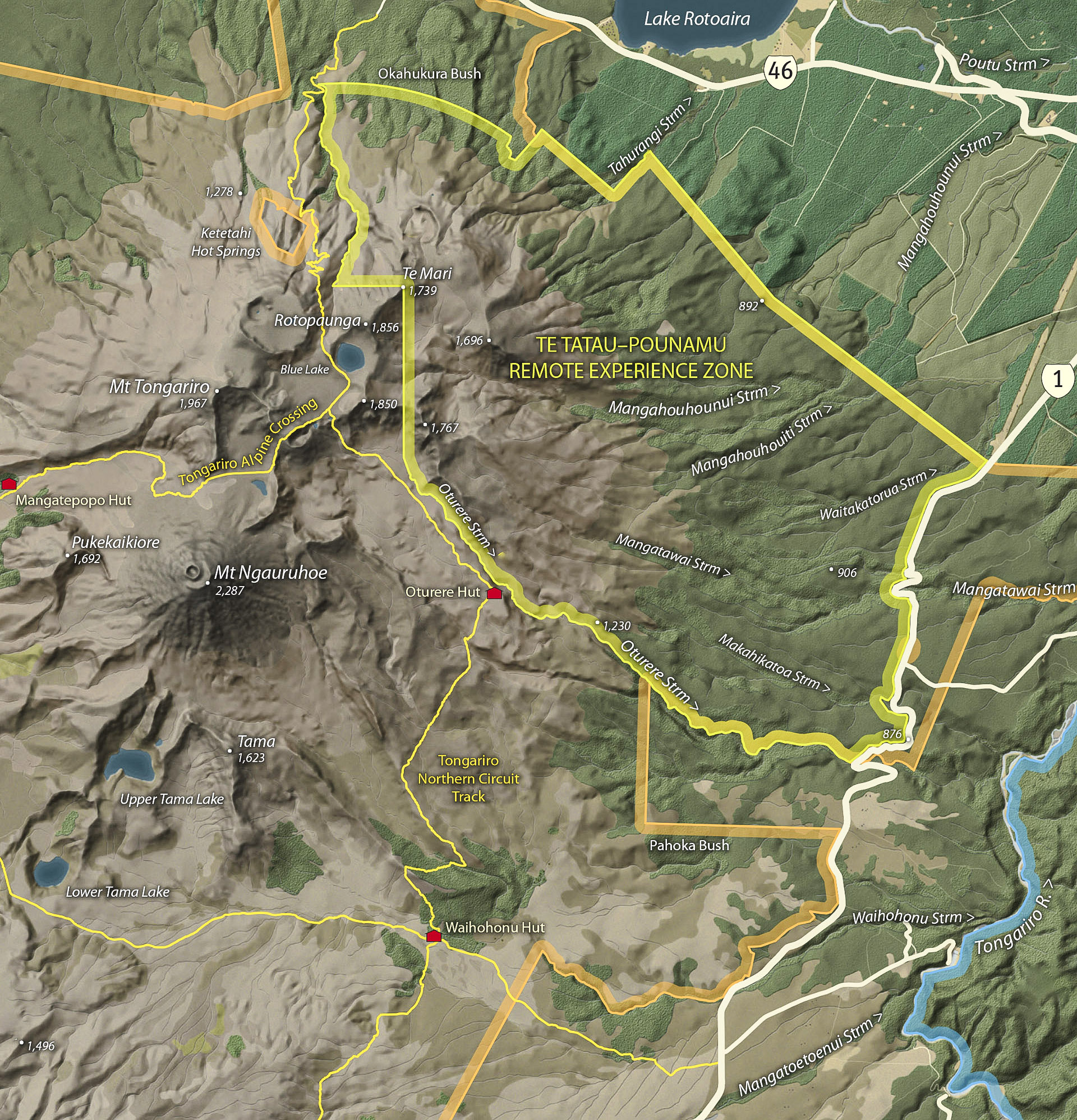
And if that’s not enough to make it worth a visit it also has two Wilderness Areas (or Remote Experience Zones), Hauhungatahi and Te Tatau-Pounamu, to tempt off-track trampers.
Both of these areas are small, less than 10,000 ha, and they do not comply with the requirements for a true wilderness such as adequate size and a well-defined buffer zone. Te Tatau-Pounamu Wilderness Area was gazetted in 1962, four years before the Hauhungatahi Wilderness, and they are both worth visiting.
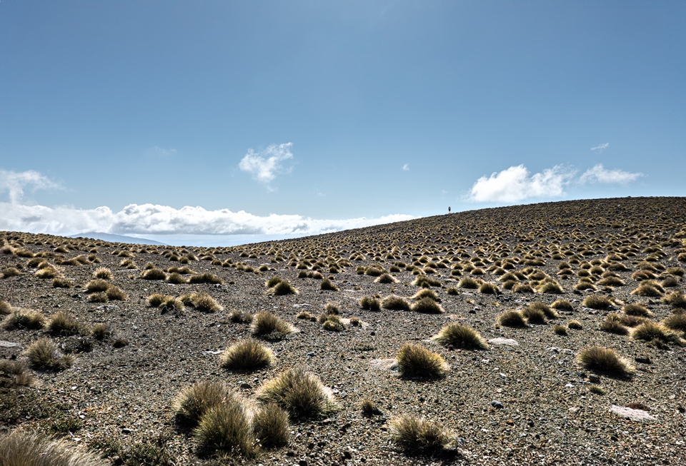
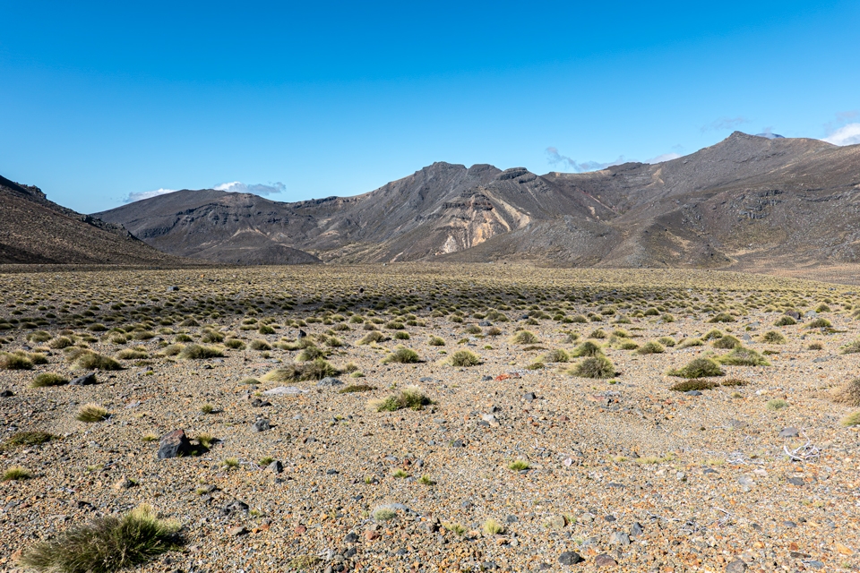
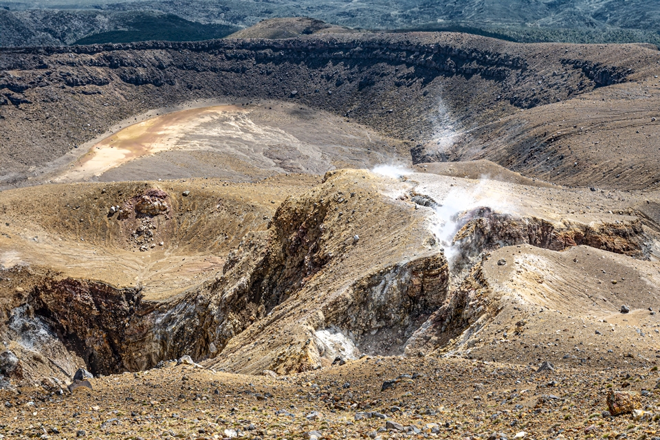
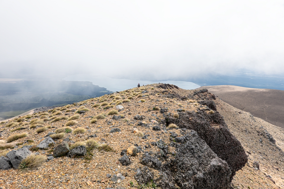
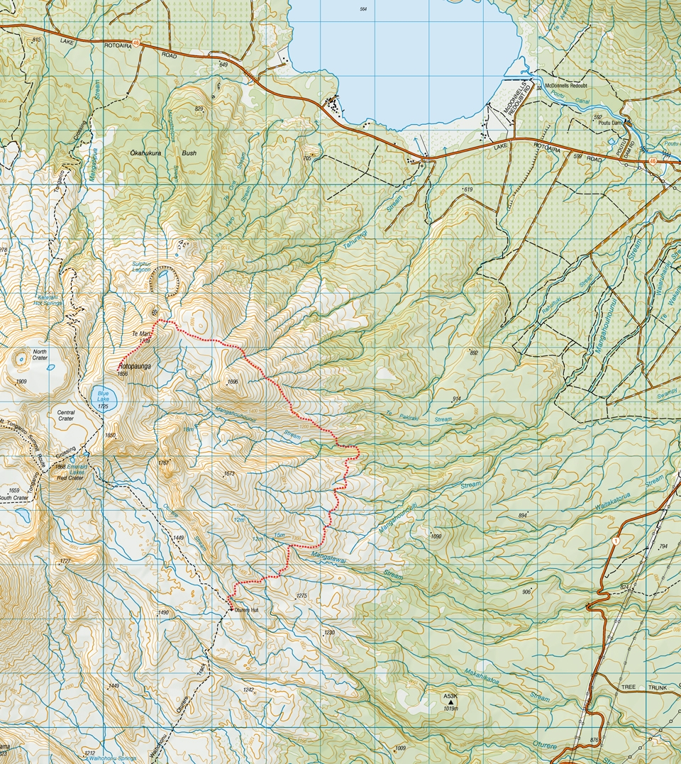
The Hauhungatahi Wilderness Area and its eroded one million year old peak are visible from the WTMC Ruapehu Lodge, and it is a relatively easy one- or two-day tramp. Meanwhile, Te Tatau-Pounamu is mostly hidden away on the eastern side of Mt Tongariro in an area less frequently visited.
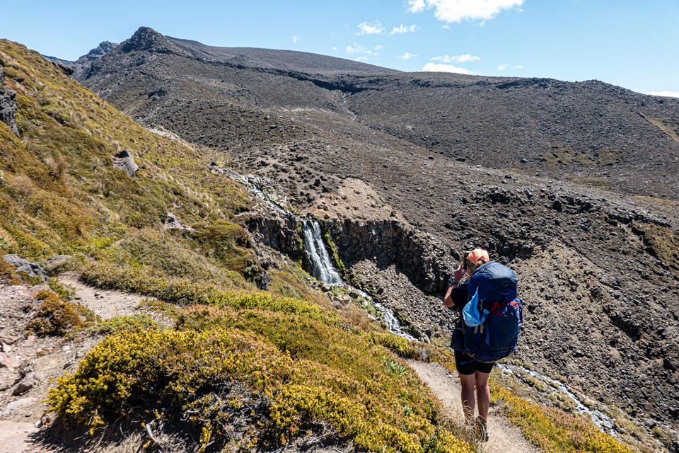
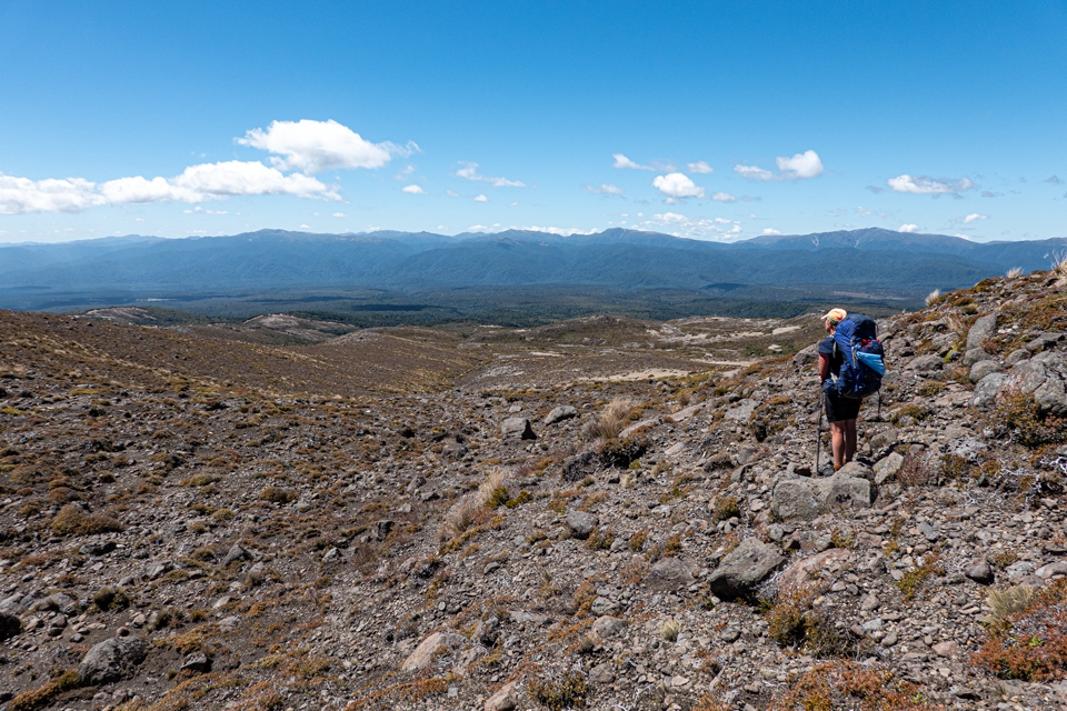
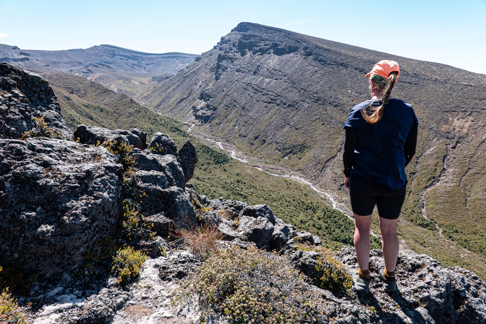
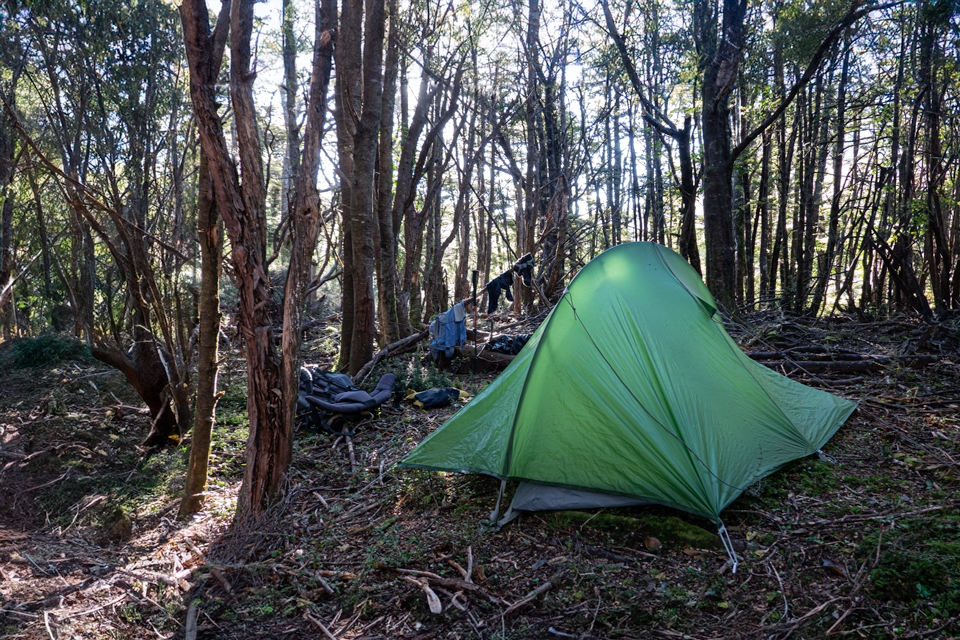
The easiest access is via the Tongariro Crossing Track near Ketetahi, or the Round the Mountain Track at Oturere Hut. Travel above the bushline is straightforward and there are plenty of good (but exposed) camping sites. Travel in the bush is variable, while travel in the scrub is mostly difficult.
So, if you are after a long day walk or a couple of days tramping away from tracks, huts, or any other human works then try it out. Some photos taken on a trip from Oturere Hut to Te Mari are below: