
Kaweka Kaleidoscope – exploring Manson Country in the Kaweka Forest Park
A 3-day hiking trip through the Kaweka Range including the remote Manson Country

It nearly makes the squatters weep,
It takes five acres to a sheep,
And each year sees these smaller flocks,
For sheep don’t thrive on snow and rocks.(An anonymous poet on the difficulty of mustering in the remote Manson Country)
I have done a number of club and private trips into the Kaweka Range over the years and they had all left quite an impression on me that I was eager to return to do more exploring. I had dreamt up a big loop and drawn it on my map of the Kaweka Range a few years back but never had the opportunity to put it into action so when Tony and I had three days to fill in from our base at the WTMC Mt Ruapehu Lodge I immediately suggested it. Tony hadn’t been into the Kaweka Range in many years and agreed to it when he saw how excited I was about it. I wasn’t sure if my loop was too ambitious as it would involve long days and sometimes the times given in the Kaweka Range can be a bit on the fast side but we were both keen to give it a go and I had a few bail out routes if needed.
We left the lodge early and got a nice sunrise as we drove towards Taihape. Our loop started at the Lakes Carpark and it was straight up on a track called the Rogue that I had chosen simply due to its interesting name. It felt like we had fallen into a fairytale world as the toadstools were out in full force with so many different colours and sizes. Taking photos of them gave us the opportunity to have a break as it was very humid as we trudged up the hill with heavy packs. It was a steep but easy track.
As we reached a spot height known as the ‘Tits’, a helicopter came zooming towards us but changed its course at the last minute, after seeing us there so it didn’t fly immediately over us. Just after this Tony decided the next track marker said ‘lunch-time’ so we stopped right there and then. As we sat there another helicopter came circling around us and the surrounding ridge and then dropping down and doing the same in the gully. It didn’t seem like the right flying pattern for heli-hunting and we found out the next day from some hunters at Manson Hut that they were doing survey work on the contorta pine trees that are pests and really shouldn’t be there. Unfortunately, these pines were planted in the 1960-70s to try and prevent erosion on what was then seen as problematic scree slopes. These scree slopes are now seen as a natural feature of the landscape. Unfortunately, the pines took over though and there is now a lot of work going into removing them as they smother native trees and their acidity destroys the habitats of native bird and invertebrate species. The problem is they grow fast so trying to beat them is a long uphill battle. Tony and I pulled out some small ones – it’s hard work that I know all about as I spent a day on Mt Tarawera pulling out the smaller ones by hand!
After Kaiarahi, Tony continued along the ridgeline and agreed to meet me at the top of Mad Dog Hill of all places. I, meanwhile, dropped down to check out Studholme Biv and Studholme Saddle Hut. We could even see the bright orange toilet of Studholme Biv from the ridgeline and Tony decided he could claim he had bagged it by line of sight! I was particularly keen to visit both of them as later this month Studholme Biv is being relocated to North Whetu and Studholme Saddle Hut is being moved to the former Biv site so it was an opportunity to see them in their original locations before the big move.
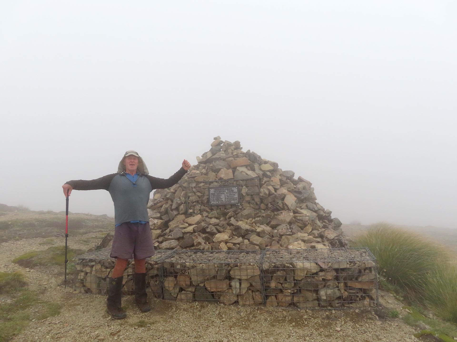
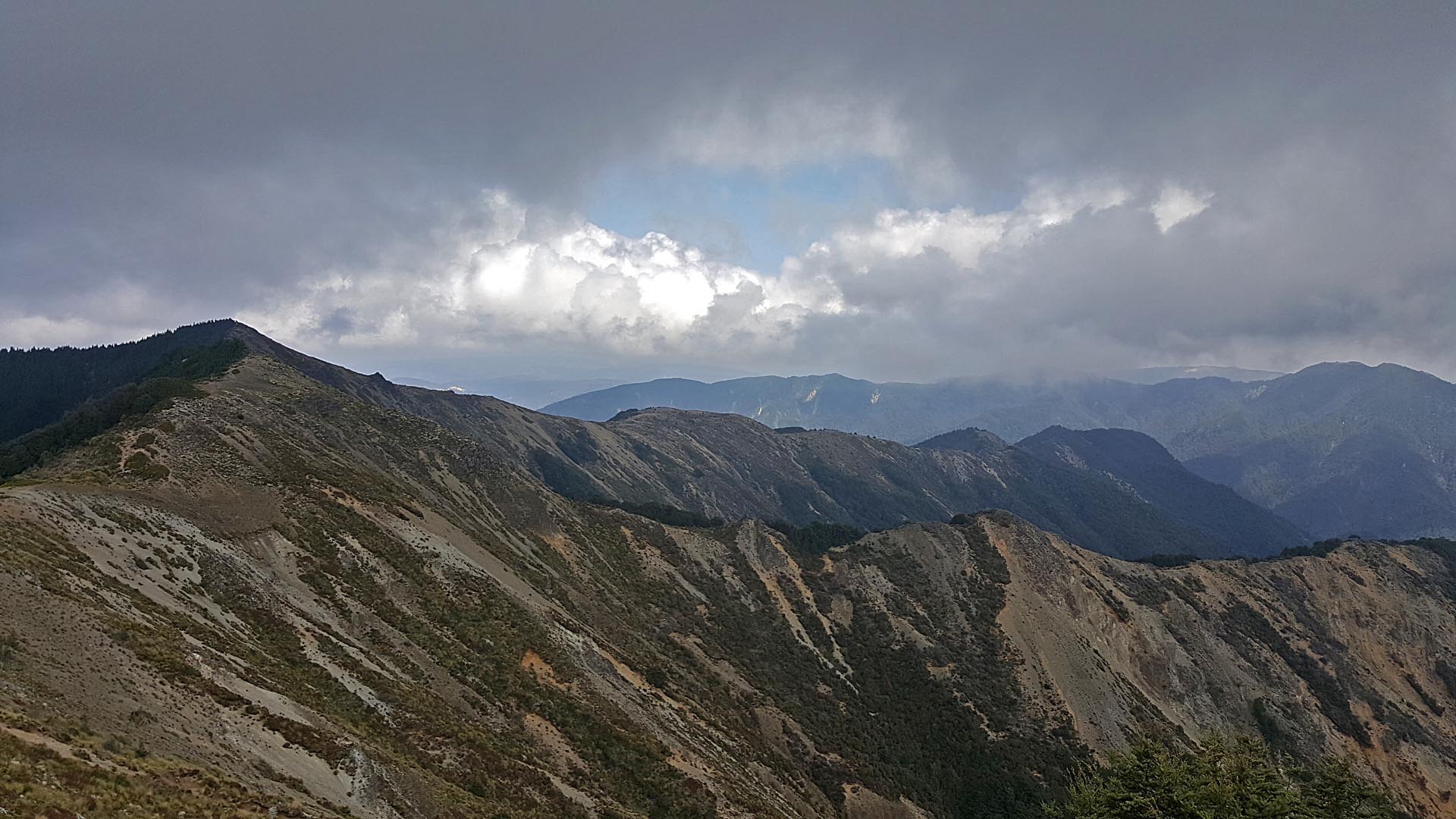
As I raced up Mad Dog Hill to meet Tony I gave him a few waves to let him know I was ok and on my way only to find out a few minutes later that I was actually just waving at a tree. Feeling rather foolish I laughed my way up the final part of the climb. The clag rolled in on Mad Dog Hill and it created a rather mystical atmosphere up there. At the junction down to Backridge Hut Tony was just about to walk through it when I protested and said we couldn’t just bypass Kaweka J, the highest point in the Kaweka Range at 1724m. I needed to go and say hello to Kaweka J despite having been there a number of times, all on bluebird days so it was a bit different getting there and only being able to see the inside of a cloud this time! What I hadn’t remembered from my previous visits to Kaweka J was the memorial plaque on it that was to honour members of the Heretaunga Tramping club who gave their lives in World War 2. It was also accompanied by a Latin inscription ‘pro patricia’, which translates to ‘for one’s country.’ I never thought I would be putting my four years of high school Latin to use in the middle of the Kaweka Range!
As we started down Backridge we walked out of the clag into beautiful sunshine again. We both heard some rumblings that at first I thought was thunder but it didn’t seem to match our weather and the timing pattern of it didn’t seem particularly natural – we both finally agreed that it must be artillery from the army training area on the edge of the Kaimanawa Range that borders the Kaweka Range. There were one or two steep sections on the ridge that required careful navigation before we hit a lovely beech forest that even included lush green moss that looked good enough to lie down in for the night. No matter how tempting that was, we were both out of water so we pushed on to Backridge Hut and made the decision to stay there for the night. Backridge Hut is a nice set-up with a lovely creek bubbling right past the door of the hut and plenty of camping room. I wandered out in the middle of the night optimistically hoping I might stumble over one of the 600 kiwi wandering around the Kaweka Range. While I didn’t see any kiwi, I did get rewarded with a clear starry night sky and bright moon.
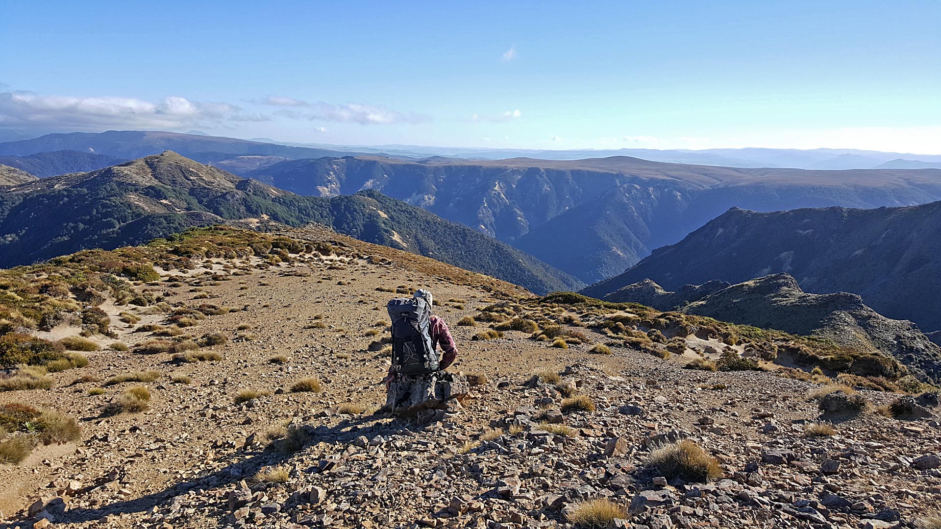
The next morning we woke to a bluebird day as we made our way up to Maminga where we were rewarded with a view of endless hills. I love the sense of total isolation this gives you—not being able to see any sign of civilisation like you often can in the Ruahine or Tararua Ranges. Mt Ruapehu was also peeking out for us to see. From here I was in completely new country as I had previously done a club trip to Backridge Hut and then wandered solo up to Maminga for a look so I was excited about exploring a new area. From here it was some of the best beech forest I have walked through—Tony said it felt a bit like being in the Richmond Range. We saw a few markers indicating fenced and unfenced plots that were established in 1997 throughout the range to show the effects of deer on mountain beech regeneration and the consequences of deer culling.
At the junction to Backridge Biv we dropped our packs and went down for a visit—it’s a tidy little biv. This was one of my bail out points as there was a direct route to Kiwi Mouth Hut from here. Luckily, we didn’t need to even consider this and we started the easy non-technical descent to Rocks Ahead Hut powered on by 100s and 1000s biscuits that I kept offering to Tony to lighten my pack.
At Rocks Ahead Tony took a picture of me trying to outdo the hut with my orange-ness. After I had a play on the 3-wire bridge, we were off in search of the big draw-card for this trip—the cable-way!! There are not many cable-ways left in NZ and I imagine this is one of the few if not only one in the North Island still in existence. Unfortunately for us, the person who had used it previously had left it hooked to the other side of the river!! Tony volunteered to go across the river and had a rather tricky time climbing up on the other side of the river – we later found somewhere with easier access when we had to go down to the river to collect water while having lunch at Rocks Ahead Biv.
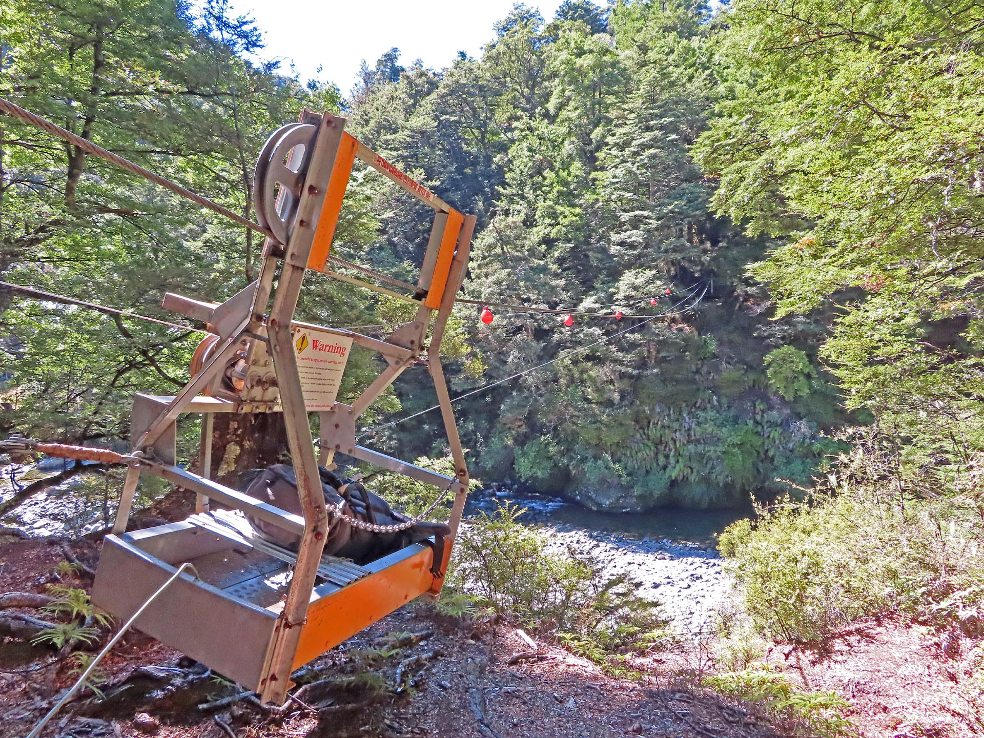
Tony jumped in the cable-way and went hurtling towards the middle of the cable-way. It was then my job to crank him across. That didn’t quite go to plan as the cable-way was clearly in need of some CRC and maintenance. I also didn’t have the upper body strength especially since the crank handle was a little high for me to put my weight into it properly. It was hard work and I was starting to worry Tony might be stuck dangling above the river for eternity. Luckily Tony found both the crank handle for solo trampers and the emergency handle. With the handle for solo trampers he could assist me and we finally got him safely across the river. Immediately I jumped in and went yahooing across the river in my first cable-way ride!! Tony then volunteered to walk back across the river while I cranked his pack across in the cable-way—even that was hard work and I only just managed to get it across by the time he turned up! At Rocks Ahead Biv we discovered it really was a small world as the last person to have signed the book was a tramper called Dave who we had met at Maungahuka Hut a few weeks earlier!
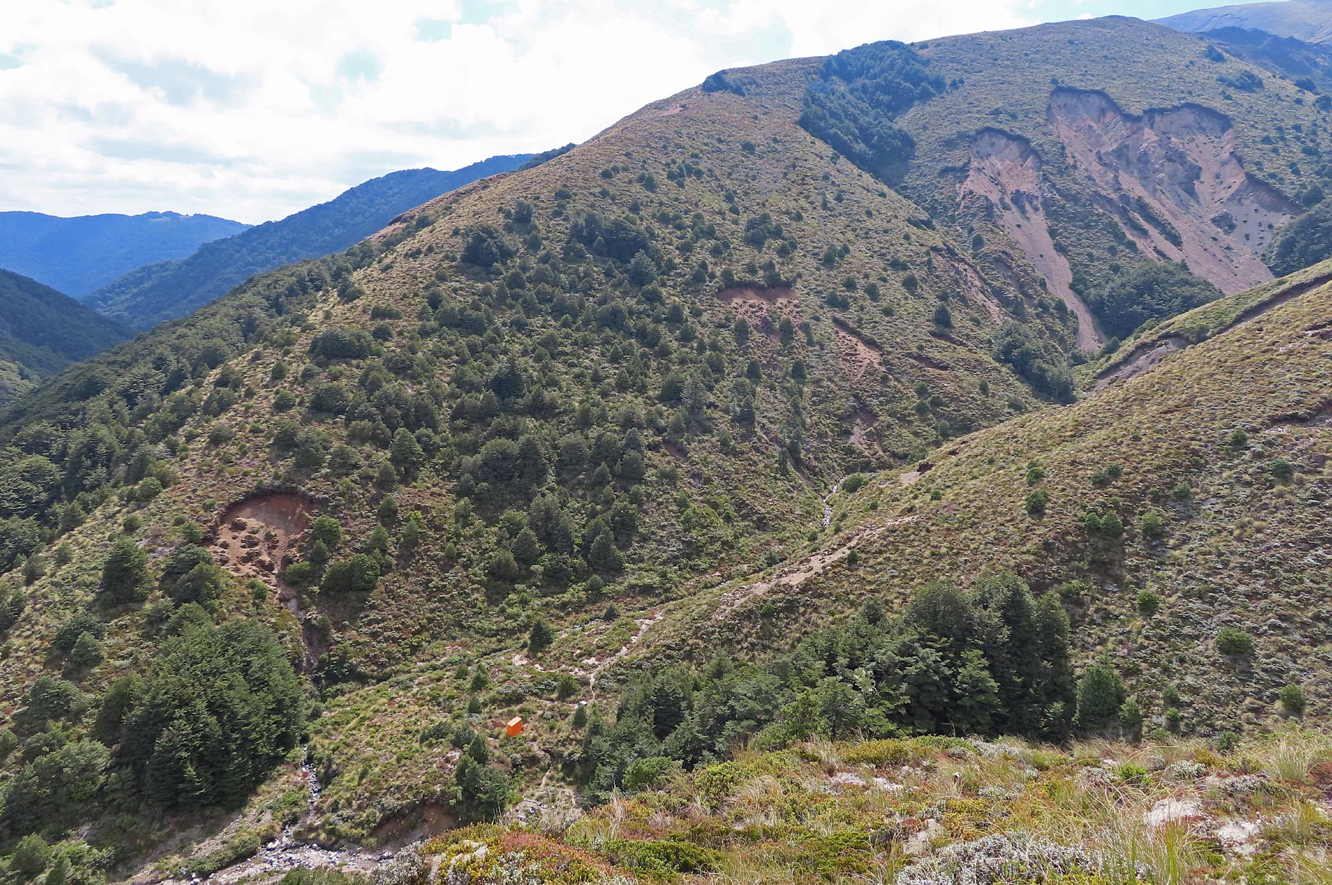
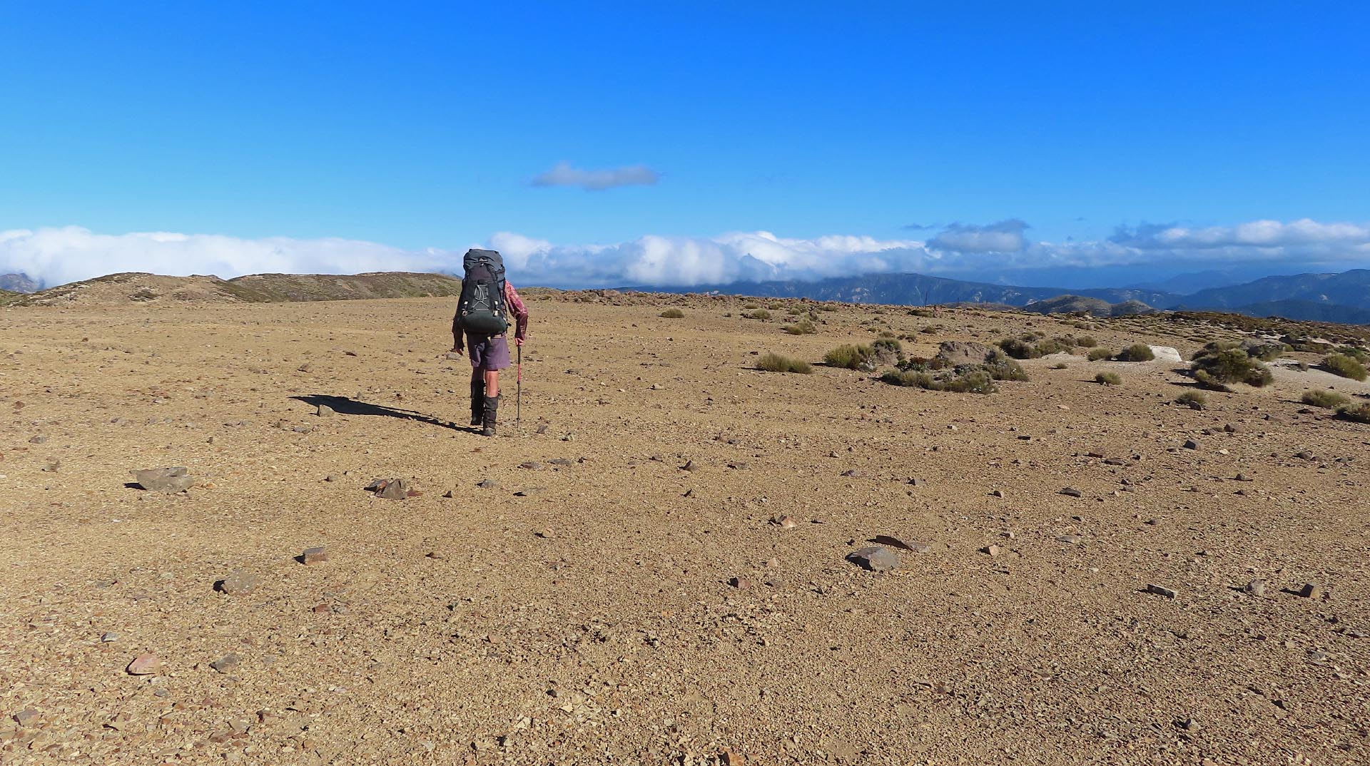
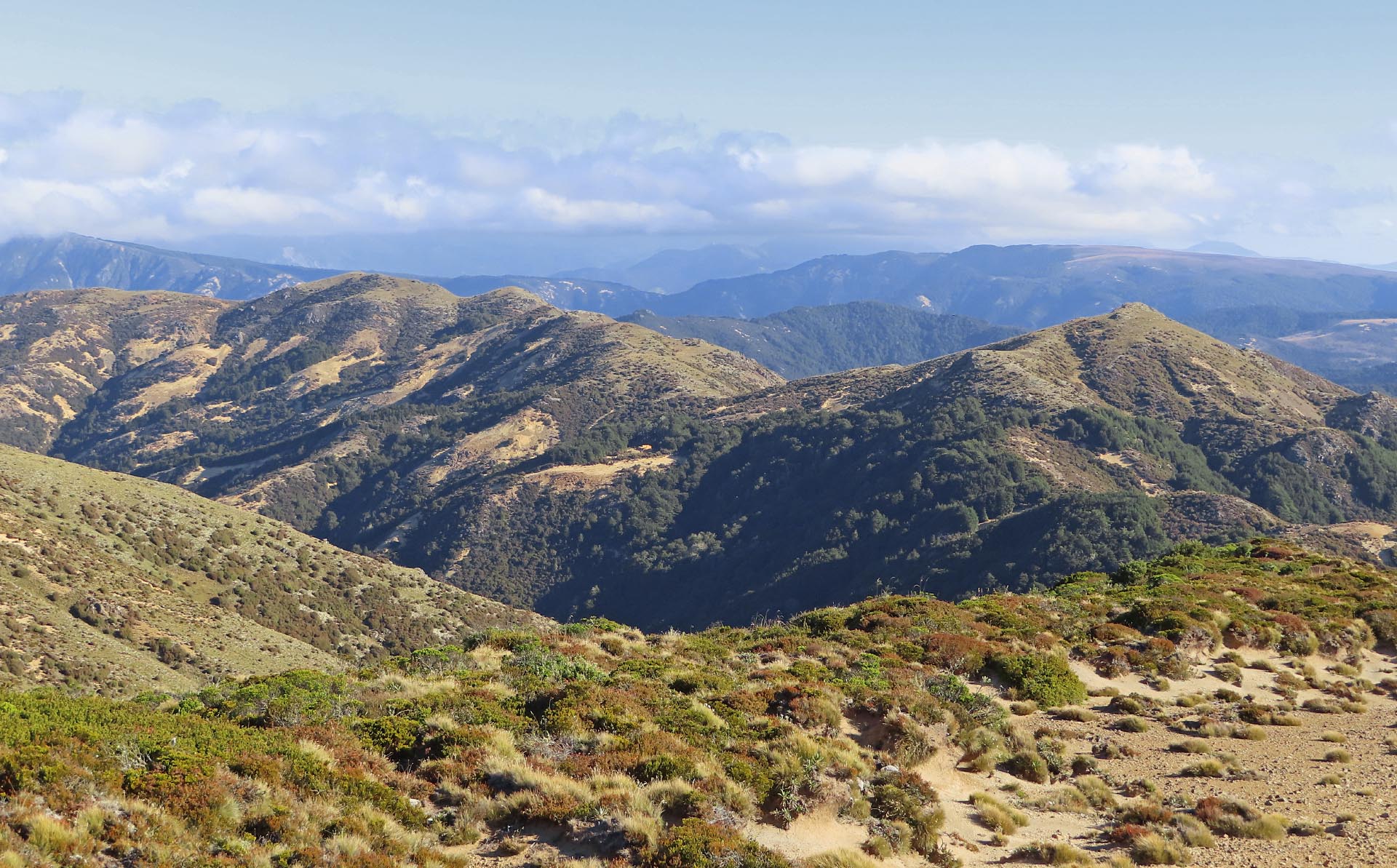
It was a steep climb up Spion Kop out of Rocks Ahead Biv and it was another hot day so we just took our time as we were melting. I was really excited about getting into Manson Country and back up on the tops again. Wilderness magazine describes Manson Country in the ‘back and beyond, the far-flung reaches of the Kaweka Range.’ The name Manson Country is not written on any map but it’s the local term for the area that lies to the West of the Ngaruroro River. Your hard work to get there is rewarded with wide open tops and spectacular views. We saw lots of pumice up there from the Lake Taupo eruption 1,800 years ago, which is equally fascinating and terrifying when thinking about the distance it had all been flung. Mother nature can be pretty awe-inspiring….
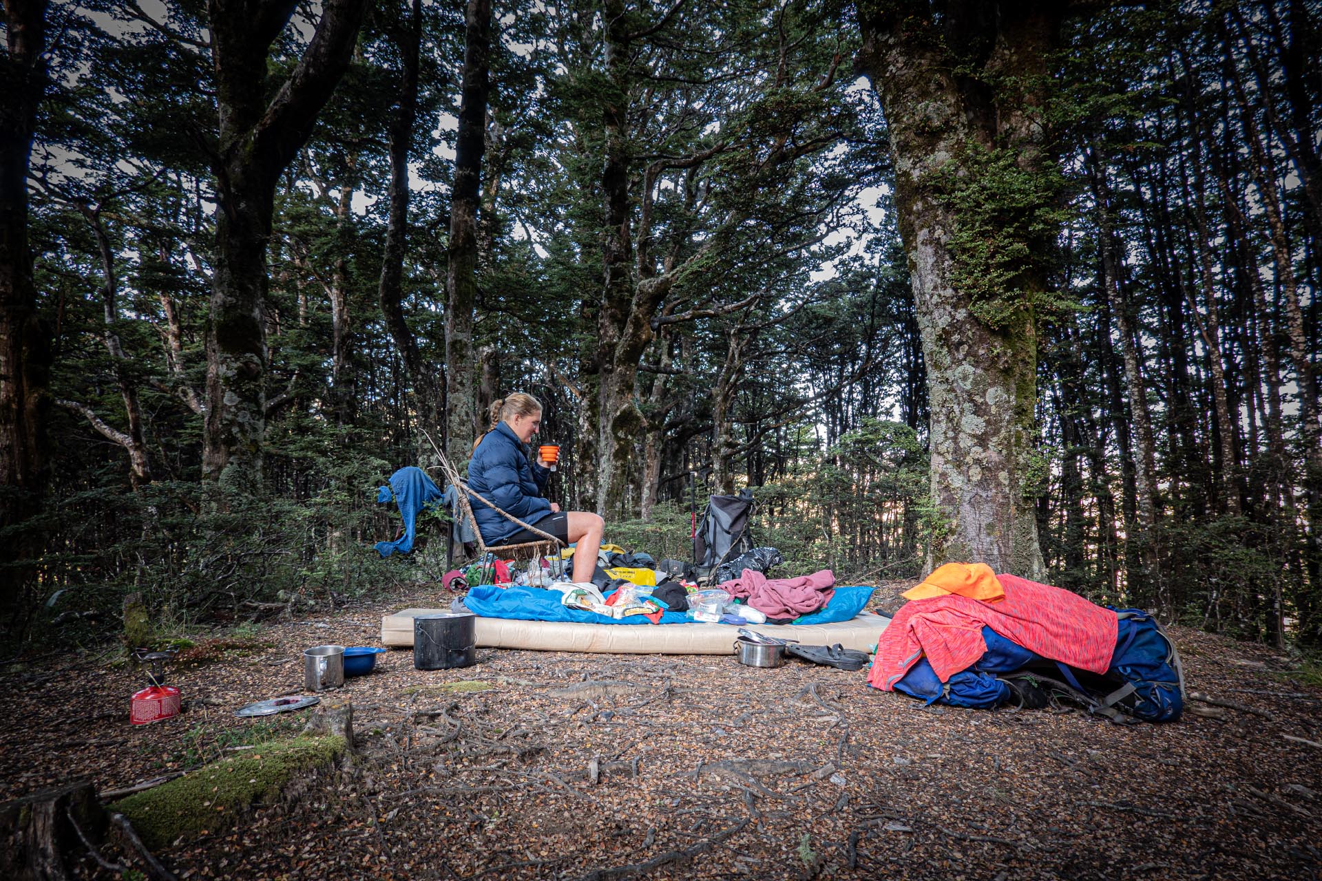
My original plan had us going all the way to Kiwi Mouth Hut for the night but we quickly realised that involved us getting there quite late and it was such perfect weather that it seemed a shame to hurry and not just enjoy it so instead we decided to stop at Manson Hut for the night and have an early start the next morning. Manson Hut had four hunters there (they had been on one of the helicopters we had seen the day before) so we decided to camp outside and after setting up camp we wandered down to see the Historic Manson Hut.
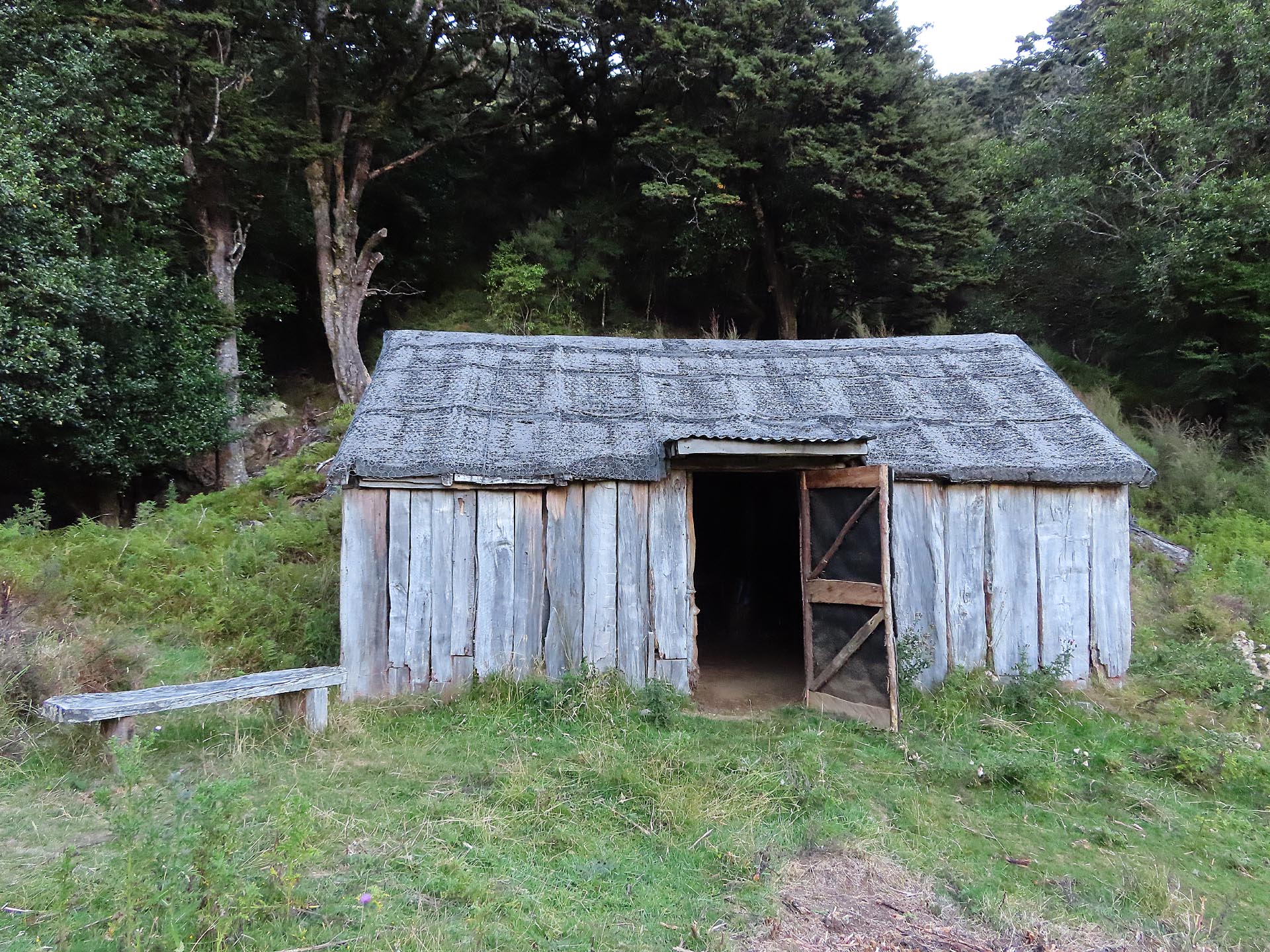
The Historic Manson Hut was built in the late 1940s to serve as a musterer’s hut—it is one of the best preserved few remaining mustering huts in NZ. Although it seems far-fetched now, the Kaweka Range was actually sheep farmed from the 1870s. The hut is very rustic due to a shortage of building materials after World War II and the dirt floor would become a mud pit on rainy days forcing the musterers and deer cullers to wear their gumboots inside.
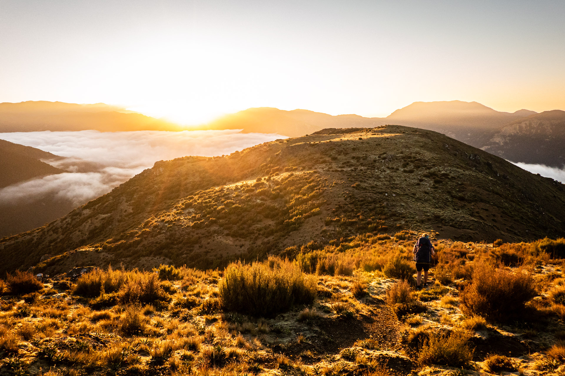
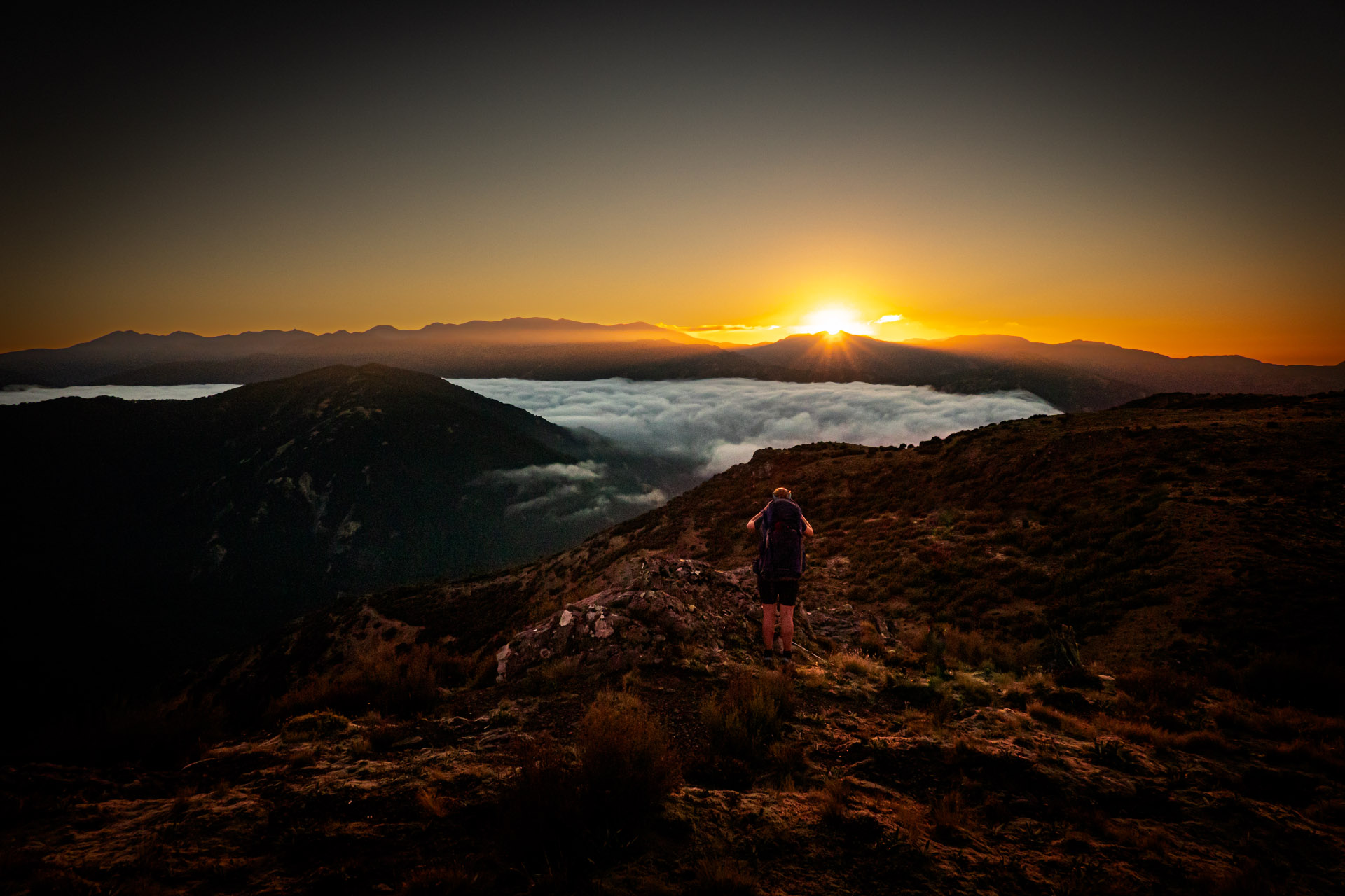
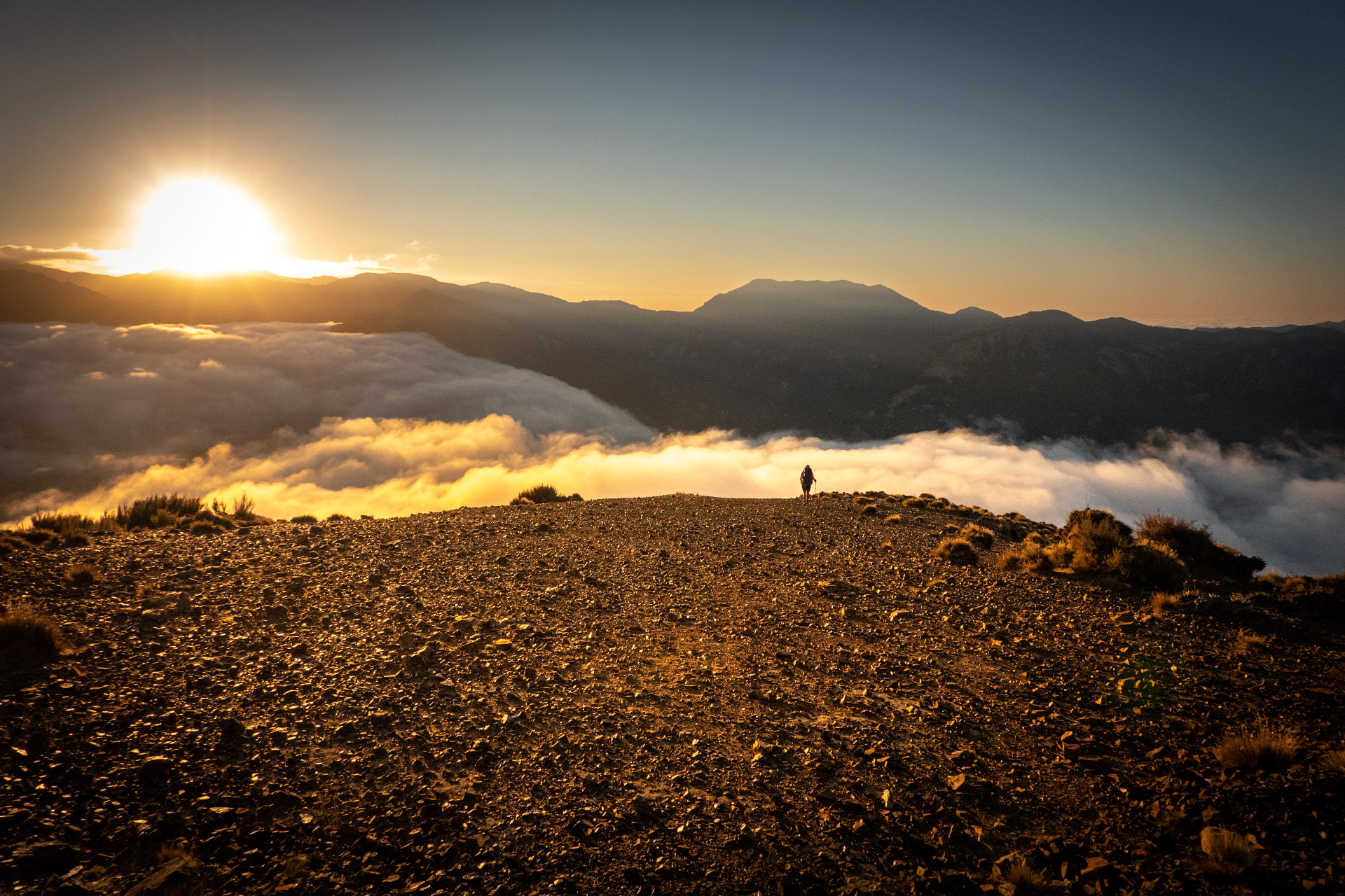
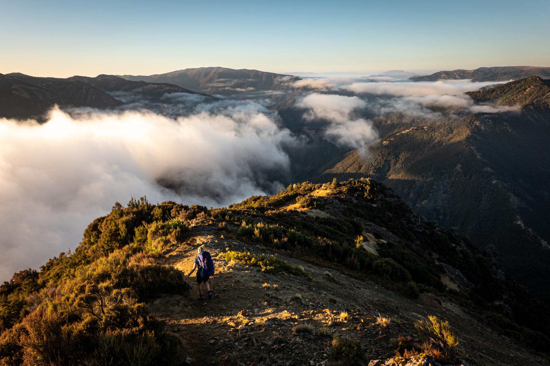
We were up at 5 am so we could take our time to pack up and were waving goodbye to Manson Hut just before 6:30 am. Once back up on the ridgeline the sunrise was truly magical especially with the layer of low-lying thick easterly cloud. It’s one of those things that is hard to describe and you just had to be there in person to enjoy it as no photo truly does it justice. We were stopping every metres to take more photos and just breathe it all in. As the sun started to peek out from behind the hills, the light was reflected back on the ridgeline we were on and on the Mt Meany plateau behind us. It’s one of the best mornings on a tramp I have had and I felt incredibly lucky to be able to experience it.
As the sun came up it was a steep descent off the tops from Manson Country into a very impressive forest of tall Manuka Trees that took us all the way down to the Ngaruroro River and across the swing Bridge to Kiwi Mouth Hut. I had been to Kiwi Mouth Hut only a few months earlier on a club trip so I knew exactly what to expect from the climb out of it so I smashed my way up and enjoyed lazing in the sun reading while Tony took the hill at a much more sensible pace. I decided that we would take the Cameron Hut track at the junction as I thought this track was more scenic than the track that went via Kiwi Saddle Hut. Tony had me laughing when he told the two trampers we met at the junction he ‘was just doing what he was told.’ Smart man!
Along this track there was more beautiful beech forest, beautiful green moss and epic rock formations on the western side of the track. Once we linked back up with the Smith Russell Track it was a quick descent to the Lakes Carpark.
Once back at the car I felt a great sense of achievement—we had completed my loop that I had been dreaming about for a few years and in doing so I had introduced Tony to the magic of the Kaweka Range and it had left him with a newly developed enthusiasm for further exploring there. Mission accomplished and a Mt Meany plateau mission coming up in the near future!
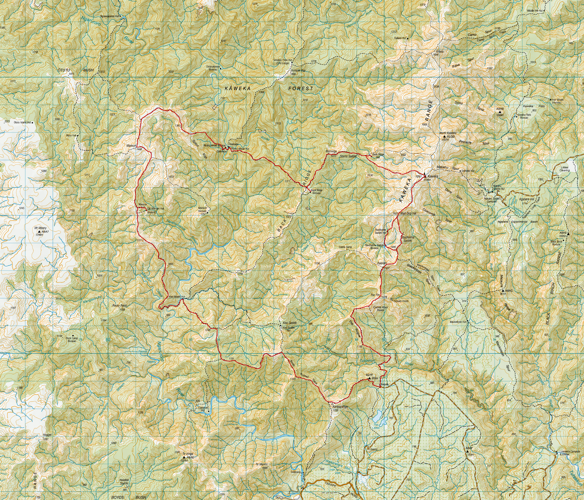
Day 1 – Lakes Carpark to Backridge Hut via Studholme Bivvy, Studholme Hut and Kaweka J
Distance 16km, Elevation 1,640m, Elapsed time 8hr 40mDay 2 – Backridge Hut to Manson Hut via Backridge Biv, Rocks Ahead Hut and Bivvy
Distance 18km, Elevation 1,390m, Elapsed time 10hr 30mDay 3 – Manson Hut to Lakes Carpark via Kiwi Mouth Hut and Cameron Hut Track
Distance 18km, Elevation 1.380m, Elapsed time 9hr 50m.